MyTopo
Crane Wisconsin US Topo Map
Couldn't load pickup availability
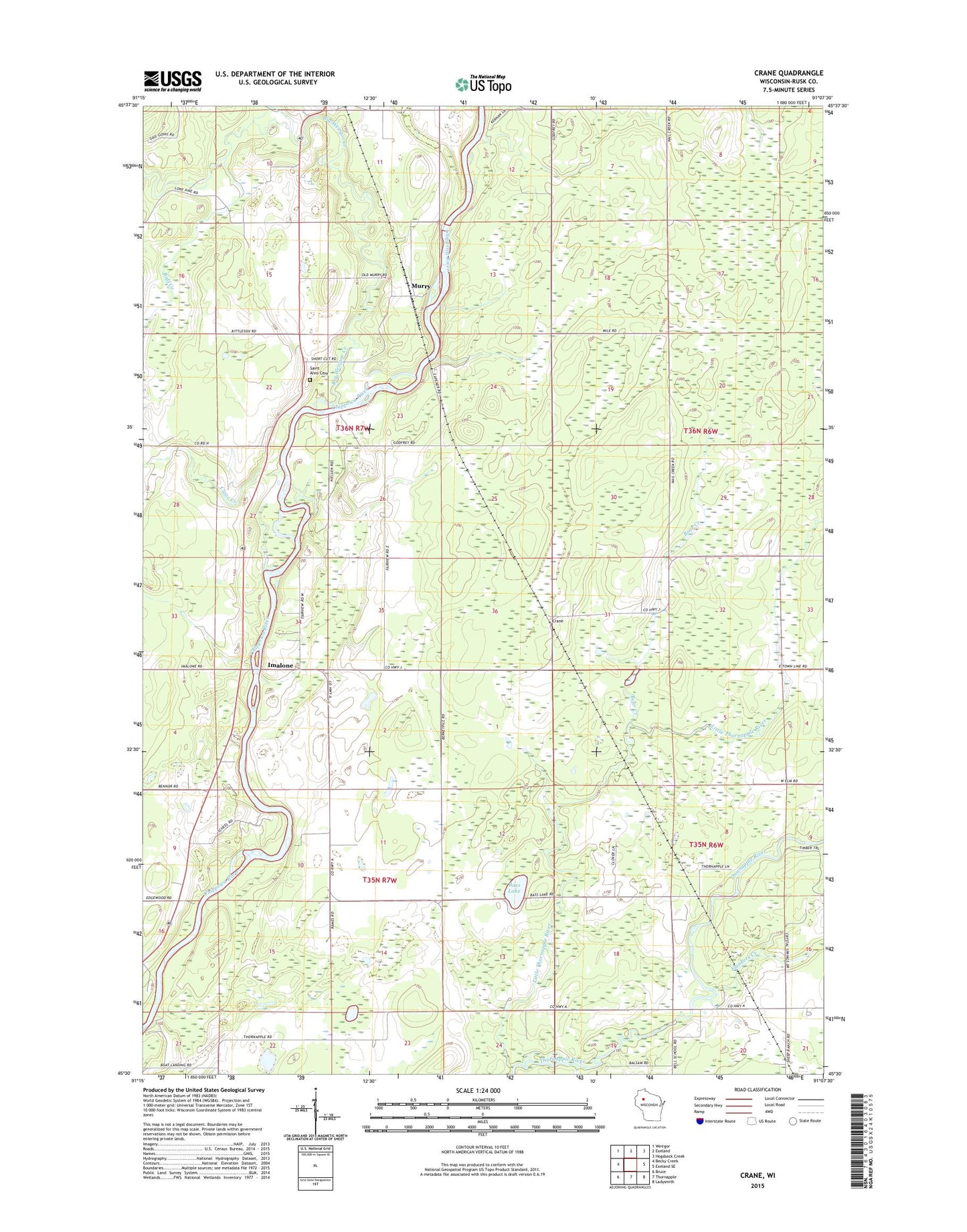
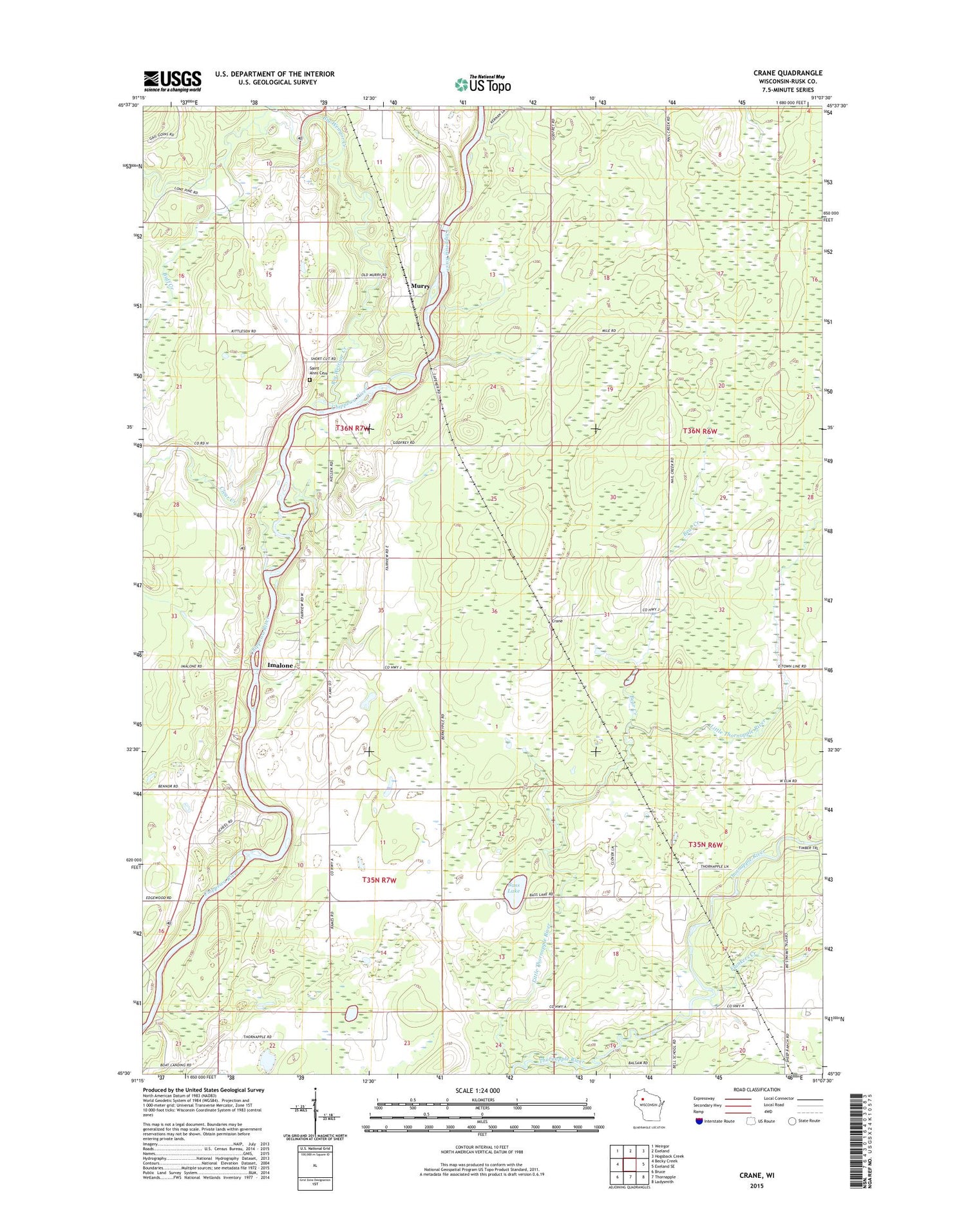
2018 topographic map quadrangle Crane in the state of Wisconsin. Scale: 1:24000. Based on the newly updated USGS 7.5' US Topo map series, this map is in the following counties: Rusk. The map contains contour data, water features, and other items you are used to seeing on USGS maps, but also has updated roads and other features. This is the next generation of topographic maps. Printed on high-quality waterproof paper with UV fade-resistant inks.
Quads adjacent to this one:
West: Becky Creek
Northwest: Weirgor
North: Exeland
Northeast: Hogsback Creek
East: Exeland SE
Southeast: Ladysmith
South: Thornapple
Southwest: Bruce
Contains the following named places: Bass Lake, Bass Lake School, Bear Creek, Big Weirgor Creek, Buff Creek, Clear Creek, Crane, Fairview School, Flunkers Creek, Imalone, Jerome School, Little Thornapple River, Little Weirgor Creek, Murry, Murry School, Murry Townhall, Nail Creek School, North Star School, Saint Anns Cemetery, Saint Anns Church, Town of Hubbard