MyTopo
Thornapple Wisconsin US Topo Map
Couldn't load pickup availability
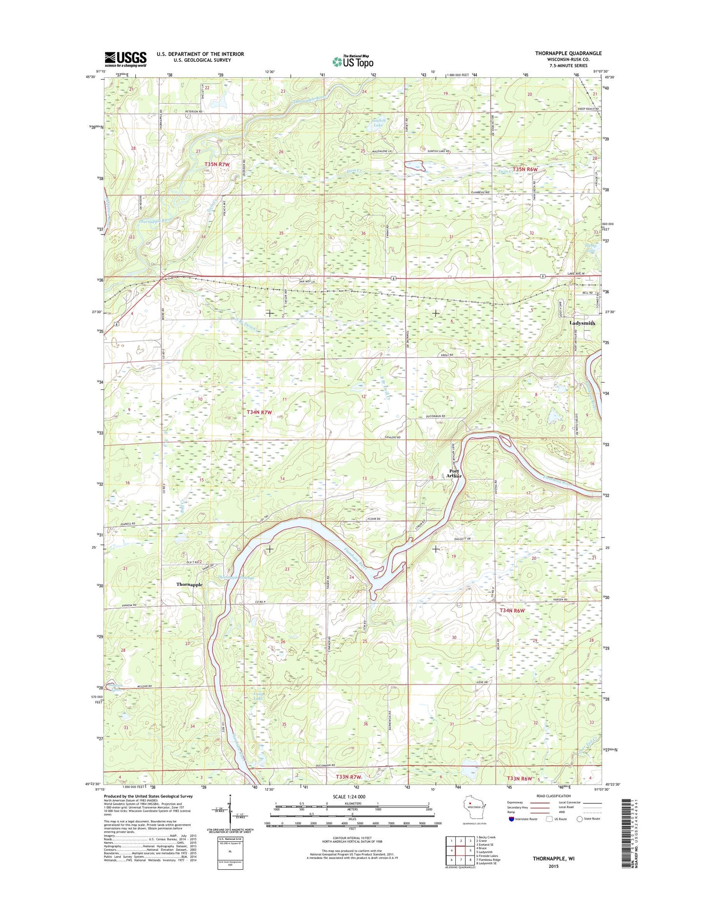
2022 topographic map quadrangle Thornapple in the state of Wisconsin. Scale: 1:24000. Based on the newly updated USGS 7.5' US Topo map series, this map is in the following counties: Rusk. The map contains contour data, water features, and other items you are used to seeing on USGS maps, but also has updated roads and other features. This is the next generation of topographic maps. Printed on high-quality waterproof paper with UV fade-resistant inks.
Quads adjacent to this one:
West: Bruce
Northwest: Becky Creek
North: Crane
Northeast: Exeland SE
East: Ladysmith
Southeast: Ladysmith SE
South: Flambeau Ridge
Southwest: Fireside Lakes
This map covers the same area as the classic USGS quad with code o45091d2.
Contains the following named places: Bell School, Dump Lake, Flambeau Estates, Girard School, Ladysmith Lookout Tower, Lone Birch School, Long Lake, Northland Estates Air Village Airport, Pleasant View School, Port Arthur, Port Arthur Dam, River Heights School, Riverside Mission, Rusk County, Saxton Lake, South Branch Twin Creek, Sunfish Lake, Thornapple, Thornapple Church, Thornapple Dam, Thornapple Flowage 1965, Thornapple Hydro Generating Station, Thornapple School, Thornapple Townhall, Thornapple WP148 Dam, Town of Thornapple, Twin Creek, West Grant School