MyTopo
Bruce Wisconsin US Topo Map
Couldn't load pickup availability
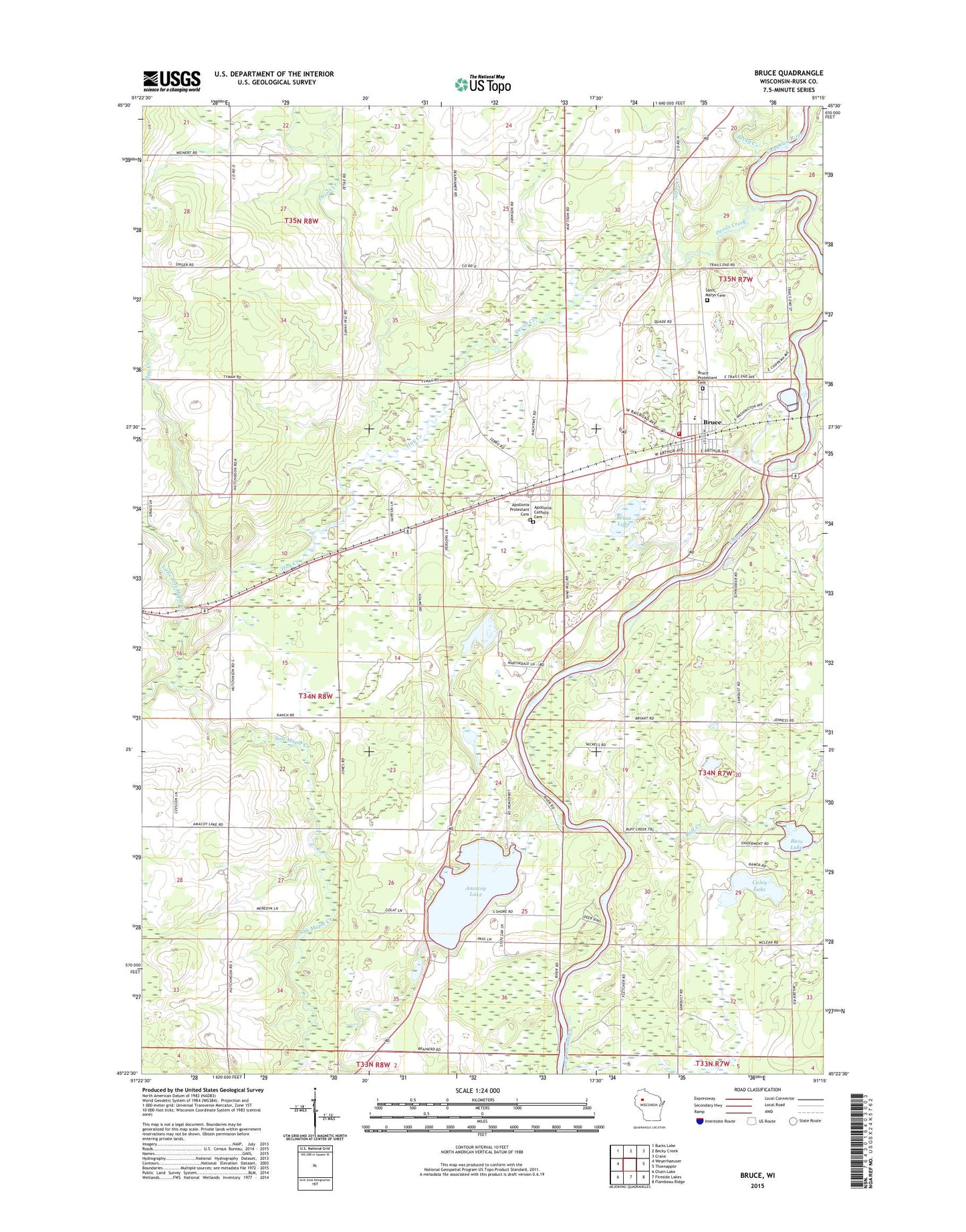
2022 topographic map quadrangle Bruce in the state of Wisconsin. Scale: 1:24000. Based on the newly updated USGS 7.5' US Topo map series, this map is in the following counties: Rusk. The map contains contour data, water features, and other items you are used to seeing on USGS maps, but also has updated roads and other features. This is the next generation of topographic maps. Printed on high-quality waterproof paper with UV fade-resistant inks.
Quads adjacent to this one:
West: Weyerhaeuser
Northwest: Bucks Lake
North: Becky Creek
Northeast: Crane
East: Thornapple
Southeast: Flambeau Ridge
South: Fireside Lakes
Southwest: Chain Lake
This map covers the same area as the classic USGS quad with code o45091d3.
Contains the following named places: Alder Creek, Amacoy 2WP1881 Dam, Amacoy Lake, Amacoy School, Apollonia, Apollonia Catholic Cemetery, Apollonia Protestant Cemetery, Atlanta Townhall, Bass Lake, Becky Creek, Bruce, Bruce Fire Department, Bruce Lake, Bruce Middle School, Bruce Post Office, Bruce Protestant Cemetery, Bruce Public School, Buff Creek, Caley Lake, Caley Lake School, Devils Creek, Harding School, Hay Creek, Hills Turkey Farm, Little Soft Maple Creek, Saint Marys Cemetery, Stubbs Townhall, Sunny Hill School, Thornapple River, Town of Stubbs, Village of Bruce, ZIP Code: 54819