MyTopo
Weirgor Wisconsin US Topo Map
Couldn't load pickup availability
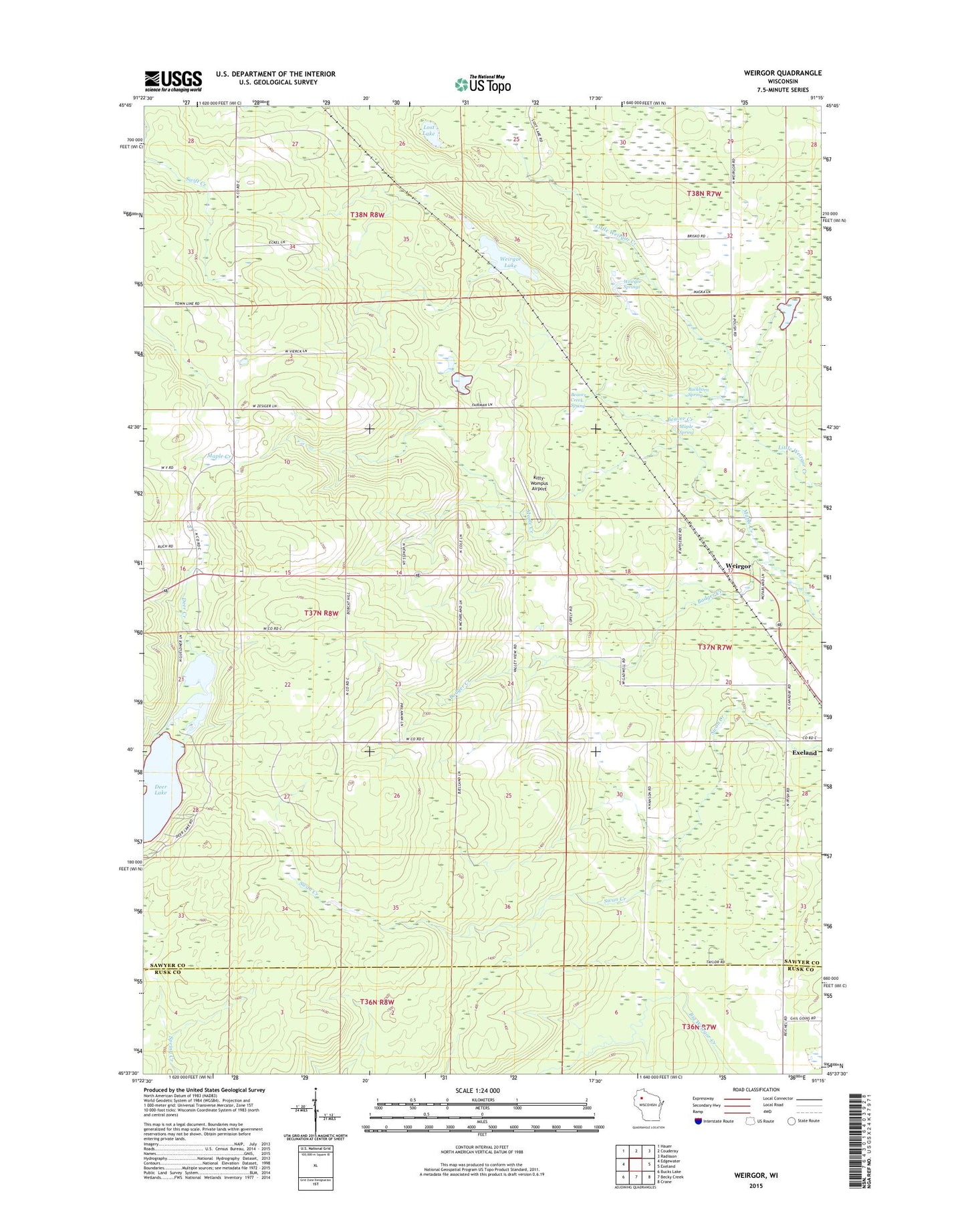
2022 topographic map quadrangle Weirgor in the state of Wisconsin. Scale: 1:24000. Based on the newly updated USGS 7.5' US Topo map series, this map is in the following counties: Sawyer, Rusk. The map contains contour data, water features, and other items you are used to seeing on USGS maps, but also has updated roads and other features. This is the next generation of topographic maps. Printed on high-quality waterproof paper with UV fade-resistant inks.
Quads adjacent to this one:
West: Edgewater
Northwest: Hauer
North: Couderay
Northeast: Radisson
East: Exeland
Southeast: Crane
South: Becky Creek
Southwest: Bucks Lake
This map covers the same area as the classic USGS quad with code o45091f3.
Contains the following named places: Badger Creek, Beaver Creek, Beaver Creek Spring, Buckhorn Spring, Kitty-Wompus Airport, Lost Lake, Maple Spring, Meteor, Meteor Hills Radio Tower, Meteor Townhall, Town of Meteor, Weirgor, Weirgor Lake, Weirgor Springs, Weirgor Springs State Wildlife Area