MyTopo
Cutler Wisconsin US Topo Map
Couldn't load pickup availability
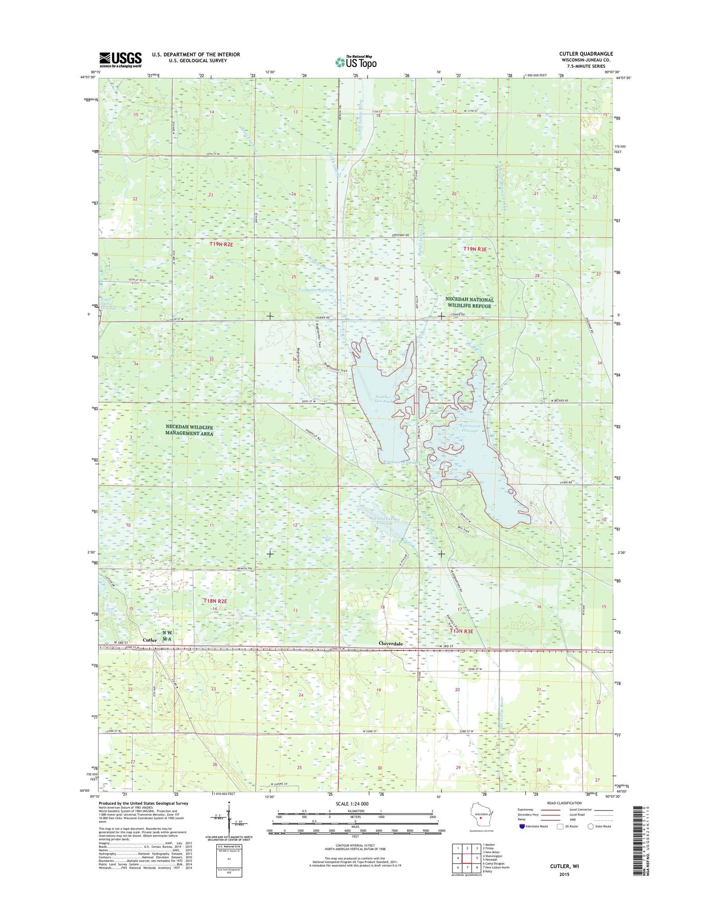
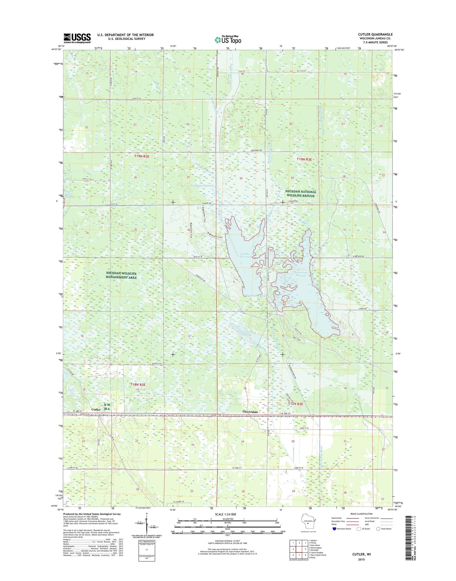
2018 topographic map quadrangle Cutler in the state of Wisconsin. Scale: 1:24000. Based on the newly updated USGS 7.5' US Topo map series, this map is in the following counties: Juneau. The map contains contour data, water features, and other items you are used to seeing on USGS maps, but also has updated roads and other features. This is the next generation of topographic maps. Printed on high-quality waterproof paper with UV fade-resistant inks.
Quads adjacent to this one:
West: Shennington
Northwest: Mather
North: Finley
Northeast: New Miner
East: Necedah
Southeast: Kelly
South: New Lisbon North
Southwest: Camp Douglas
Contains the following named places: Bewick Lateral, Campground Number Five, Carpenter Lateral, Cloverdale, Cutler, Meadow Valley State Wildlife Area, Number One Pool, Number Two Pool, Rattail Lateral, Rynearson 1 2WP282 Dam, Rynearson 2 2WP282 Dam, Rynearson Flowage, Rynearson Flowage 1, Rynearson Flowage 2, South Spencer-Robinson Ditch, Spencer-Robinson Ditch, Suk and Cerney Flowage, Suk and Cerney Flowage Dam