MyTopo
Necedah Wisconsin US Topo Map
Couldn't load pickup availability
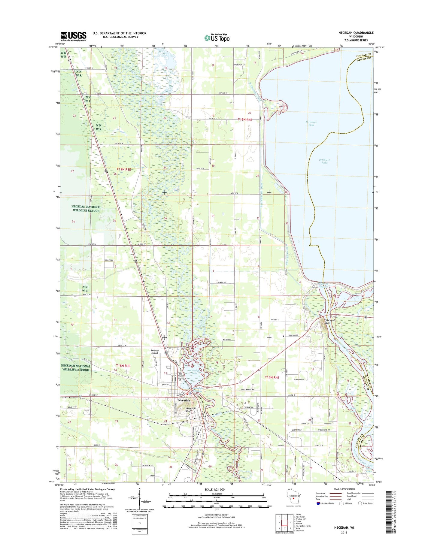
2022 topographic map quadrangle Necedah in the state of Wisconsin. Scale: 1:24000. Based on the newly updated USGS 7.5' US Topo map series, this map is in the following counties: Juneau, Adams. The map contains contour data, water features, and other items you are used to seeing on USGS maps, but also has updated roads and other features. This is the next generation of topographic maps. Printed on high-quality waterproof paper with UV fade-resistant inks.
Quads adjacent to this one:
West: Cutler
Northwest: Finley
North: New Miner
Northeast: Arkdale NW
East: Arkdale
Southeast: Dellwood
South: Kelly
Southwest: New Lisbon North
This map covers the same area as the classic USGS quad with code o44090a1.
Contains the following named places: Bayview Cemetery, Fish Lake, Juneau County Adolescent Needs Charter School, Necedah, Necedah Airport, Necedah Bluff, Necedah Dam, Necedah Elementary School, Necedah Fire Department, Necedah Flowage 491, Necedah Lake, Necedah Middle / High School, Necedah Oak-Pine Forest State Natural Area, Necedah Police Department, Necedah Post Office, Necedah Wastewater Treatment Facility, Petenwell Dam, Petenwell Flowage 5879, Petenwell Rock, Queen of the Holy Rosary School, Queen of the Holy Rosary Shrine, Town of Necedah, Village of Necedah, West Petenwell Ditch, ZIP Code: 54646