MyTopo
New Miner Wisconsin US Topo Map
Couldn't load pickup availability
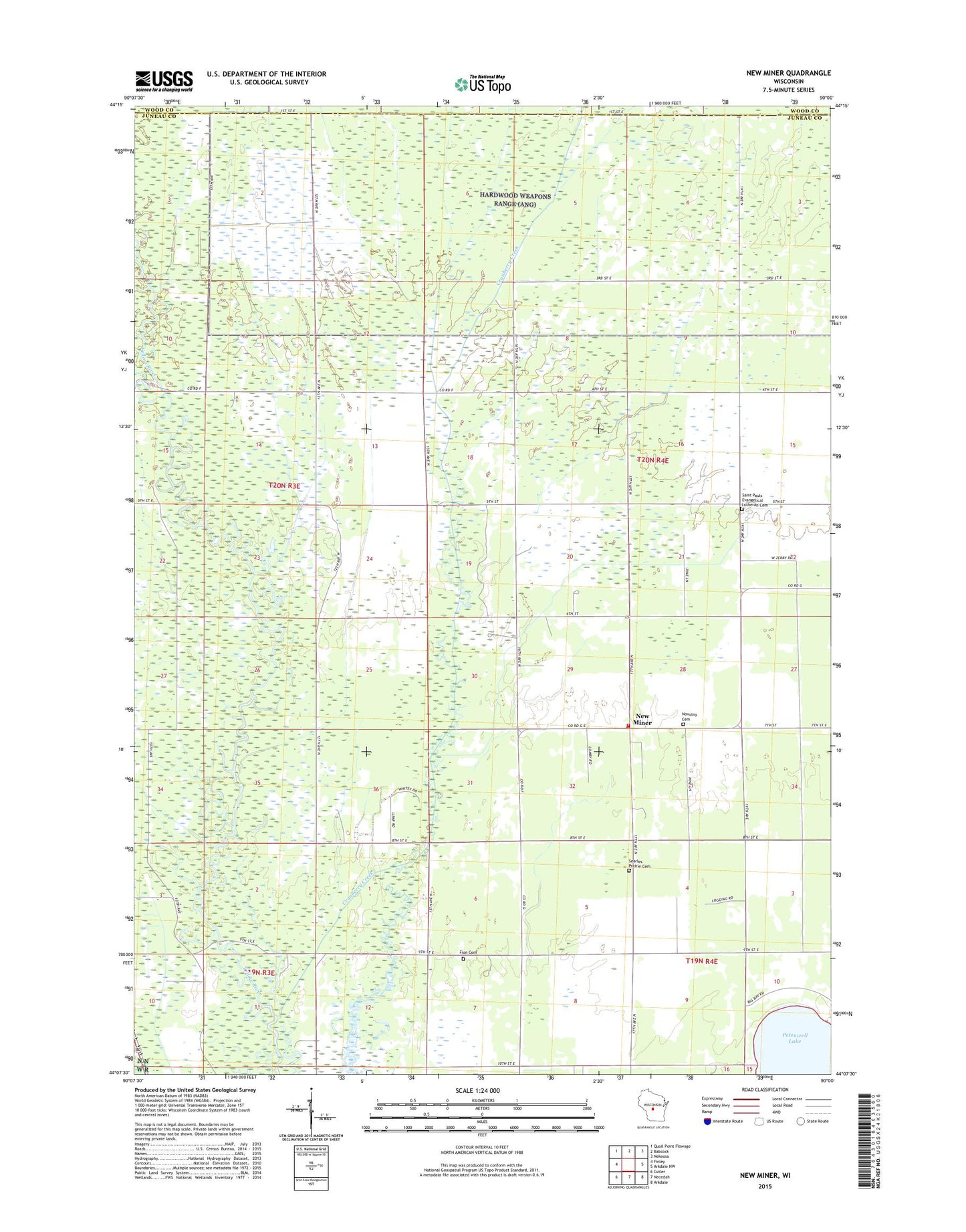
2022 topographic map quadrangle New Miner in the state of Wisconsin. Scale: 1:24000. Based on the newly updated USGS 7.5' US Topo map series, this map is in the following counties: Juneau, Wood. The map contains contour data, water features, and other items you are used to seeing on USGS maps, but also has updated roads and other features. This is the next generation of topographic maps. Printed on high-quality waterproof paper with UV fade-resistant inks.
Quads adjacent to this one:
West: Finley
Northwest: Quail Point Flowage
North: Babcock
Northeast: Nekoosa
East: Arkdale NW
Southeast: Arkdale
South: Necedah
Southwest: Cutler
This map covers the same area as the classic USGS quad with code o44090b1.
Contains the following named places: 14 Reservoir, 39 Reservoir, 41 Reservoir, Armenia Volunteer Fire Department, Cranberry Creek, Cranberry Creek 2 2WP194 Dam, Cranberry Creek 3 2WP194 Dam, Cranberry Creek 5 2WP194 Dam, Cranberry Creek Mound Group State Natural Area, New Miner, Novotny Cemetery, Saint Paul Church, Saint Pauls Evangelical Lutheran Cemetery, Searles Prairie Cemetery, Town of Armenia, Zion Cemetery