MyTopo
New Lisbon North Wisconsin US Topo Map
Couldn't load pickup availability
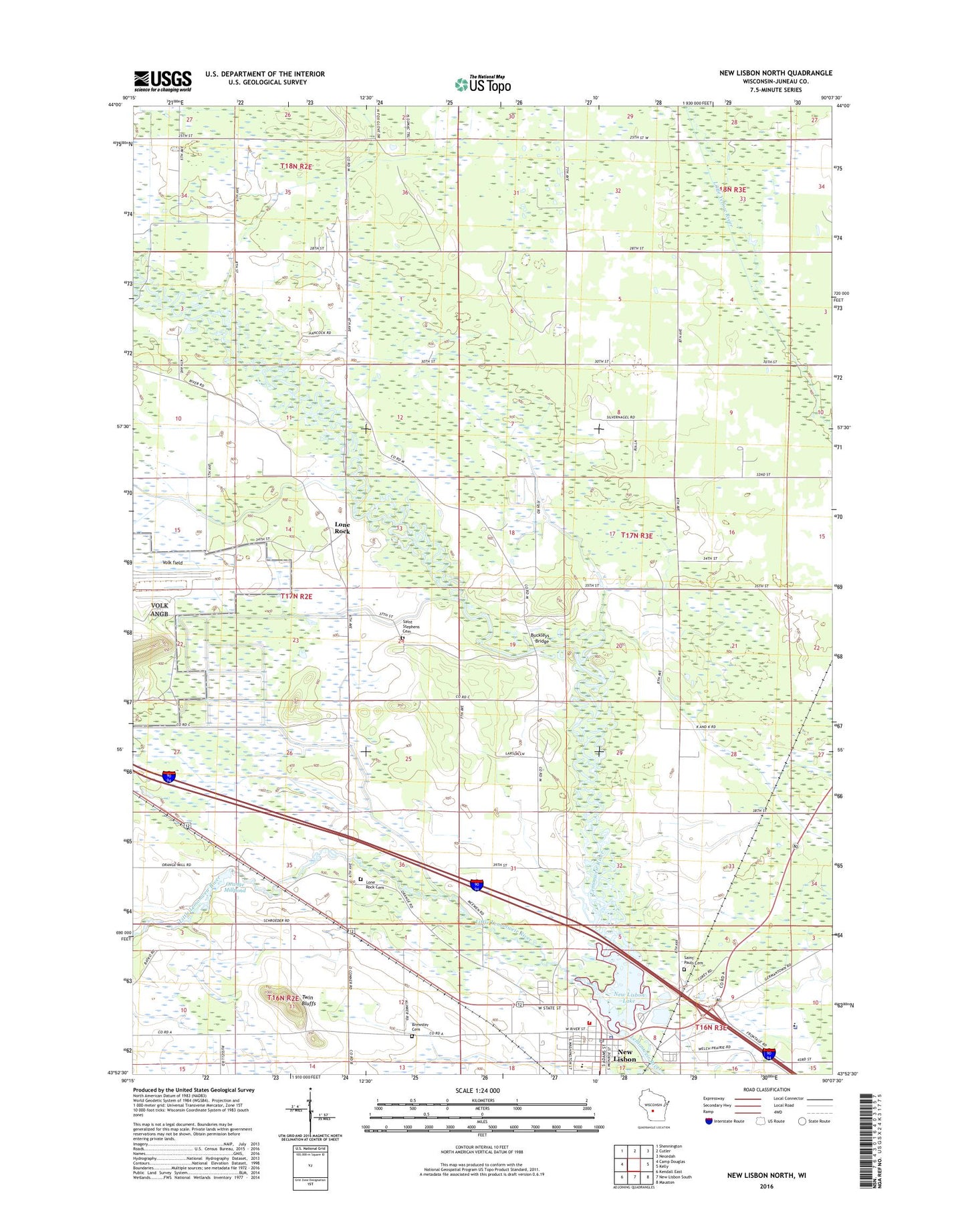
2022 topographic map quadrangle New Lisbon North in the state of Wisconsin. Scale: 1:24000. Based on the newly updated USGS 7.5' US Topo map series, this map is in the following counties: Juneau. The map contains contour data, water features, and other items you are used to seeing on USGS maps, but also has updated roads and other features. This is the next generation of topographic maps. Printed on high-quality waterproof paper with UV fade-resistant inks.
Quads adjacent to this one:
West: Camp Douglas
Northwest: Shennington
North: Cutler
Northeast: Necedah
East: Kelly
Southeast: Mauston
South: New Lisbon South
Southwest: Kendall East
This map covers the same area as the classic USGS quad with code o43090h2.
Contains the following named places: Bethany Lutheran Church, Brewster Cemetery, Buckleys Bridge, City of New Lisbon, First Baptist Church, Kennedy County Park, Little Lemonweir River, Lone Rock, New Lisbon, New Lisbon 2WP254 Dam, New Lisbon Correctional Institution, New Lisbon Correctional Institution School, New Lisbon Elementary School, New Lisbon Fire Department, New Lisbon High School, New Lisbon Lake, New Lisbon Memorial Library, New Lisbon Municipal Building, New Lisbon Police Department, New Lisbon Post Office, Orange Mill, Orange Millpond, Saint Lukes Evangelical Lutheran Church, Saint Paul's Catholic Cemetery, Saint Pauls Catholic Church, Saint Stephens Evangelical Lutheran Cemetery, Town of Clearfield, Town of Orange Cemetery, Twin Bluffs, ZIP Code: 53950