MyTopo
Ellenboro Wisconsin US Topo Map
Couldn't load pickup availability
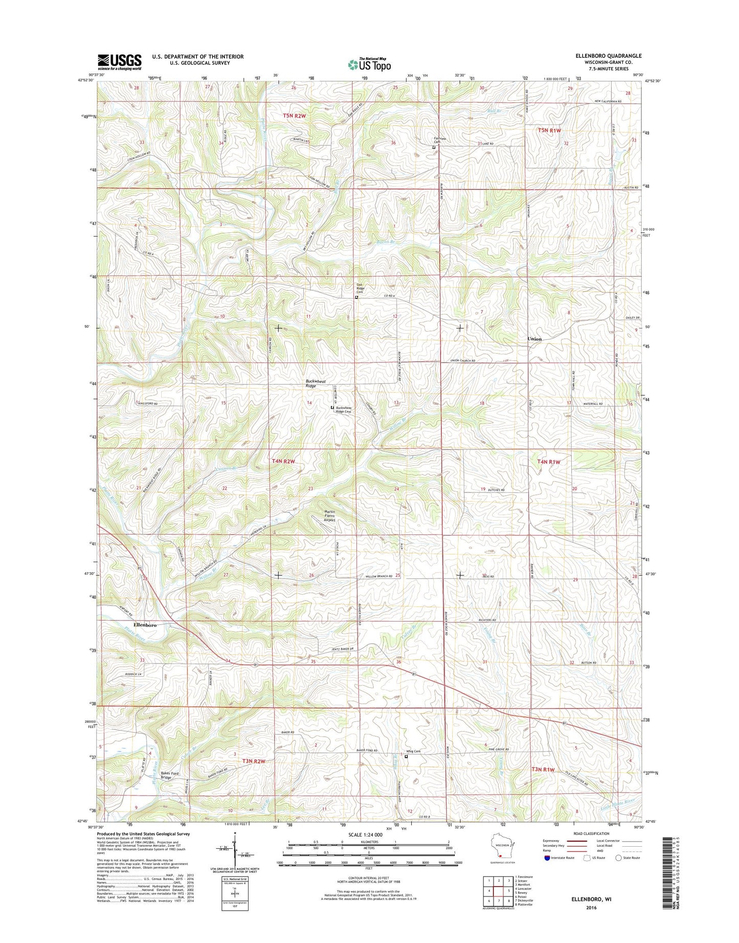
2018 topographic map quadrangle Ellenboro in the state of Wisconsin. Scale: 1:24000. Based on the newly updated USGS 7.5' US Topo map series, this map is in the following counties: Grant. The map contains contour data, water features, and other items you are used to seeing on USGS maps, but also has updated roads and other features. This is the next generation of topographic maps. Printed on high-quality waterproof paper with UV fade-resistant inks.
Quads adjacent to this one:
West: Lancaster
Northwest: Fennimore
North: Stitzer
Northeast: Montfort
East: Rewey
Southeast: Platteville
South: Dickeyville
Southwest: Potosi
Contains the following named places: Bacon Branch, Baker Ford Bridge, Bevan Farms, Bren - Mar Farms, Buck Wheat Ridge Cemetery, Buckwheat Farm, Buckwheat Ridge, Bull Branch, Cannon Branch, Culver Branch, Ellenboro, Fairview Cemetery, Hall Farm, Henry School, Lee Branch, Lima-Union Church, Martin Fierro Airport, Nobland Farms, Oak Ridge Cemetery, Pheasant Ridge Farm, Shea Dairy, Town of Ellenboro, Triple H Farm, Twin Platte School, Union, Union School, Whig Cemetery, Whig Church, White School, Willow Branch, Wilsons Creek