MyTopo
Fennimore Wisconsin US Topo Map
Couldn't load pickup availability
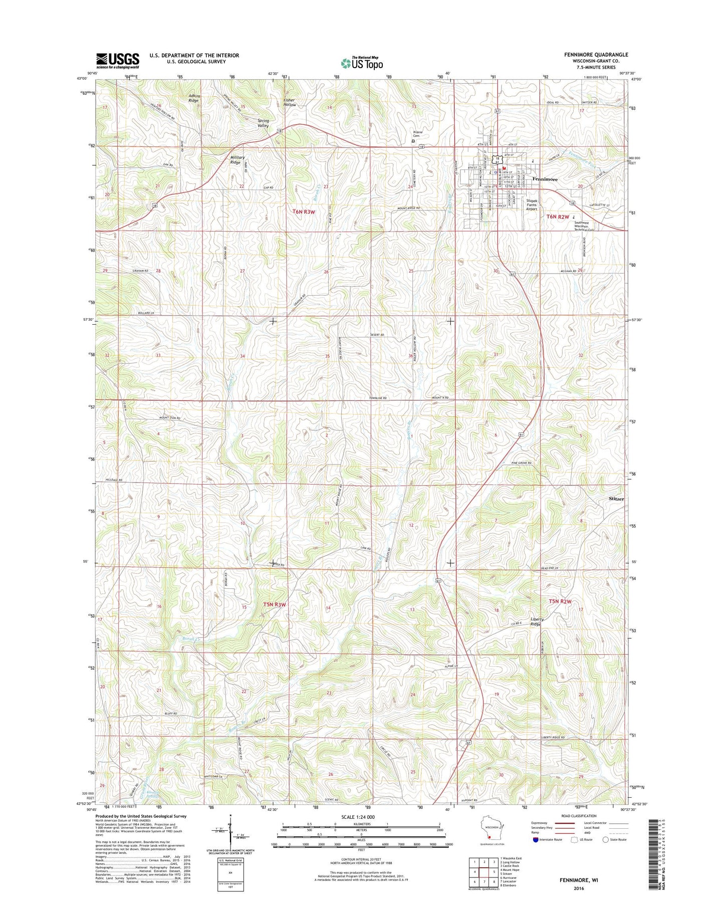
2022 topographic map quadrangle Fennimore in the state of Wisconsin. Scale: 1:24000. Based on the newly updated USGS 7.5' US Topo map series, this map is in the following counties: Grant. The map contains contour data, water features, and other items you are used to seeing on USGS maps, but also has updated roads and other features. This is the next generation of topographic maps. Printed on high-quality waterproof paper with UV fade-resistant inks.
Quads adjacent to this one:
West: Mount Hope
Northwest: Wauzeka East
North: Long Hollow
Northeast: Castle Rock
East: Stitzer
Southeast: Ellenboro
South: Lancaster
Southwest: Hurricane
This map covers the same area as the classic USGS quad with code o42090h6.
Contains the following named places: Borah Creek, City of Fennimore, Croft Quarry, Dellens Farms, Dwight T Parker Public Library, Fennimore, Fennimore Elementary School, Fennimore Middle / High School, Fennimore Police Department, Fennimore Post Office, Fennimore Railroad Historical Society Museum, Fennimore Rural Rescue Squad, Fennimore Rural Volunteer Fire Department, Fennimore Wastewater Treatment Facility, Five J Stock Farm, Grant County Christian Center, Klondike Springs, Klondyke Park, L and K Farms, Liberty Ridge, Maple Lane Trailer Court, Marsden Park, Mount Zion Church, Orthridge Farms, Prairie Cemetery, Rogers Branch, Rogers Hollow School, Rose Stone Farm, Rowdon School, Saint Marys Catholic Church, Saint Peter Lutheran Church, Scanlan Farms, Shaw Farm, Smith Farms, Southwest Wisconsin Technical College, Stupek Farms Airport, Town of Mount Ida, Town of North Lancaster, Trinity Evangelical Free Church, Whitcomb School, Wind Point Farms, Zart's Dairy, ZIP Code: 53809