
MyTopo
Fall Creek Wisconsin US Topo Map
Couldn't load pickup availability
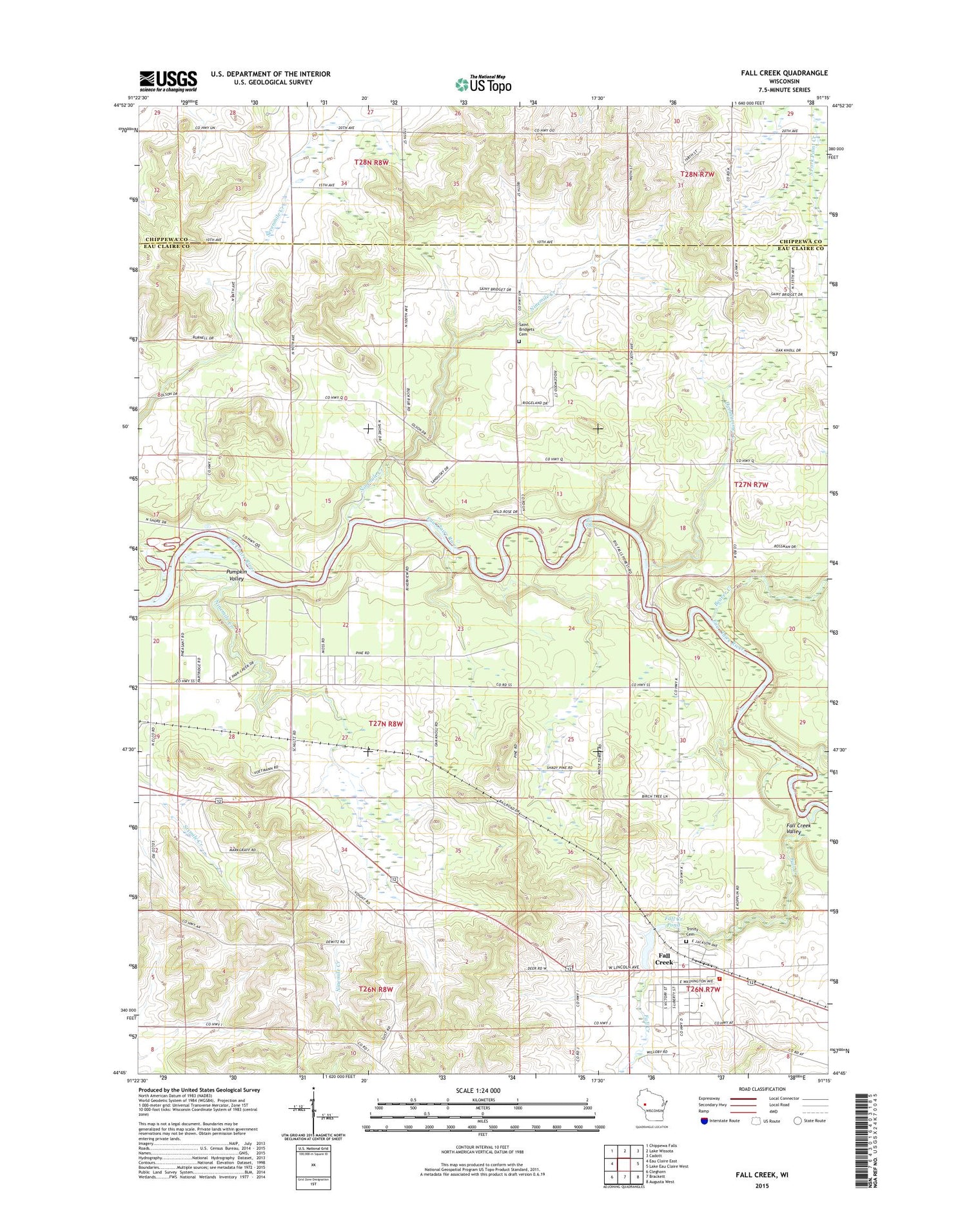
2018 topographic map quadrangle Fall Creek in the state of Wisconsin. Scale: 1:24000. Based on the newly updated USGS 7.5' US Topo map series, this map is in the following counties: Eau Claire, Chippewa. The map contains contour data, water features, and other items you are used to seeing on USGS maps, but also has updated roads and other features. This is the next generation of topographic maps. Printed on high-quality waterproof paper with UV fade-resistant inks.
Quads adjacent to this one:
West: Eau Claire East
Northwest: Chippewa Falls
North: Lake Wissota
Northeast: Cadott
East: Lake Eau Claire West
Southeast: Augusta West
South: Brackett
Southwest: Cleghorn
Contains the following named places: Beaver Creek, Big Falls, Bluff School, Bourman School, Connell's Orchard, Countryside Manor Mobile Home Park, Culbert School, Deinhammer Creek, Fall Creek, Fall Creek Area Fire District, Fall Creek Elementary School, Fall Creek High School, Fall Creek Middle School, Fall Creek Police Department, Fall Creek Pond, Fall Creek Post Office, Fall Creek Valley, Hager Farm, Hillyview School, J and J Tree Farm, Knudston Farms, Ninemile Creek, Oakview School, Pumpkin Valley, Saint Bridgets Cemetery, Saint Bridgets Church, Seymour Central School, Seymour Town Hall, Springfield Prairie School, Sweet Pine Farm, Top of the Hill Farm, Town of Seymour, Trinity Cemetery, Village of Fall Creek, Vogler Flour Mill Dam, Washington School, WCFW-FM (Chippewa Falls), Wildlands Charter School, ZIP Code: 54742


