MyTopo
Lake Wissota Wisconsin US Topo Map
Couldn't load pickup availability
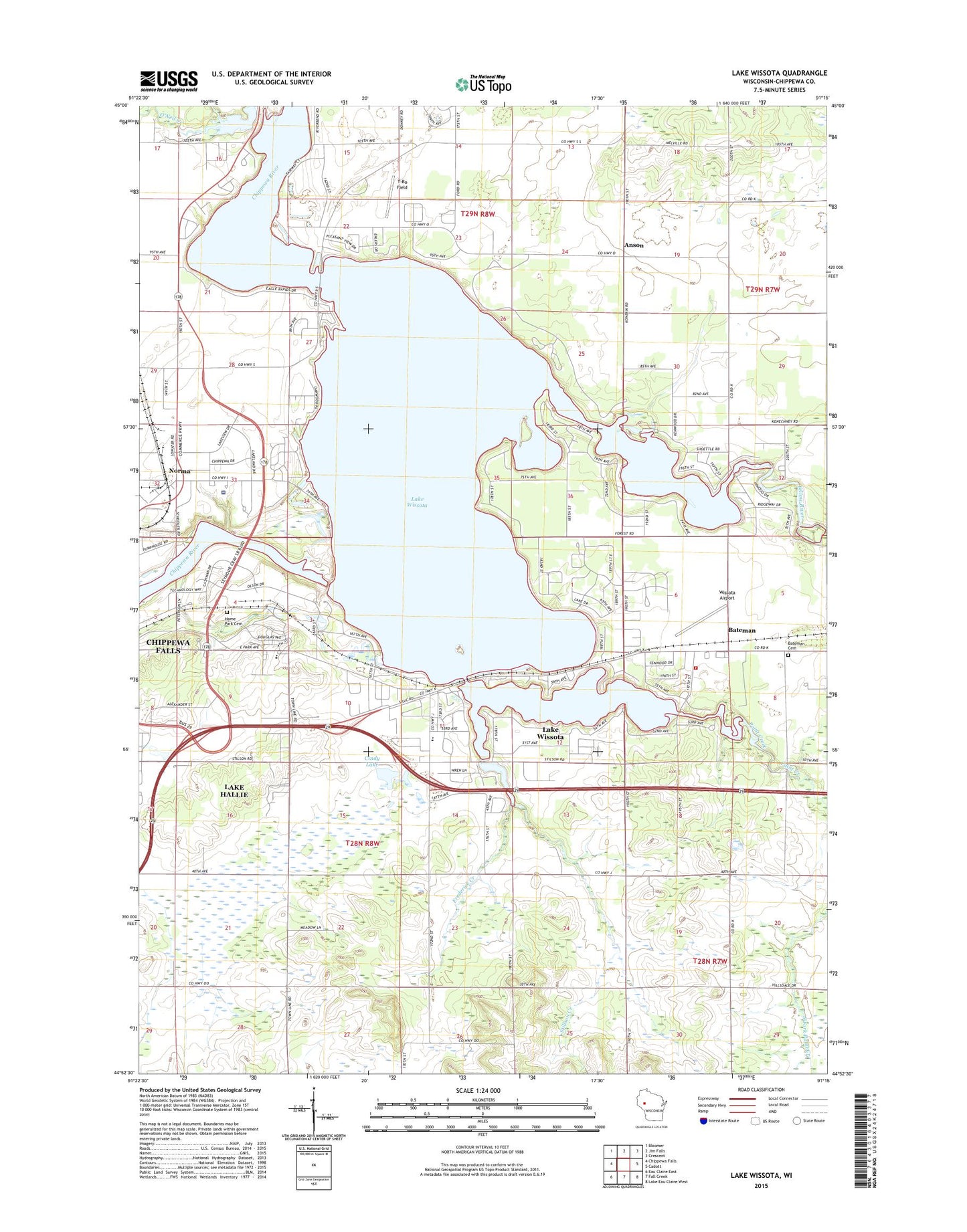
2022 topographic map quadrangle Lake Wissota in the state of Wisconsin. Scale: 1:24000. Based on the newly updated USGS 7.5' US Topo map series, this map is in the following counties: Chippewa. The map contains contour data, water features, and other items you are used to seeing on USGS maps, but also has updated roads and other features. This is the next generation of topographic maps. Printed on high-quality waterproof paper with UV fade-resistant inks.
Quads adjacent to this one:
West: Chippewa Falls
Northwest: Bloomer
North: Jim Falls
Northeast: Crescent
East: Cadott
Southeast: Lake Eau Claire West
South: Fall Creek
Southwest: Eau Claire East
This map covers the same area as the classic USGS quad with code o44091h3.
Contains the following named places: Amber Farm, Anson, Anson Station, Bateman, Bateman Cemetery, Butak Farms, Camp Sko-Lo-A, Chippewa Fire District Station 3, Cindy Lake, Colony Pit, Eagle School, Elks Country Club, Elm Grove School, English Lutheran Church, Frederick Creek, Frederick School, Hallie State Public Hunting Grounds, Home Park Cemetery, Jim Creek, Lake Wissota, Lake Wissota 5548, Lake Wissota Census Designated Place, Lake Wissota State Park, Liberty Christian School, Norma, Northern Wisconsin Center, O'Neil Creek, Paint Creek, Pine Harbor Woods Park, Saint Joseph's Hospital, Saint Simeons Church, Stillson Creek, Stillson Elementary School, T-Bo Field, Timber Terrace Golf Course, Town of Hallie, Town of Lafayette, Wissota Airport, Wissota Hydro Generating Station, Wissota WP37 Dam, Yellow River