
MyTopo
Fence Lake Wisconsin US Topo Map
Couldn't load pickup availability
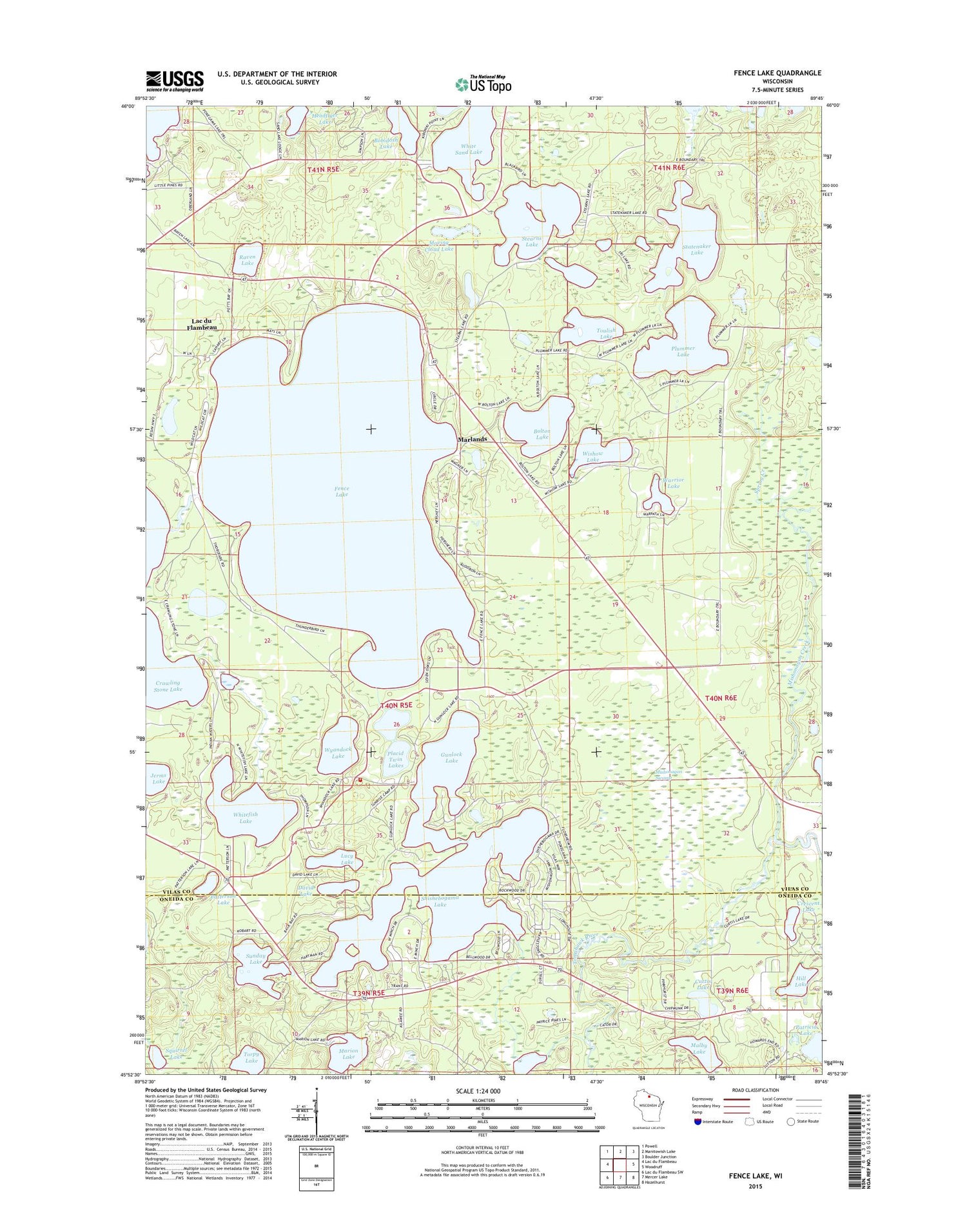
2018 topographic map quadrangle Fence Lake in the state of Wisconsin. Scale: 1:24000. Based on the newly updated USGS 7.5' US Topo map series, this map is in the following counties: Vilas, Oneida. The map contains contour data, water features, and other items you are used to seeing on USGS maps, but also has updated roads and other features. This is the next generation of topographic maps. Printed on high-quality waterproof paper with UV fade-resistant inks.
Quads adjacent to this one:
West: Lac du Flambeau
Northwest: Powell
North: Manitowish Lake
Northeast: Boulder Junction
East: Woodruff
Southeast: Hazelhurst
South: Mercer Lake
Southwest: Lac du Flambeau SW
Contains the following named places: Bobidosh Lake, Bolton Lake, Crescent Lake, Curtis Lake, David Lake, Fence Lake, Flambeau Lookout Tower, Gunlock Lake, Headflyer Lake, Hill Lake, Inkpot Lake, Lac du Flambeau Fire and Ambulance Department Station 2, Lac du Flambeau Station, Lucy Lake, Malby Lake, Marion Lake, Marlands, Marlands Lake, Marlands School, Mercer Springs, Mishonagon Creek, Mishonagon Swamp, Moving Cloud Lake, Patricia Lake, Patterson Lake, Placid Twin Lakes, Plummer Lake, Raven Lake, Shishebogama Lake, Spring Creek, Statenaker Lake, Stearns Lake, Sunday Lake, Torpy Lake, Toulish Lake, Warrior Lake, Whitefish Lake, Wishow Lake, Wyandock Lake


