MyTopo
Boulder Junction Wisconsin US Topo Map
Couldn't load pickup availability
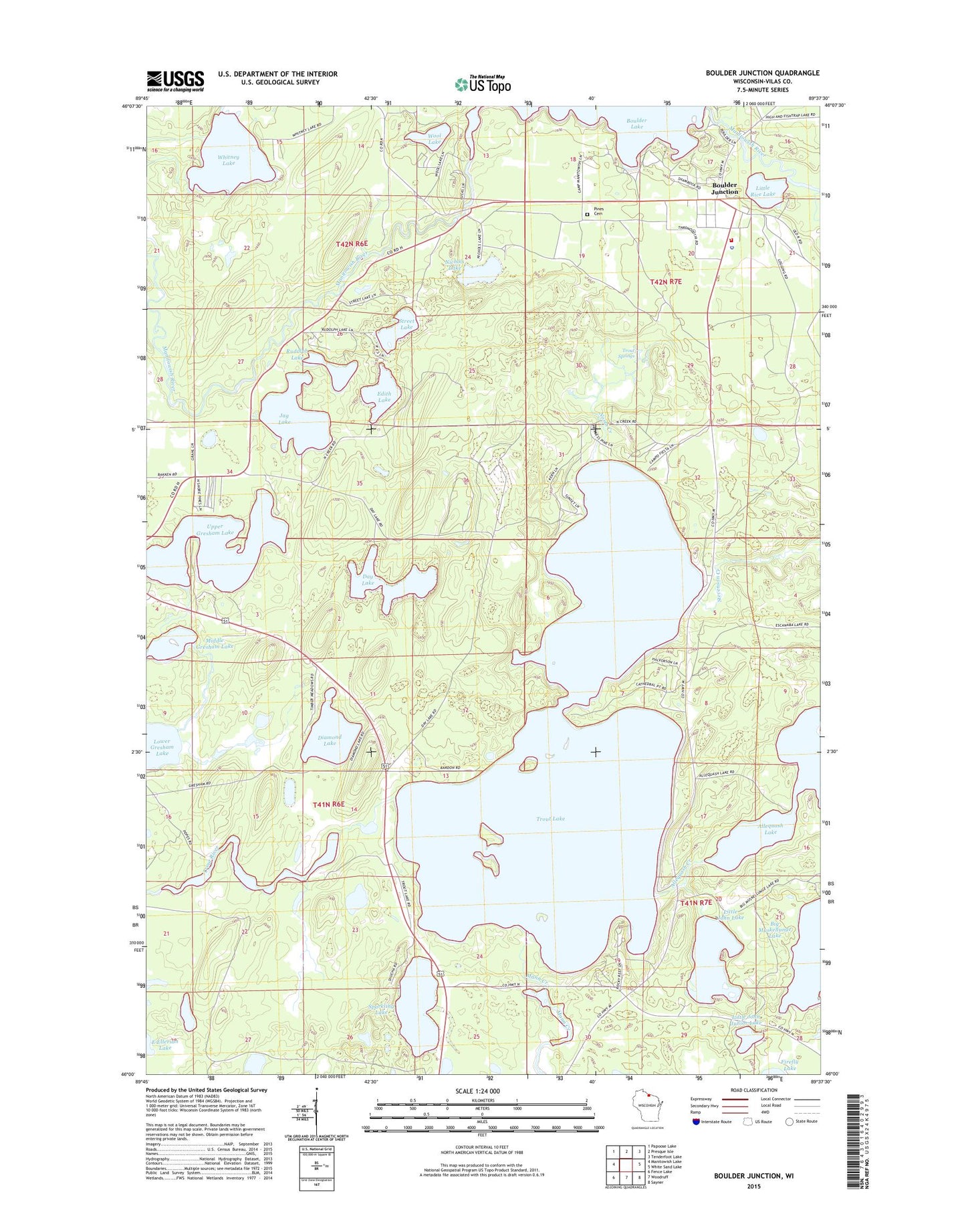
2022 topographic map quadrangle Boulder Junction in the state of Wisconsin. Scale: 1:24000. Based on the newly updated USGS 7.5' US Topo map series, this map is in the following counties: Vilas. The map contains contour data, water features, and other items you are used to seeing on USGS maps, but also has updated roads and other features. This is the next generation of topographic maps. Printed on high-quality waterproof paper with UV fade-resistant inks.
Quads adjacent to this one:
West: Manitowish Lake
Northwest: Papoose Lake
North: Presque Isle
Northeast: Tenderfoot Lake
East: White Sand Lake
Southeast: Sayner
South: Woodruff
Southwest: Fence Lake
This map covers the same area as the classic USGS quad with code o46089a6.
Contains the following named places: Allequash Lake, Boulder Junction, Boulder Junction Census Designated Place, Boulder Junction Police Department, Boulder Junction Post Office, Boulder Junction Volunteer Fire Department, Boulder Lake, Boulder Lookout Tower, Camp Fiesta, Camp Manito-wish, Day Lake, Day Lake State Natural Area, Diamond Lake, Edith Lake, Jag Lake, Little John Junior Lake, Little John Lake, Little Rice Lake, Mann Creek, Middle Gresham Lake, Midge Lake, Nichols Lake, North Creek, Pines Cemetery, Rudolph Lake, Sparkling Lake, Stevenson Creek, Street Lake, Town of Boulder Junction, Trout Lake, Trout Lake Conifer Swamp State Natural Area, Trout Springs, Upper Gresham Lake, White Sand Creek, Whitney Lake, Wool Lake, ZIP Code: 54512