
MyTopo
Florence East Wisconsin US Topo Map
Couldn't load pickup availability
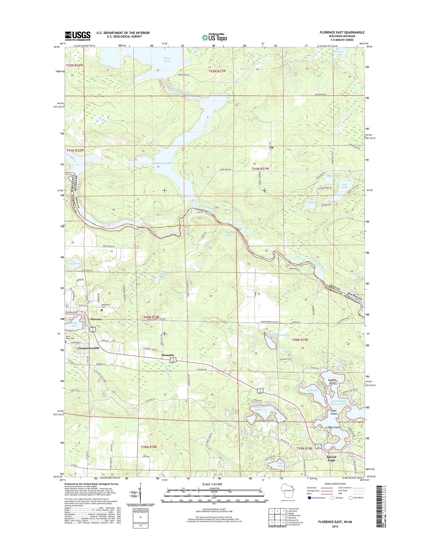
2018 topographic map quadrangle Florence East in the states of Wisconsin, Michigan. Scale: 1:24000. Based on the newly updated USGS 7.5' US Topo map series, this map is in the following counties: Florence, Iron. The map contains contour data, water features, and other items you are used to seeing on USGS maps, but also has updated roads and other features. This is the next generation of topographic maps. Printed on high-quality waterproof paper with UV fade-resistant inks.
Quads adjacent to this one:
West: Florence West
Northwest: Crystal Falls
North: Lake Mary
Northeast: Sagola
East: Randville
Southeast: Iron Mountain
South: Iron Mountain SW
Southwest: Florence SE
Contains the following named places: Alpha - Mastodon Township Volunteer Fire Department Station 2, Baird Creek, Baird Lake, Bass Island, Bass Lake, Bethlehem Lutheran Church, Brule Island Dam, Brule Island Power Plant, Brule River, Brule River Flowage, Buckeye Lookout Tower, Commonwealth, Commonwealth Cemetery, Cosgrove Lake, Deadman Creek, Eagle Island, First Creek, First Presbyterian Church, Fisher Creek, Fisher Lake, Florence Census Designated Place, Florence County Courthouse, Florence County Sheriff's Office, Florence Elementary School, Florence Middle - High School, Florence Middle School, Gages Creek, Gages Lake, Hematite, Jule Lake, Lake Anna, Lilly Lake, Long Lake, Lost Lake, Marlow Lake, Michigamme Falls Dam, Michigamme Lake, Michigamme River, Middle Lake, Montgomery Lake, Mud Lake, North Lake, Paint River, Peavy Falls Dam, Pershing School, Railroad Lake, Robbins Island, Saint Johns Lutheran Church, Saint Marys Catholic Church, Spread Eagle, Spread Eagle Chain of Lakes, West Lake, Woodlawn Cemetery


