MyTopo
Florence West Wisconsin US Topo Map
Couldn't load pickup availability
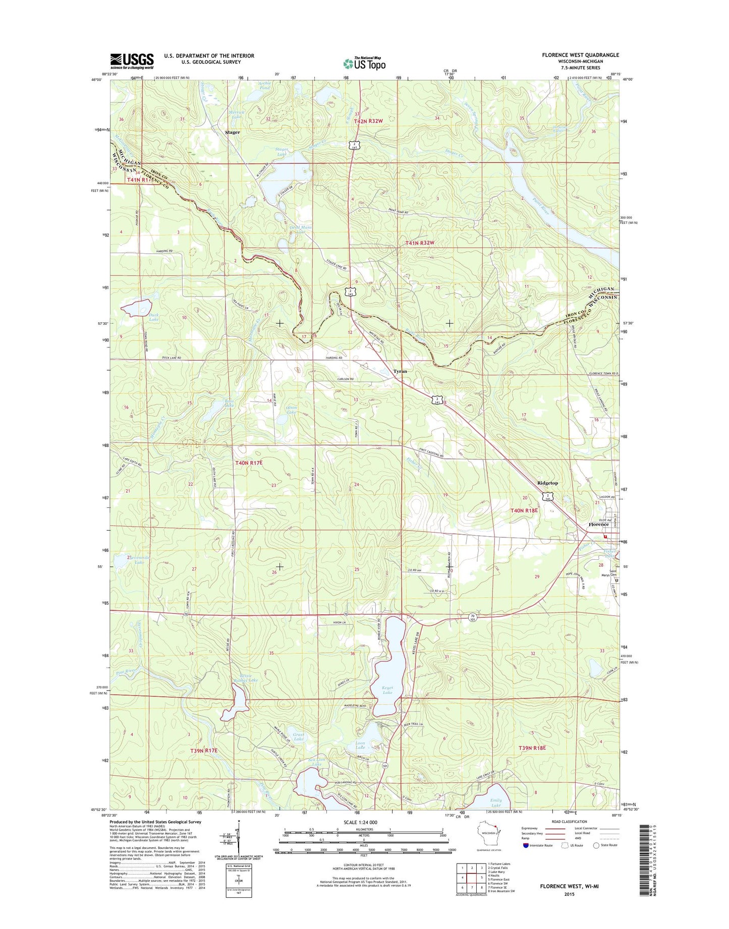
2022 topographic map quadrangle Florence West in the states of Wisconsin, Michigan. Scale: 1:24000. Based on the newly updated USGS 7.5' US Topo map series, this map is in the following counties: Florence, Iron. The map contains contour data, water features, and other items you are used to seeing on USGS maps, but also has updated roads and other features. This is the next generation of topographic maps. Printed on high-quality waterproof paper with UV fade-resistant inks.
Quads adjacent to this one:
West: Naults
Northwest: Fortune Lakes
North: Crystal Falls
Northeast: Lake Mary
East: Florence East
Southeast: Iron Mountain SW
South: Florence SE
Southwest: Florence SW
This map covers the same area as the classic USGS quad with code o45088h3.
Contains the following named places: American Legion Park, Archie Pond, Bass Lake, Bessie Babbet Lake, Brule School, Dead Mans Lake, Duck Lake, Florence, Florence Fire Department, Florence Post Office, Florence Rescue Squad, Grass Lake, Horserace Rapids, Keyes Lake, Loon Lake, McGoverns Creek, Merrick Lake, Montagne Creek, Olson Lake, Paint River Pond, Ridgetop, Sea Lion Lake, Seven Springs Creek, Sevenmile Creek, Sevenmile Lake, South Slough, Stager, Stager Creek, Stager Lake, Stager Lake Park, Stager Station, Tyran