MyTopo
Florence SE Wisconsin US Topo Map
Couldn't load pickup availability
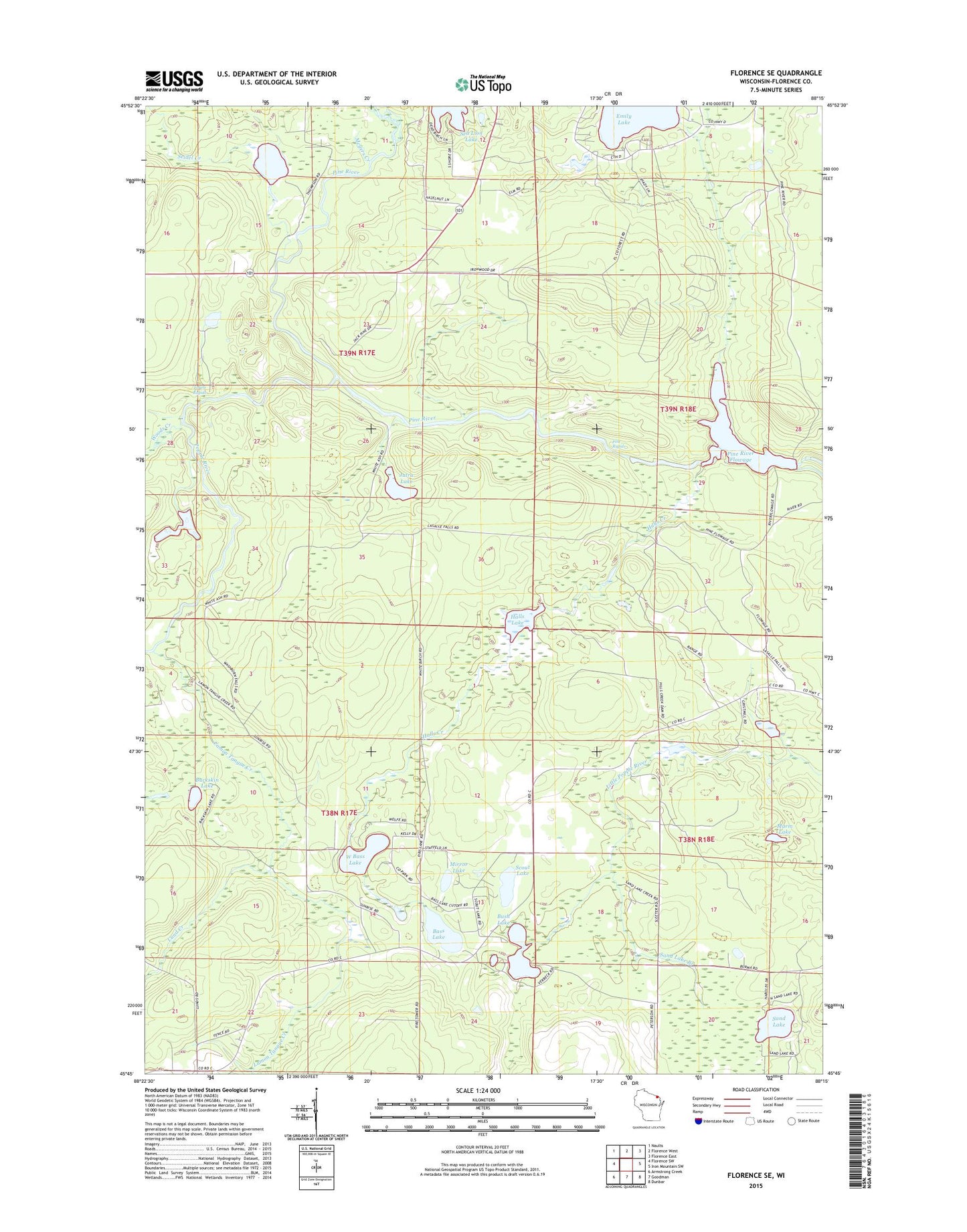
2022 topographic map quadrangle Florence SE in the state of Wisconsin. Scale: 1:24000. Based on the newly updated USGS 7.5' US Topo map series, this map is in the following counties: Florence. The map contains contour data, water features, and other items you are used to seeing on USGS maps, but also has updated roads and other features. This is the next generation of topographic maps. Printed on high-quality waterproof paper with UV fade-resistant inks.
Quads adjacent to this one:
West: Florence SW
Northwest: Naults
North: Florence West
Northeast: Florence East
East: Iron Mountain SW
Southeast: Dunbar
South: Goodman
Southwest: Armstrong Creek
This map covers the same area as the classic USGS quad with code o45088g3.
Contains the following named places: Bass Lake, Bass Lake Lookout Tower, Breakwater Falls, Buckskin Lake, Bush Lake, Emily Lake, Halls Creek, Halls Creek Wildlife Flowage 3WR1799 Dam, Halls Lake, Halls Lake 4.95, Homestead Park, Jutra Lake, Lamon Tangue Creek, Little Emily Lake, Lund Creek, Marm Lake, Meyers Creek, Mirror Lake, Pine Dam, Pine Rapids, Pine River Dam, Pine River Flowage, Pine River Flowage 543, Popple Rapids, Popple River, Prairie School, Sand Lake, Sand Lake Branch, Scout Lake, Seidel Creek, Seidel Lake, Town of Fern, Town of Homestead, Township of Fern Pit, West Bass Lake, Woods Creek, ZIP Code: 54121