MyTopo
Fountain City Wisconsin US Topo Map
Couldn't load pickup availability
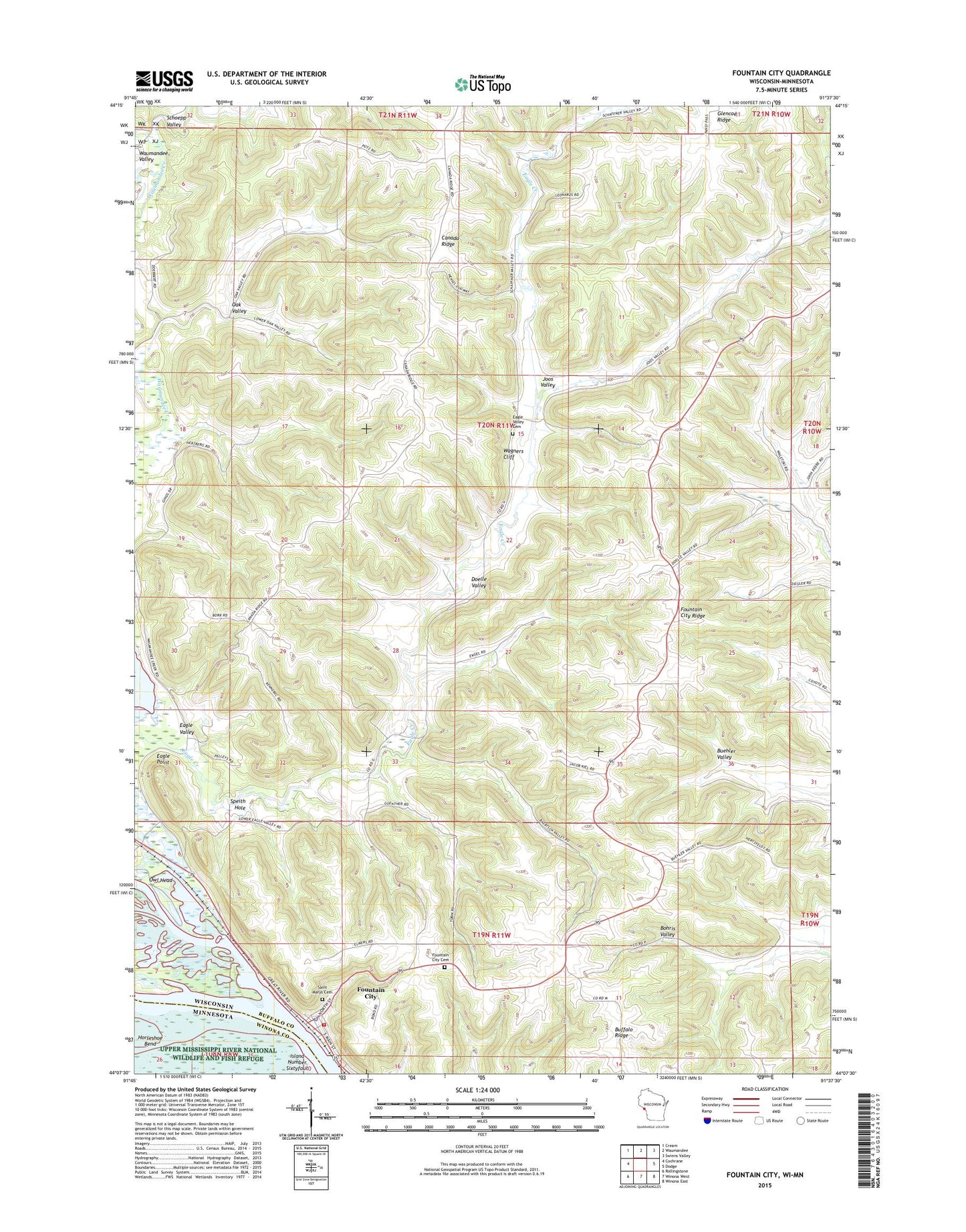
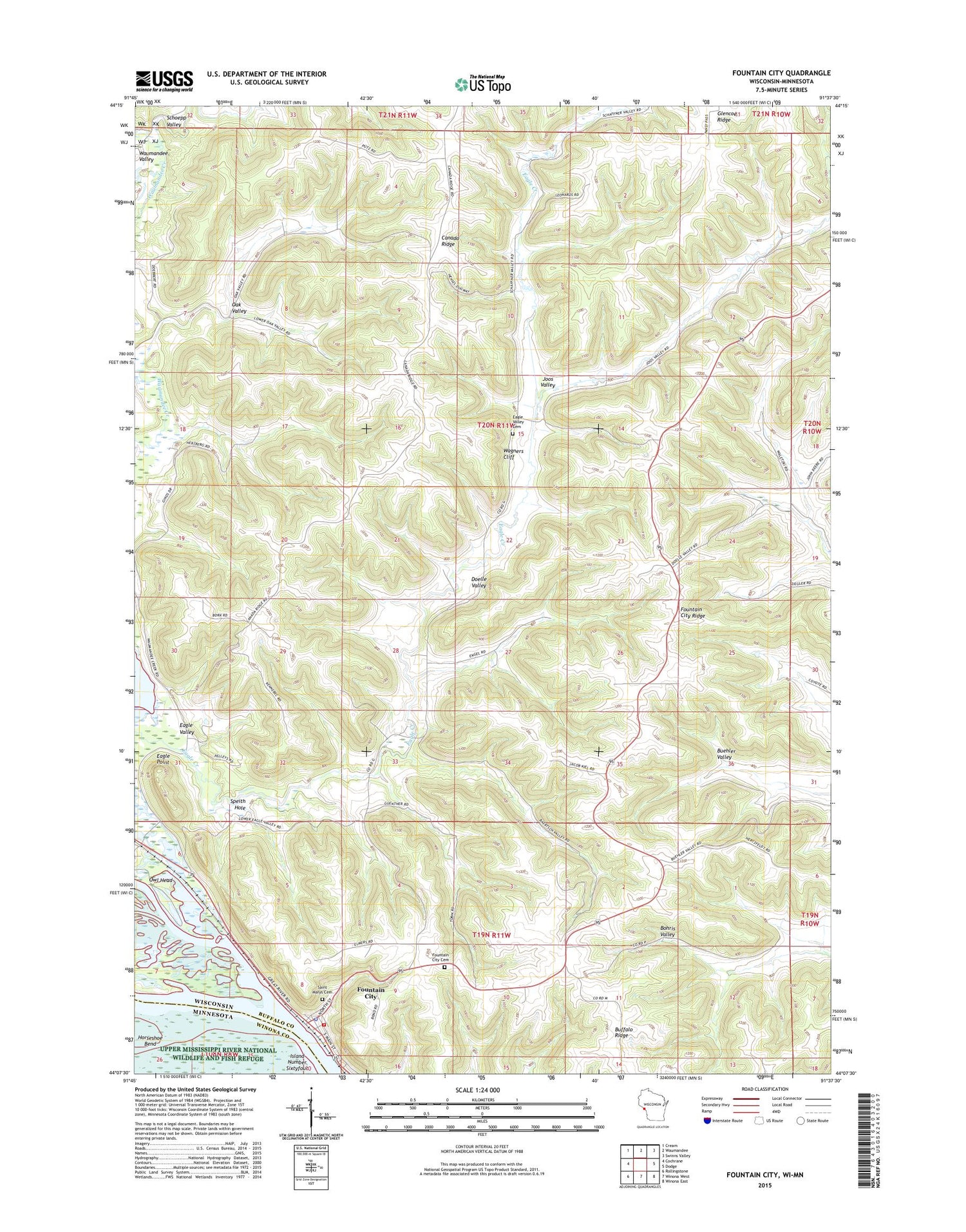
2018 topographic map quadrangle Fountain City in the states of Wisconsin, Minnesota. Scale: 1:24000. Based on the newly updated USGS 7.5' US Topo map series, this map is in the following counties: Buffalo, Winona. The map contains contour data, water features, and other items you are used to seeing on USGS maps, but also has updated roads and other features. This is the next generation of topographic maps. Printed on high-quality waterproof paper with UV fade-resistant inks.
Quads adjacent to this one:
West: Cochrane
Northwest: Cream
North: Waumandee
Northeast: Swinns Valley
East: Dodge
Southeast: Winona East
South: Winona West
Southwest: Rollingstone
Contains the following named places: Canada Ridge, Cross School, Eagle Point, Eagle Valley, Eagle Valley Cemetery, Evangelical Reformed Church, Fairview School, Fountain City, Fountain City Bay, Fountain City Cemetery, Fountain City Fire Department, Fountain City Post Office, Fountain City Ridge, Fountain Police Department, Glencoe Ridge, Horseshoe Bend, Joos Valley, Merrick State Park, Oak Valley, Owl Head, Saint Marys Cemetery, Schoepp Valley, Schoepps Creek, Speith Hole, Town of Cross, Upper Mississippi Wild Life and Fish Refuge, Wagners Cliff, Waumandee Creek, ZIP Code: 54629