MyTopo
Swinns Valley Wisconsin US Topo Map
Couldn't load pickup availability
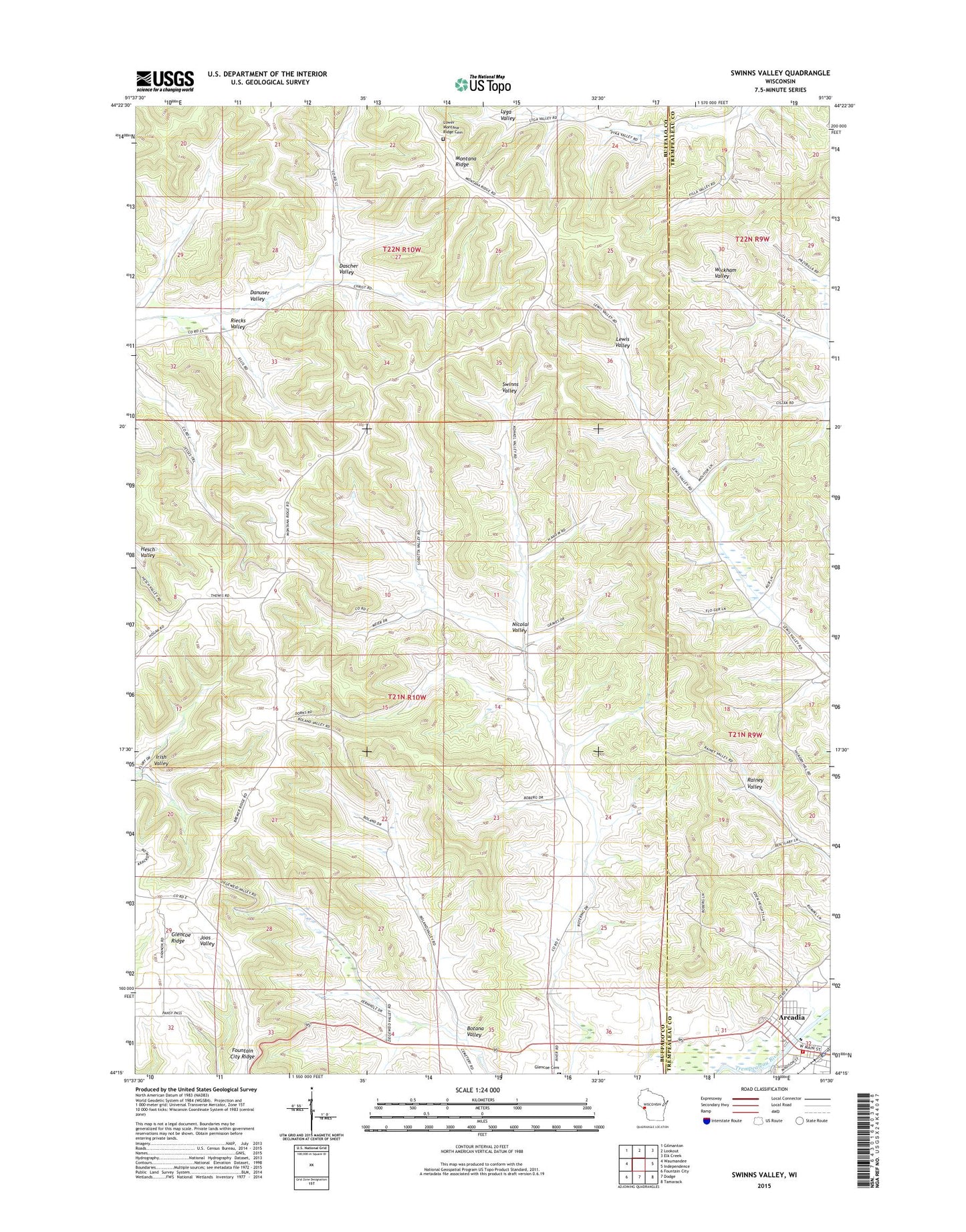
2022 topographic map quadrangle Swinns Valley in the state of Wisconsin. Scale: 1:24000. Based on the newly updated USGS 7.5' US Topo map series, this map is in the following counties: Buffalo, Trempealeau. The map contains contour data, water features, and other items you are used to seeing on USGS maps, but also has updated roads and other features. This is the next generation of topographic maps. Printed on high-quality waterproof paper with UV fade-resistant inks.
Quads adjacent to this one:
West: Waumandee
Northwest: Gilmanton
North: Lookout
Northeast: Elk Creek
East: Independence
Southeast: Tamarack
South: Dodge
Southwest: Fountain City
This map covers the same area as the classic USGS quad with code o44091c5.
Contains the following named places: Arcadia, Arcadia - Glencoe Fire Department, Botana Valley, Christ Lutheran Church, Cowie School, Dascher Valley, Glencoe, Hillside School, Lower Montana Ridge Cemetery, McWeeney School, Montana Ridge, Montana Ridge School, Nicolai Valley, Pecks School, Riecks Valley, Town of Glencoe, Trinity United Methodist Church, Turton Creek, Upper Irish Valley School