MyTopo
Cream Wisconsin US Topo Map
Couldn't load pickup availability
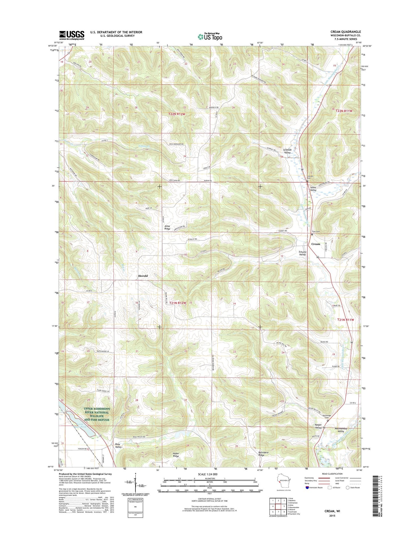
2022 topographic map quadrangle Cream in the state of Wisconsin. Scale: 1:24000. Based on the newly updated USGS 7.5' US Topo map series, this map is in the following counties: Buffalo. The map contains contour data, water features, and other items you are used to seeing on USGS maps, but also has updated roads and other features. This is the next generation of topographic maps. Printed on high-quality waterproof paper with UV fade-resistant inks.
Quads adjacent to this one:
West: Alma
Northwest: Urne
North: Modena
Northeast: Gilmanton
East: Waumandee
Southeast: Fountain City
South: Cochrane
Southwest: Weaver
This map covers the same area as the classic USGS quad with code o44091c7.
Contains the following named places: 0.24 Reservoir, 1.3 Reservoir, 1.4 Reservoir, 1.5 Reservoir, 5.1 Reservoir, 54610, 54622, Alma Mill 2 D6519 Dam, Alma Mill 3 D6519 Dam, Alma Mill 4 D6519 Dam, Alma Mill 5 D6519 Dam, Alma Mill 6 D6519 Dam, Alma Ridge, Alma Ridge School, Anchorage, Anchorage Cemetery, Anchorage School, Belvidere Ridge, Cream, Garden Valley 10 E597 Dam, Herold, Jahns Creek, Jahns Valley, Lakeview School, Lincoln Cemetery, Little Bluebell School, Lizzy Pauls Pond, Rose Valley, Rose Valley School, Schmidt Valley, Schultz Valley, Tell Church, Town of Belvidere, Yaeger Valley, Zion Church, Zion Evangelical Lutheran Cemetery