MyTopo
Foxboro Wisconsin US Topo Map
Couldn't load pickup availability
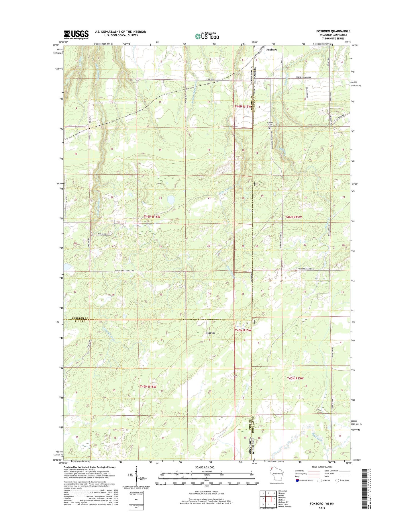
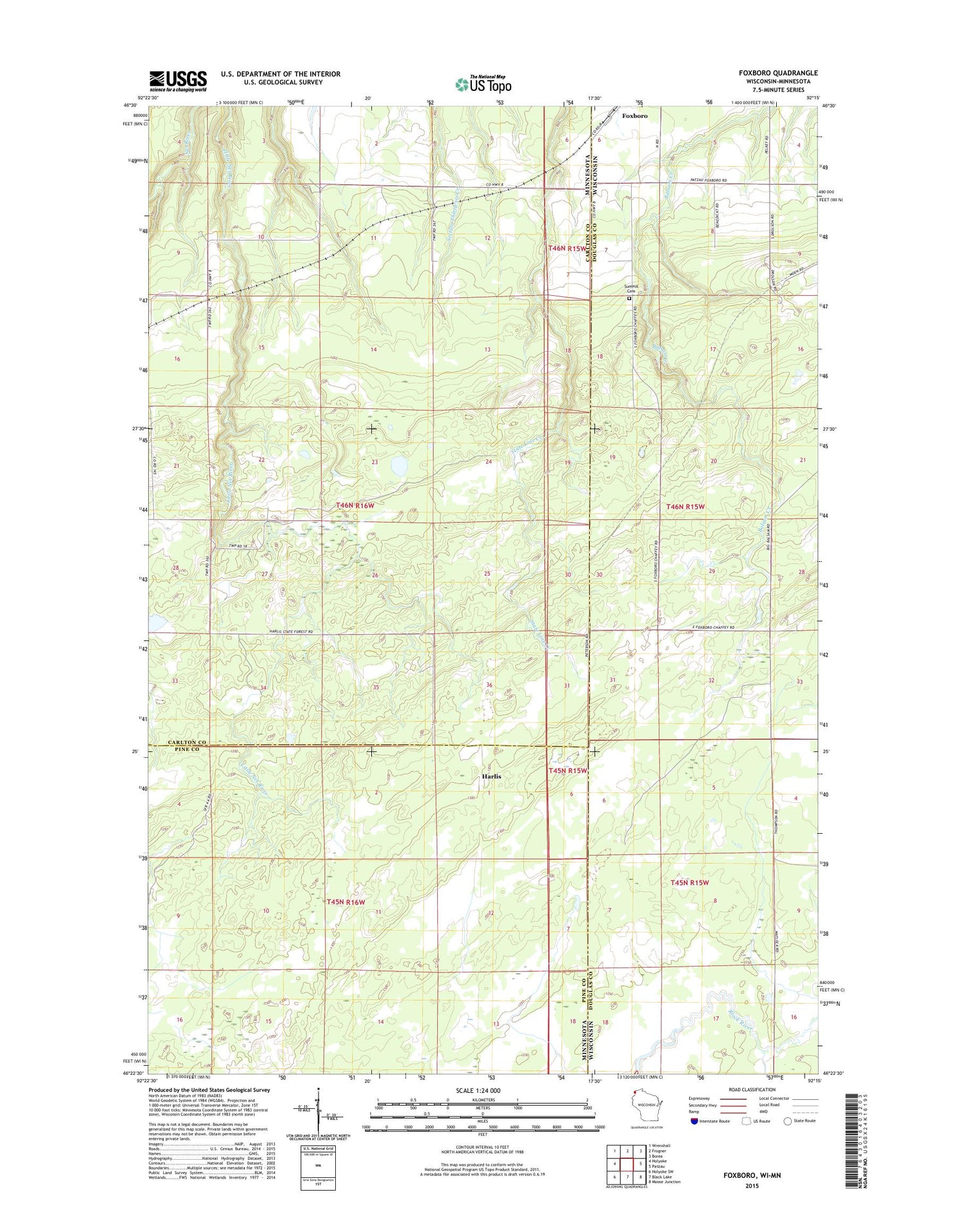
2018 topographic map quadrangle Foxboro in the states of Minnesota, Wisconsin. Scale: 1:24000. Based on the newly updated USGS 7.5' US Topo map series, this map is in the following counties: Douglas, Carlton, Pine. The map contains contour data, water features, and other items you are used to seeing on USGS maps, but also has updated roads and other features. This is the next generation of topographic maps. Printed on high-quality waterproof paper with UV fade-resistant inks.
Quads adjacent to this one:
West: Holyoke
Northwest: Wrenshall
North: Frogner
Northeast: Borea
East: Patzau
Southeast: Moose Junction
South: Black Lake
Southwest: Holyoke SW
Contains the following named places: Foxboro, Harlis, Summit Cemetery, Township of Holyoke