MyTopo
Gordon Wisconsin US Topo Map
Couldn't load pickup availability
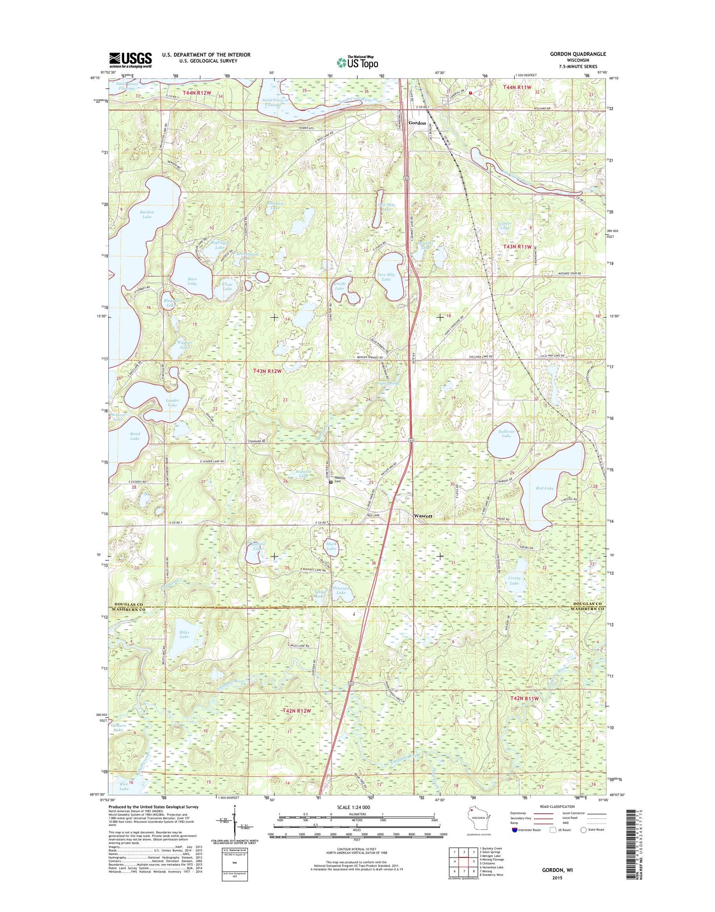
2018 topographic map quadrangle Gordon in the state of Wisconsin. Scale: 1:24000. Based on the newly updated USGS 7.5' US Topo map series, this map is in the following counties: Douglas, Washburn. The map contains contour data, water features, and other items you are used to seeing on USGS maps, but also has updated roads and other features. This is the next generation of topographic maps. Printed on high-quality waterproof paper with UV fade-resistant inks.
Quads adjacent to this one:
West: Minong Flowage
Northwest: Buckety Creek
North: Solon Springs
Northeast: Metzger Lake
East: Chittamo
Southeast: Stanberry West
South: Minong
Southwest: Horseshoe Lake
Contains the following named places: Arrowhead Lake, Bass Lake, Beglinger Lake, Bergen Springs, Bluegill Lake, Bond Lake, Brule River State Forest Annex, Buffalo Lake, Clear Lake, Crotty Lake, Eau Claire River Flowage 33, Frog Creek, Gordon, Gordon 2WP49 Dam, Gordon Census Designated Place, Gordon Post Office, Gordon Town Constable, Gordon Volunteer Fire Department, Gordon Wascott Emergency Medical Services, Grover Lake, Harriet Lake, Kreide Lake, Leader Lake, Miles Lake, Muck Lake, Northwood School, One Mile Lake, Peterson Lake, Rainbow Lake, Red Lake, Rice Lake, Shell Creek, Sullivan Lake, Town of Wascott, Two Mile Lake, Wagner Lake, Wascott, Wascott Cemetery, Wascott Lake, Whitefish Lake, Yoekel Lake