MyTopo
Irma Wisconsin US Topo Map
Couldn't load pickup availability
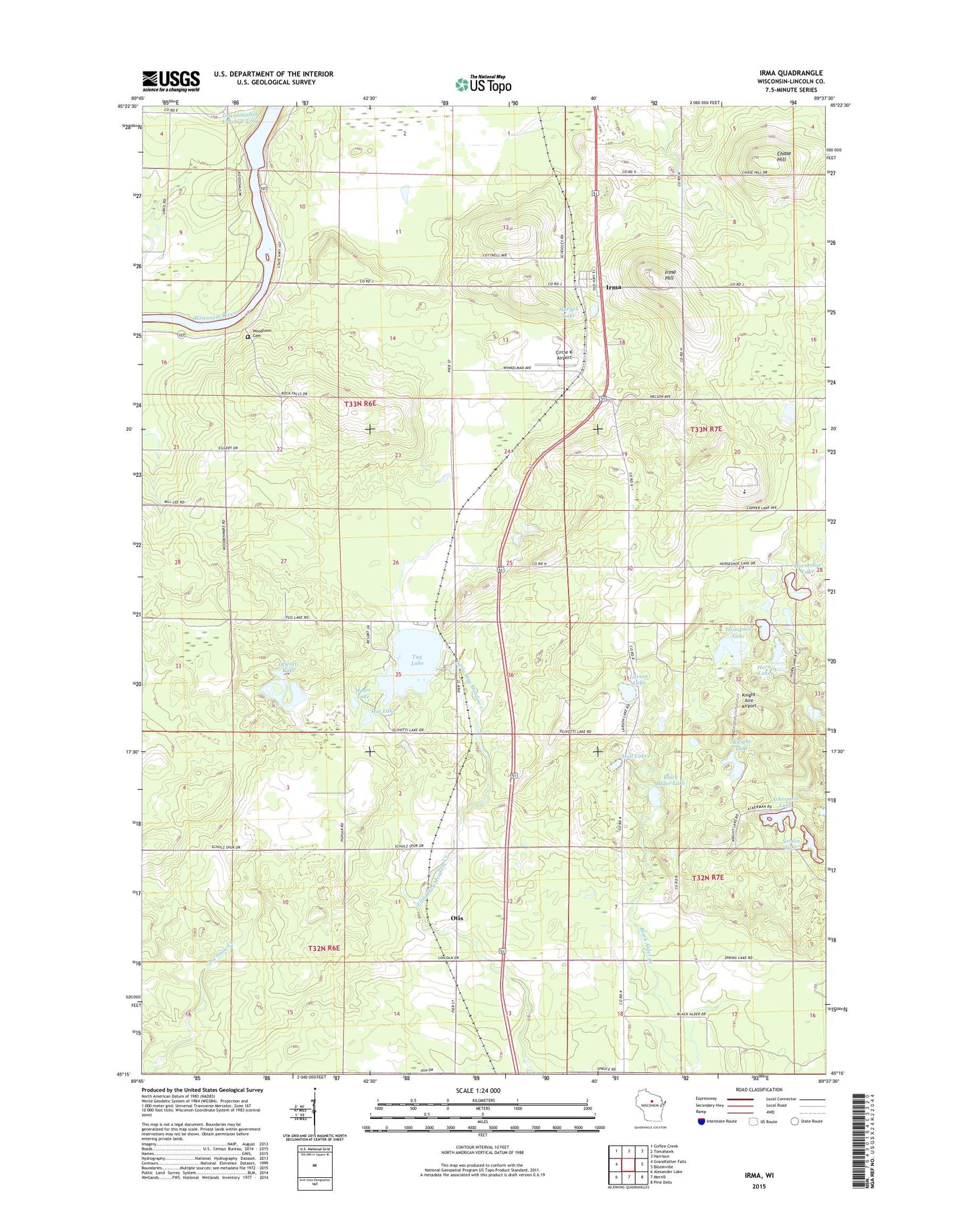
2022 topographic map quadrangle Irma in the state of Wisconsin. Scale: 1:24000. Based on the newly updated USGS 7.5' US Topo map series, this map is in the following counties: Lincoln. The map contains contour data, water features, and other items you are used to seeing on USGS maps, but also has updated roads and other features. This is the next generation of topographic maps. Printed on high-quality waterproof paper with UV fade-resistant inks.
Quads adjacent to this one:
West: Grandfather Falls
Northwest: Coffee Creek
North: Tomahawk
Northeast: Harrison
East: Bloomville
Southeast: Pine Dells
South: Merrill
Southwest: Alexander Lake
This map covers the same area as the classic USGS quad with code o45089c6.
Contains the following named places: Ackerman Lake, Bethany Church, Black Alder Lake, Camp Birch Trail, Chase Hill, Chat Church, Chat School, Circle K Airport, Cotter School, Grandmother Dam, Grandmother Falls WP185 Dam, Hat Lake, Heart Lake, Horgen Lake, Horn Lake, Horseshoe Lake, Irma, Irma Hill, Irma Post Office, Knight Aire Airport, Knight Lake, Larson Lake, Lincoln County, Lincoln Hills School, Lincoln Hills School Correctional Institute, Mud Lake, Nelson Lake, Olivotti Lake, Otis, Rock Falls Lookout Tower, Rock Falls Townhall, Schultz Spur School, Schulz Spur, Thompson Lake, Town of Rock Falls, Tug Lake, Tug Lake County Park, Tug Lake School, Woodlawn Cemetery, Woodlawn School, ZIP Code: 54442