MyTopo
Gurney Wisconsin US Topo Map
Couldn't load pickup availability
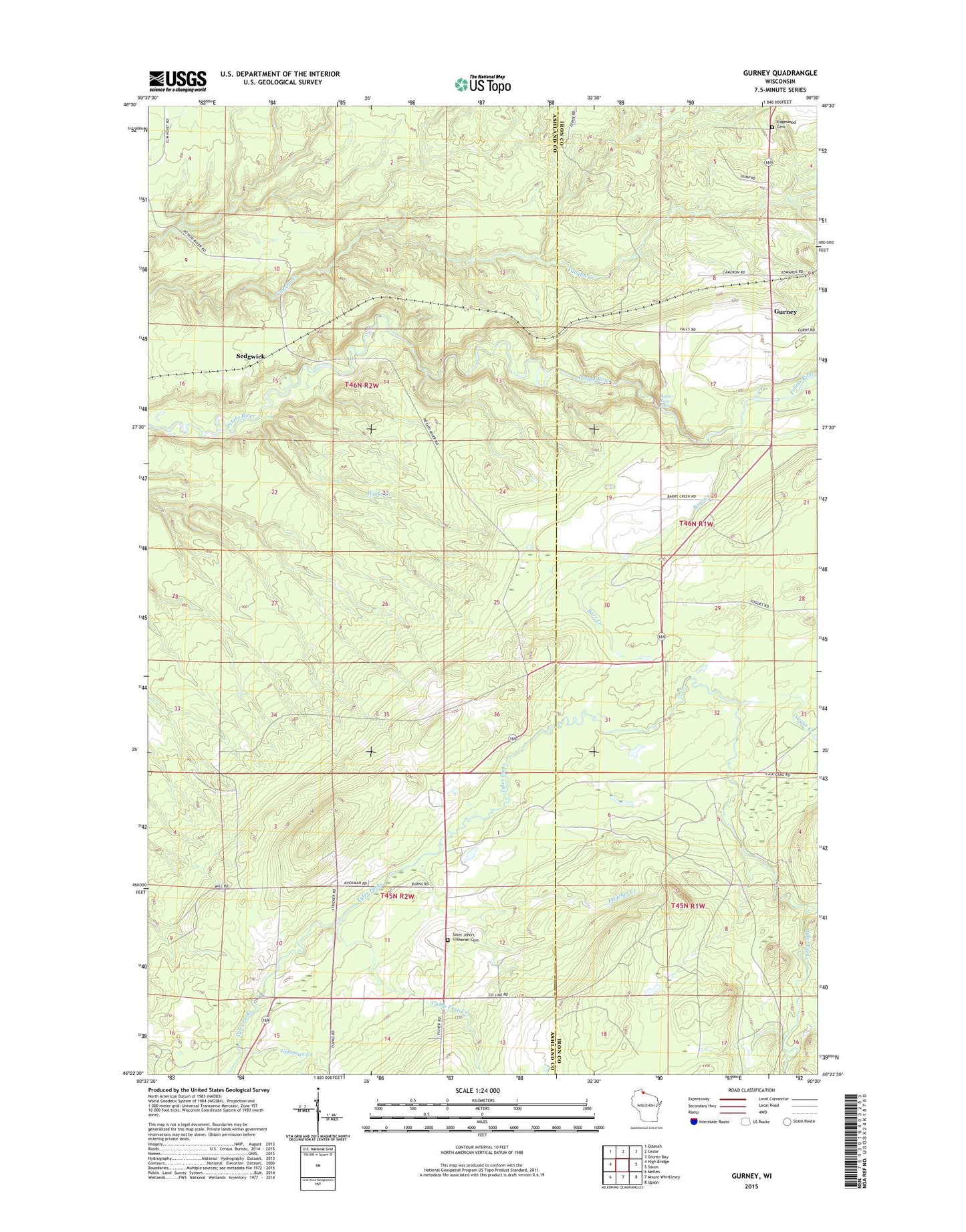
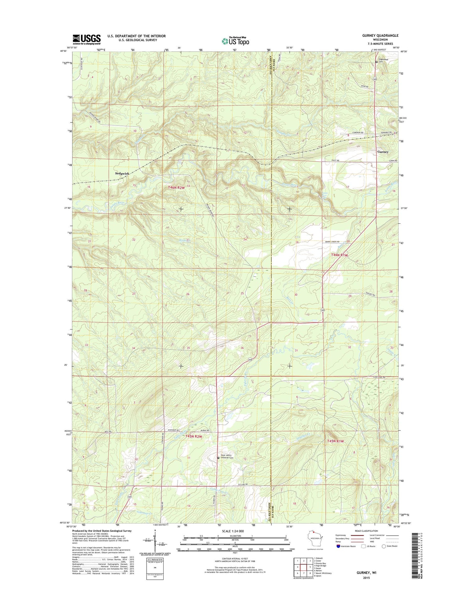
2018 topographic map quadrangle Gurney in the state of Wisconsin. Scale: 1:24000. Based on the newly updated USGS 7.5' US Topo map series, this map is in the following counties: Ashland, Iron. The map contains contour data, water features, and other items you are used to seeing on USGS maps, but also has updated roads and other features. This is the next generation of topographic maps. Printed on high-quality waterproof paper with UV fade-resistant inks.
Quads adjacent to this one:
West: High Bridge
Northwest: Odanah
North: Cedar
Northeast: Oronto Bay
East: Saxon
Southeast: Upson
South: Mount Whittlesey
Southwest: Mellen
Contains the following named places: Barr Creek, Camp Four Creek, Edgewood Cemetery, Feldcher Creek, Gehrman Creek, Gurney, Potato River Falls, Saint John's Lutheran Cemetery, Sedgwick, Spud River Landing Strip, Town of Gurney, Vogue Creek, Winks Creek