MyTopo
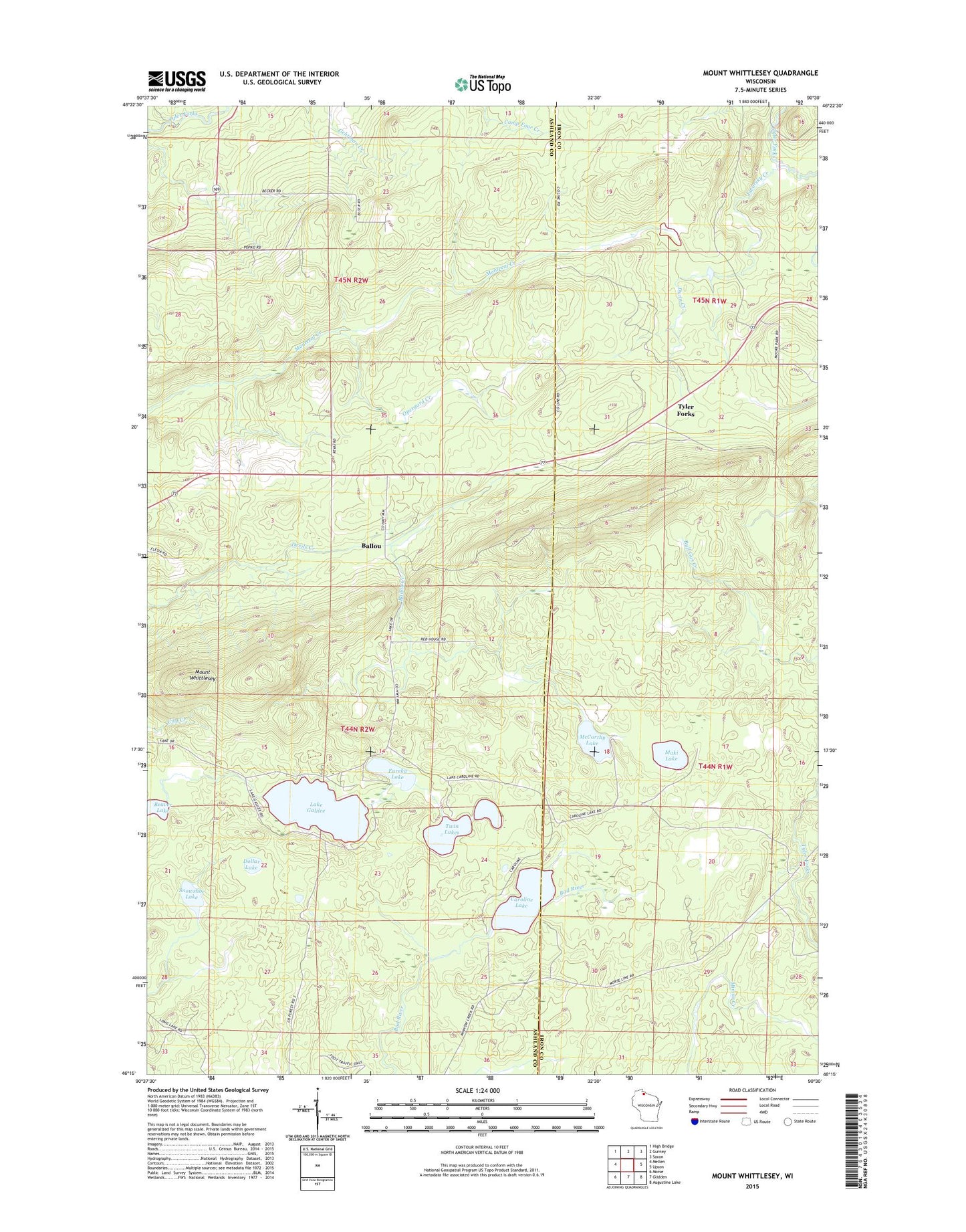
Mount Whittlesey Wisconsin US Topo Map
Couldn't load pickup availability
2022 topographic map quadrangle Mount Whittlesey in the state of Wisconsin. Scale: 1:24000. Based on the newly updated USGS 7.5' US Topo map series, this map is in the following counties: Ashland, Iron. The map contains contour data, water features, and other items you are used to seeing on USGS maps, but also has updated roads and other features. This is the next generation of topographic maps. Printed on high-quality waterproof paper with UV fade-resistant inks.
Quads adjacent to this one:
West: Mellen
Northwest: High Bridge
North: Gurney
Northeast: Saxon
East: Upson
Southeast: Augustine Lake
South: Glidden
Southwest: Morse
This map covers the same area as the classic USGS quad with code o46090c5.
Contains the following named places: Ballou, Ballou Creek, Beaver Lake, Caroline Lake, Caroline Lake State Natural Area, Dollar Lake, Dunn Creek, Eureka Lake, Javorsky Creek, Lake Galilee, Maki Lake, McCarthy Lake, Mellen Lookout Tower, Mount Whittlesey, O'Dovero Farms, Opergard Creek, Snowshoe Lake, Twin Lakes, Tyler Forks