MyTopo
Saxon Wisconsin US Topo Map
Couldn't load pickup availability
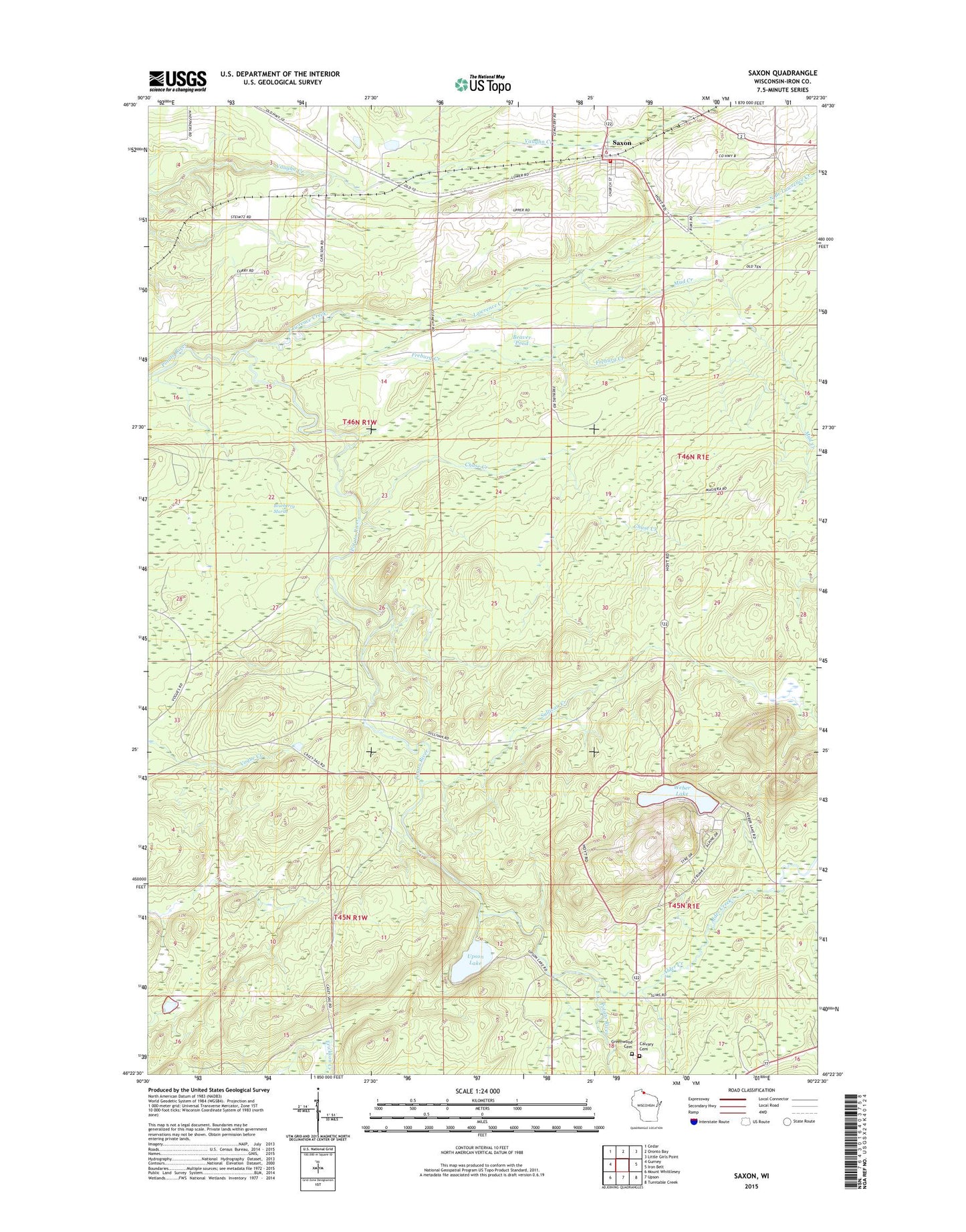
2022 topographic map quadrangle Saxon in the state of Wisconsin. Scale: 1:24000. Based on the newly updated USGS 7.5' US Topo map series, this map is in the following counties: Iron. The map contains contour data, water features, and other items you are used to seeing on USGS maps, but also has updated roads and other features. This is the next generation of topographic maps. Printed on high-quality waterproof paper with UV fade-resistant inks.
Quads adjacent to this one:
West: Gurney
Northwest: Cedar
North: Oronto Bay
Northeast: Little Girls Point
East: Iron Belt
Southeast: Turntable Creek
South: Upson
Southwest: Mount Whittlesey
This map covers the same area as the classic USGS quad with code o46090d4.
Contains the following named places: Alder Creek, Beaver Pond, Blueberry Marsh, Calvary Cemetery, Chase Creek, Freburg Creek, Greenwood Cemetery, Iron County Fairground, Lawrence Creek, Mud Creek, North Branch Lawrence Creek, Saxon, Saxon - Gurney Fire Department, Saxon Census Designated Place, Saxon Post Office, Sullivan Creek, Upson Lake, Upson Lookout Tower, Weber Lake, ZIP Code: 54559