MyTopo
Nenno Wisconsin US Topo Map
Couldn't load pickup availability
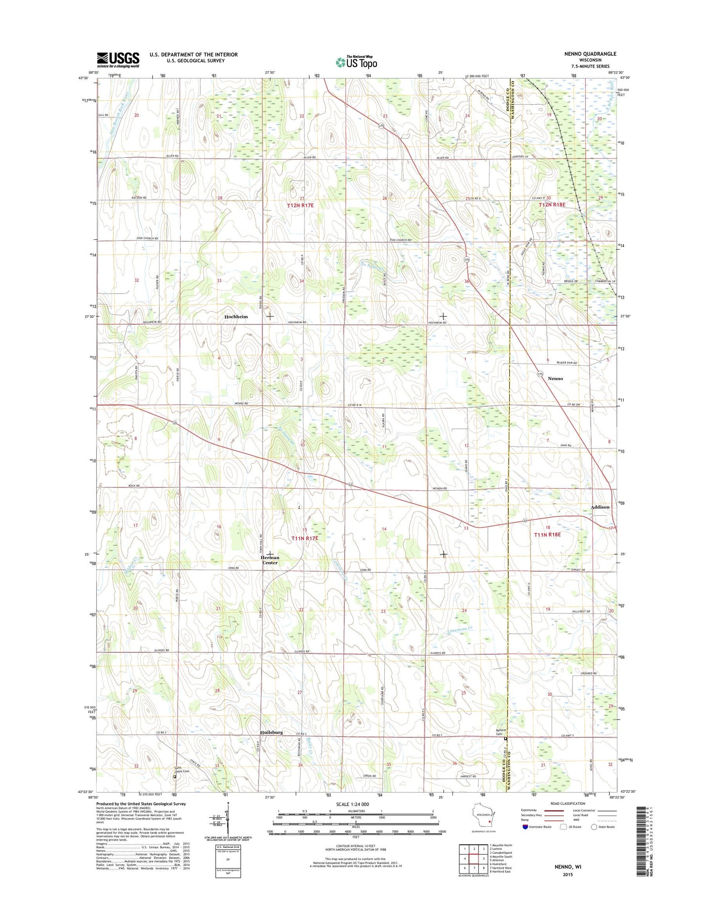
2022 topographic map quadrangle Nenno in the state of Wisconsin. Scale: 1:24000. Based on the newly updated USGS 7.5' US Topo map series, this map is in the following counties: Dodge, Washington. The map contains contour data, water features, and other items you are used to seeing on USGS maps, but also has updated roads and other features. This is the next generation of topographic maps. Printed on high-quality waterproof paper with UV fade-resistant inks.
Quads adjacent to this one:
West: Mayville South
Northwest: Mayville North
North: Lomira
Northeast: Campbellsport
East: Allenton
Southeast: Hartford East
South: Hartford West
Southwest: Hustisford
This map covers the same area as the classic USGS quad with code o43088d4.
Contains the following named places: Addison Center School, Albrecht Dairy, Bingen Farm, Christian Farm, Christs Manger School, Full Harvest Farm, Gundrum Farms, Herman Center, Herman Elementary School, Hochheim, Homestead Acres, Huilsburg, Immanuel Lutheran School, Immanuel School, Klink Dairy, Kohlsville River, Level Acres Dairy, Liberty School, Nenno, No Name Creek, Reform Cemetery, Rock Springs Dairy Farm, Rosenkranz Farms, Saint Johns Cemetery, Steger Farm, Town of Herman, Town of Theresa, Trinity School, Zion School, ZIP Code: 53091