MyTopo
Highland East Wisconsin US Topo Map
Couldn't load pickup availability
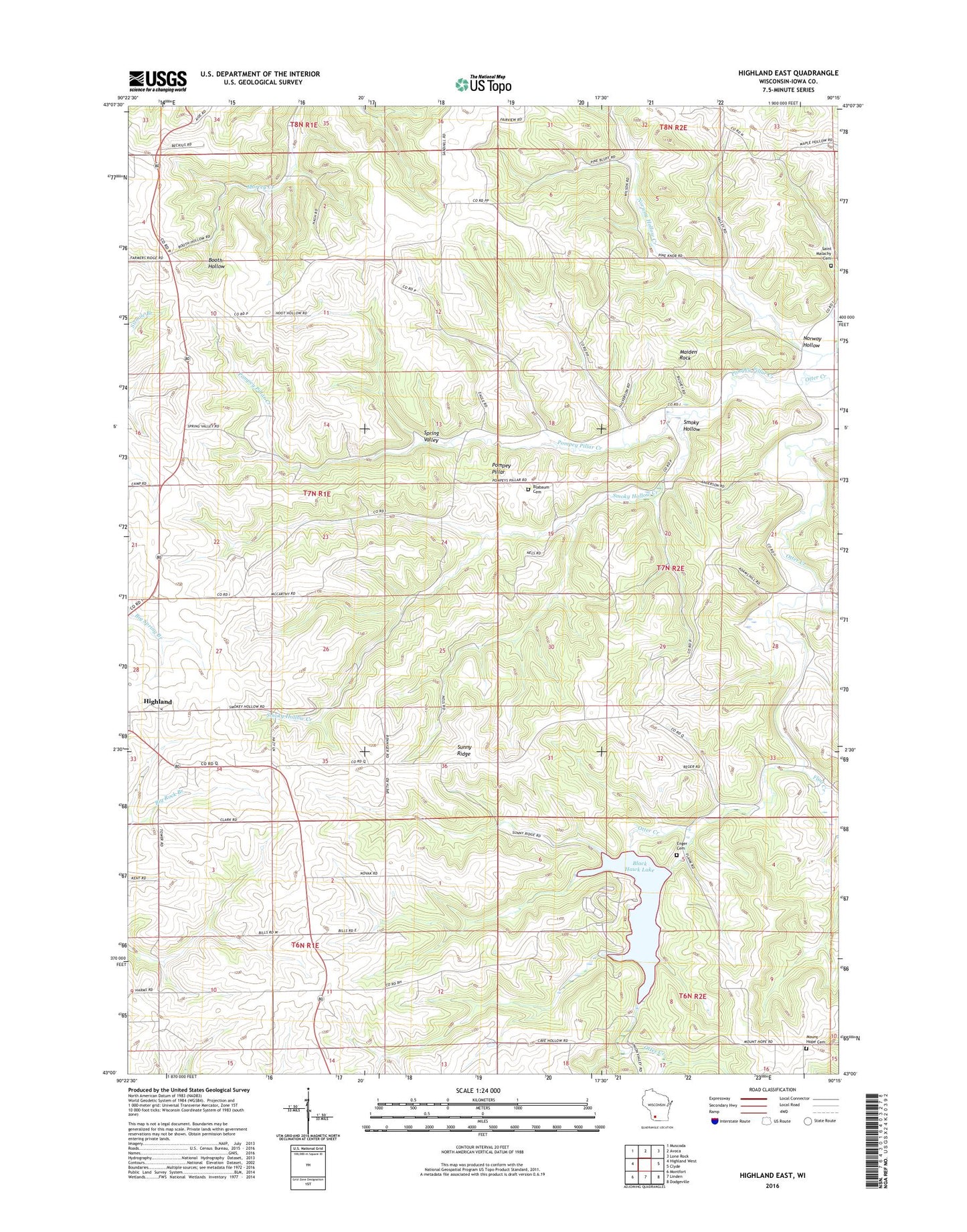
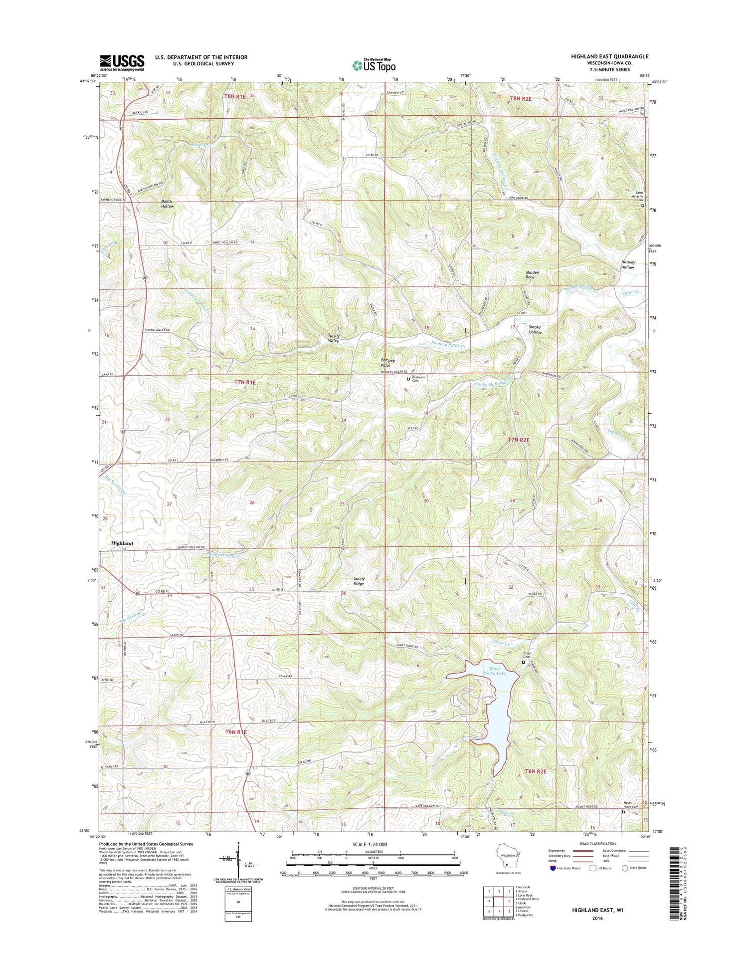
2018 topographic map quadrangle Highland East in the state of Wisconsin. Scale: 1:24000. Based on the newly updated USGS 7.5' US Topo map series, this map is in the following counties: Iowa. The map contains contour data, water features, and other items you are used to seeing on USGS maps, but also has updated roads and other features. This is the next generation of topographic maps. Printed on high-quality waterproof paper with UV fade-resistant inks.
Quads adjacent to this one:
West: Highland West
Northwest: Muscoda
North: Avoca
Northeast: Lone Rock
East: Clyde
Southeast: Dodgeville
South: Linden
Southwest: Montfort
Contains the following named places: Big Spring School, Blabaum Cemetery, Black Hawk Lake, Black Hawk Lake Recreation Area, Blackhawk Lake Dam, Dickinson Creek, Dorota H 581 Dam, Enger Cemetery, Flint Creek, Forest Field School, Hackl Quarry, Maiden Rock, Mount Hope Cemetery, Norway Hollow, Norway Hollow Creek, Otter Creek Church, Pierick Airport, Pine Knob School, Pompey Pillar, Pompey Pillar Creek, Smoky Hollow, Smoky Hollow Creek, Spring Valley, Spring Valley Church, Strawberry School, Sunny Ridge, Town of Highland, Union Mill School, WHHI-FM (Highland), ZIP Code: 53543