MyTopo
Clyde Wisconsin US Topo Map
Couldn't load pickup availability
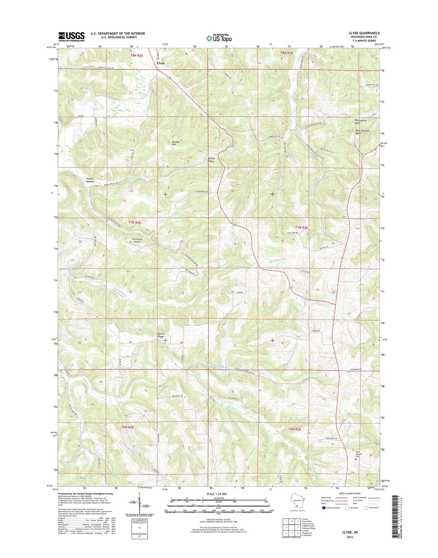
2022 topographic map quadrangle Clyde in the state of Wisconsin. Scale: 1:24000. Based on the newly updated USGS 7.5' US Topo map series, this map is in the following counties: Iowa. The map contains contour data, water features, and other items you are used to seeing on USGS maps, but also has updated roads and other features. This is the next generation of topographic maps. Printed on high-quality waterproof paper with UV fade-resistant inks.
Quads adjacent to this one:
West: Highland East
Northwest: Avoca
North: Lone Rock
Northeast: Spring Green
East: Pleasant Ridge
Southeast: Jonesdale
South: Dodgeville
Southwest: Linden
This map covers the same area as the classic USGS quad with code o43090a2.
Contains the following named places: 13.94 Reservoir, Big Spring, Clyde, Deer Shelter Rock, Dickinson School, Dunbar Hill, Five Point School, Floyd School, Gold Mine School, Harker Creek, Highpoint School, Hunter Hollow, Iowa County, Lee Creek, North Dodgeville Church, Norwegian Hollow Creek, Otter Creek 12 3WR1178 Dam, Pengelly Creek, Percussion Rock, Rock Church, Rock Church Cemetery, Saint Johns Church, Saint Malachy Cemetery, Saint Malachy Church, Smith School, Southwind Airport, Spring Valley School, Standart Church, Union Ridge, Union Ridge School, Wayside School