MyTopo
Dodgeville Wisconsin US Topo Map
Couldn't load pickup availability
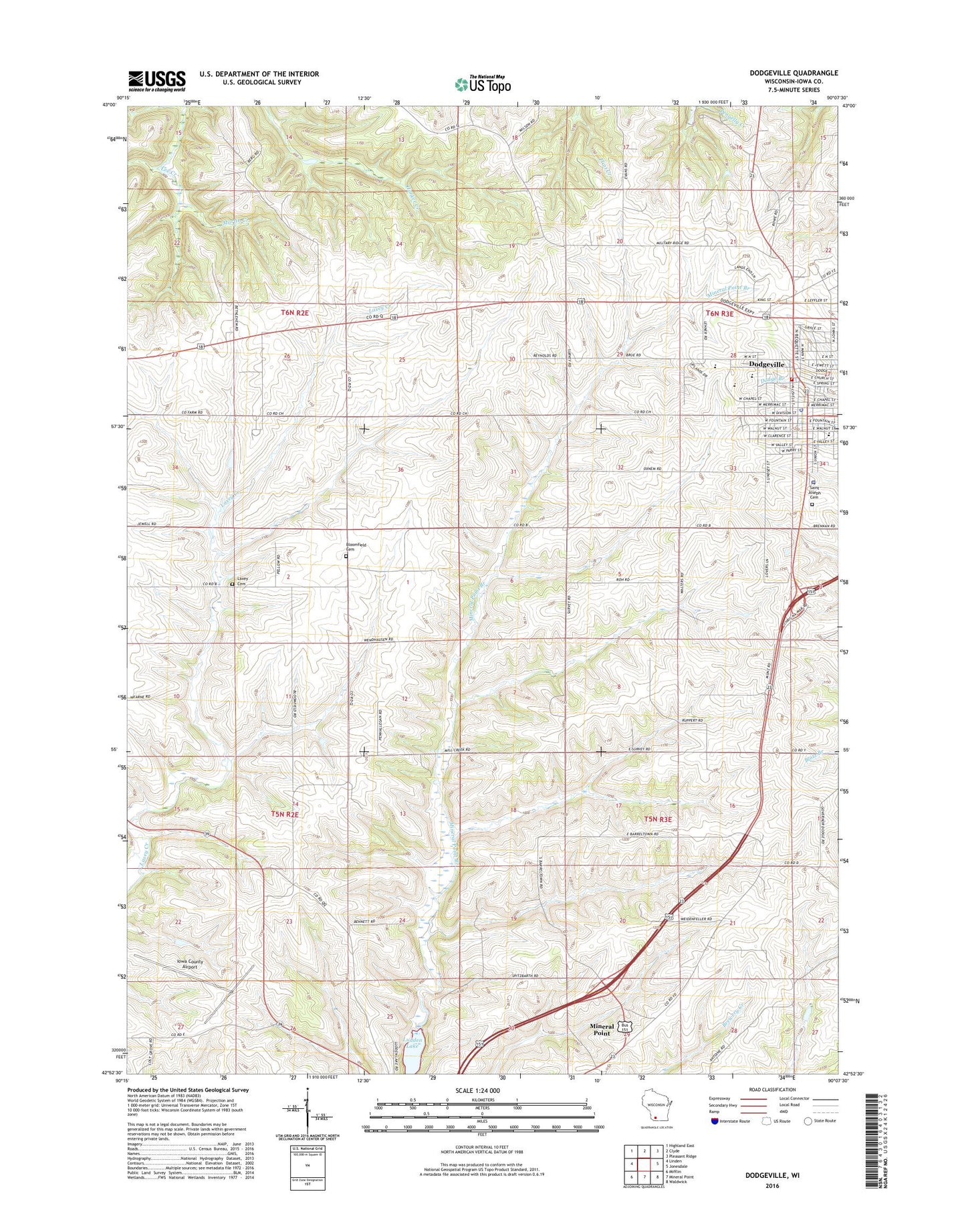
2022 topographic map quadrangle Dodgeville in the state of Wisconsin. Scale: 1:24000. Based on the newly updated USGS 7.5' US Topo map series, this map is in the following counties: Iowa. The map contains contour data, water features, and other items you are used to seeing on USGS maps, but also has updated roads and other features. This is the next generation of topographic maps. Printed on high-quality waterproof paper with UV fade-resistant inks.
Quads adjacent to this one:
West: Linden
Northwest: Highland East
North: Clyde
Northeast: Pleasant Ridge
East: Jonesdale
Southeast: Waldwick
South: Mineral Point
Southwest: Mifflin
This map covers the same area as the classic USGS quad with code o42090h2.
Contains the following named places: Barreltown School, Bethlehem Church, Bloomfield Cemetery, Bloomfield School, Burgess Quarry, City of Dodgeville, Diamond Grove School, Dodgeville, Dodgeville Area Ambulance Service, Dodgeville Elementary School, Dodgeville Fire Department, Dodgeville High School, Dodgeville Middle School, Dodgeville Municipal Airport, Dodgeville Police Department, Dodgeville Post Office, Fieldhouse Fruit Farm, Iowa County Airport, Iowa County Sheriff's Department, Jamesville School, Laxey Cemetery, Ludden Lake, Martin Creek, Memorial Hospital Heliport, North Survey School, Oaklawn School, Pine Grove School, Plum Grove School, Plymouth Congregational Church, Saint Joseph Cemetery, Saint Joseph Church, Saint Joseph School, South Survey School, Upland Hills Health Hospital, WDMP-AM (Dodgeville), WDMP-FM (Dodgeville), ZIP Code: 53533