MyTopo
Hilbert Wisconsin US Topo Map
Couldn't load pickup availability
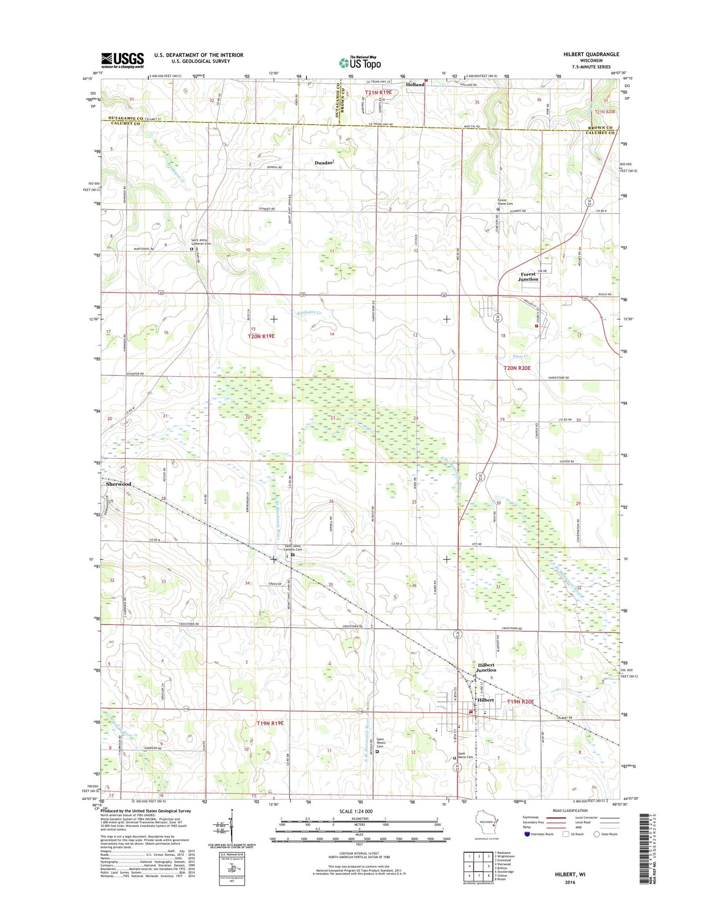
2018 topographic map quadrangle Hilbert in the state of Wisconsin. Scale: 1:24000. Based on the newly updated USGS 7.5' US Topo map series, this map is in the following counties: Calumet, Brown, Outagamie. The map contains contour data, water features, and other items you are used to seeing on USGS maps, but also has updated roads and other features. This is the next generation of topographic maps. Printed on high-quality waterproof paper with UV fade-resistant inks.
Quads adjacent to this one:
West: Sherwood
Northwest: Kaukauna
North: Wrightstown
Northeast: Greenleaf
East: Brillion
Southeast: Potter
South: Chilton
Southwest: Stockbridge
Contains the following named places: Byron School, Dundas, Forest Assembly Ground, Forest Home Cemetery, Forest Junction, Forest Junction Census Designated Place, Forest Junction Post Office, Forest Junction Volunteer Fire Department, Foxden Dairy Farms, Hilbert, Hilbert Elementary School, Hilbert High School, Hilbert Junction, Hilbert Post Office, Hilbert School, Hilbert Village Volunteer Fire Department, Hilbert Wastewater Treatment Plant, Holland, Holland Town Fire Department, Holmes School, Howe School, Jackson School, Longfellow School, Peanuts Park, Saint John, Saint John Church, Saint John Lutheran Cemetery, Saint Johns Catholic Cemetery, Saint Mary Catholic School, Saint Marys Catholic Church, Saint Mary's Cemetery, Saint Peter Cemetery, Saint Peter Lutheran Church, Saint Peter Lutheran School, Town of Woodville, Village of Hilbert, Webster School, ZIP Codes: 54123, 54129