MyTopo
Potter Wisconsin US Topo Map
Couldn't load pickup availability
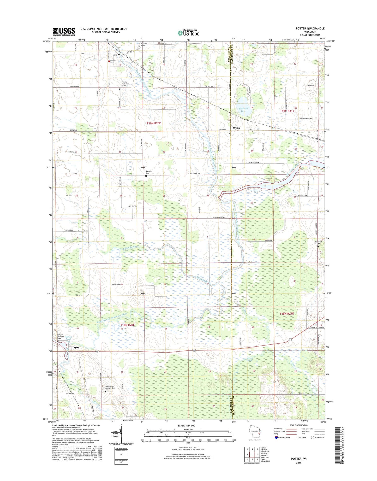
2022 topographic map quadrangle Potter in the state of Wisconsin. Scale: 1:24000. Based on the newly updated USGS 7.5' US Topo map series, this map is in the following counties: Calumet, Manitowoc. The map contains contour data, water features, and other items you are used to seeing on USGS maps, but also has updated roads and other features. This is the next generation of topographic maps. Printed on high-quality waterproof paper with UV fade-resistant inks.
Quads adjacent to this one:
West: Chilton
Northwest: Hilbert
North: Brillion
Northeast: Reedsville
East: Valders
Southeast: School Hill
South: Kiel
Southwest: Marytown
This map covers the same area as the classic USGS quad with code o44088a1.
Contains the following named places: Brocker Pit, Bullhead Lake, Calumet School, Cedar Creek, Free German Cemetery, Hawthorne School, Hayton, Hayton Dam, Hayton Hillside Cemetery, Hayton Marsh, Hayton Pond 104, Killsnake River, Killsnake State Wildlife Area, Lee School, North Branch Manitowoc River, Peace United Church of Christ, Pine Creek, Potter, Potter Post Office, Potter Volunteer Fire Department, Rantoul Cemetery, Riverview School, Saint Martin Catholic Cemetery, Saint Martin Church, Saint Martin School, South Branch Manitowoc River, Streckert Cemetery, Town of Charlestown, Town of Rantoul, Trinity Lutheran Cemetery, Trinity Lutheran School, Village of Potter, Wagner School, Wells, ZIP Code: 54160