MyTopo
Greenleaf Wisconsin US Topo Map
Couldn't load pickup availability
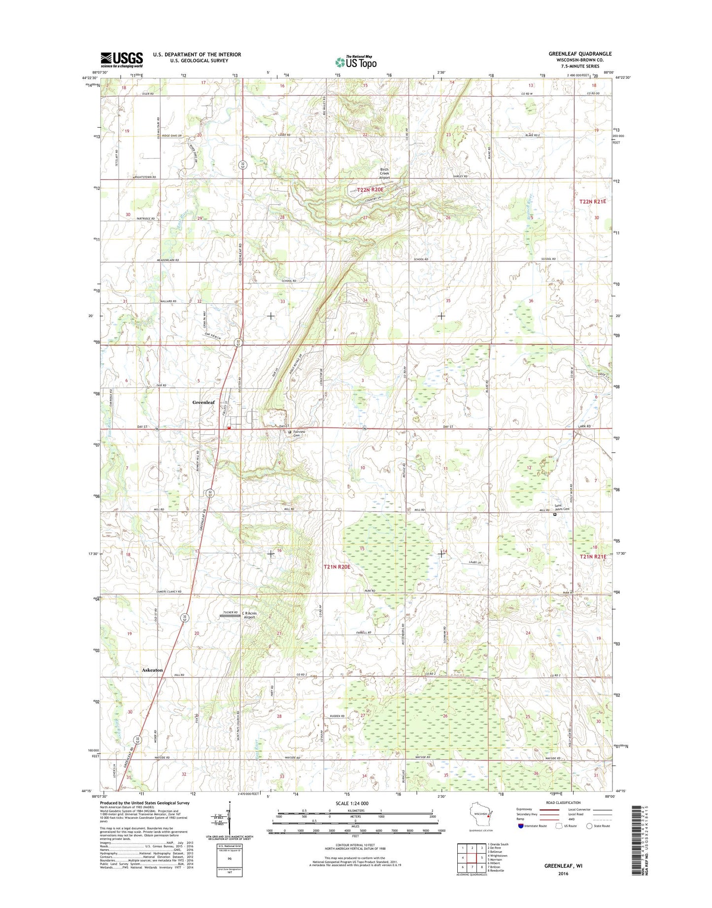
2022 topographic map quadrangle Greenleaf in the state of Wisconsin. Scale: 1:24000. Based on the newly updated USGS 7.5' US Topo map series, this map is in the following counties: Brown. The map contains contour data, water features, and other items you are used to seeing on USGS maps, but also has updated roads and other features. This is the next generation of topographic maps. Printed on high-quality waterproof paper with UV fade-resistant inks.
Quads adjacent to this one:
West: Wrightstown
Northwest: Oneida South
North: De Pere
Northeast: Bellevue
East: Morrison
Southeast: Reedsville
South: Brillion
Southwest: Hilbert
This map covers the same area as the classic USGS quad with code o44088c1.
Contains the following named places: Askeaton, Askeaton School, Birch Creek Airport, C R Acres Airport, Country Aire Farms, Dyers School, East Creek Farm, East Holland School, Fairview Cemetery, Greenleaf, Greenleaf Census Designated Place, Greenleaf Post Office, Greenleaf Quarry, Greenleaf Volunteer Fire Department, Heatherbrook Farm, Hilly Haven Golf Course, Holland Red Maple Swamp State Natural Area, Holland State Wildlife Area, Jefferson School, Ledgeville School, Pershing School, Ravine School, Saint Johns Cemetery, Saint Johns Church, Saint Marys School, Saint Patricks Church, Schink School, Skeater Park, Town of Holland, Town of Wrightstown, Wobeck Farm, ZIP Code: 54126