MyTopo
Ingram Wisconsin US Topo Map
Couldn't load pickup availability
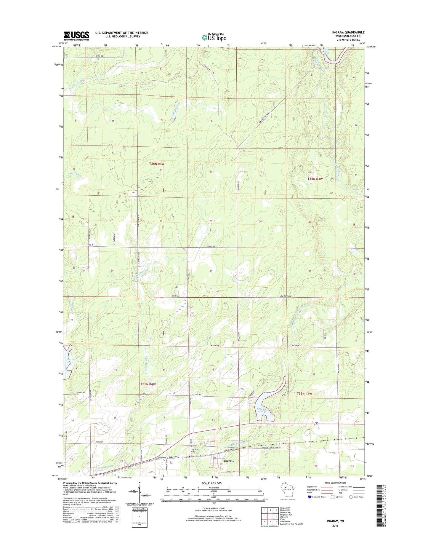
2022 topographic map quadrangle Ingram in the state of Wisconsin. Scale: 1:24000. Based on the newly updated USGS 7.5' US Topo map series, this map is in the following counties: Rusk. The map contains contour data, water features, and other items you are used to seeing on USGS maps, but also has updated roads and other features. This is the next generation of topographic maps. Printed on high-quality waterproof paper with UV fade-resistant inks.
Quads adjacent to this one:
West: Big Falls Dam
Northwest: Ingram NW
North: Ingram NE
Northeast: Kennan NW
East: Hawkins
Southeast: Jump River Fire Tower NW
South: Sheldon NE
Southwest: Tony
This map covers the same area as the classic USGS quad with code o45090e7.
Contains the following named places: Ingram, Ingram Cemetery, Kaiser and Fisher Flowage 2WP1835 Dam, Ladd Creek Lookout Tower, Lake La Verne, Otter Slide Rapids, Skinner Creek, Town of Cedar Rapids, Town of Richland, Village of Ingram, ZIP Code: 54526