MyTopo
Ingram NE Wisconsin US Topo Map
Couldn't load pickup availability
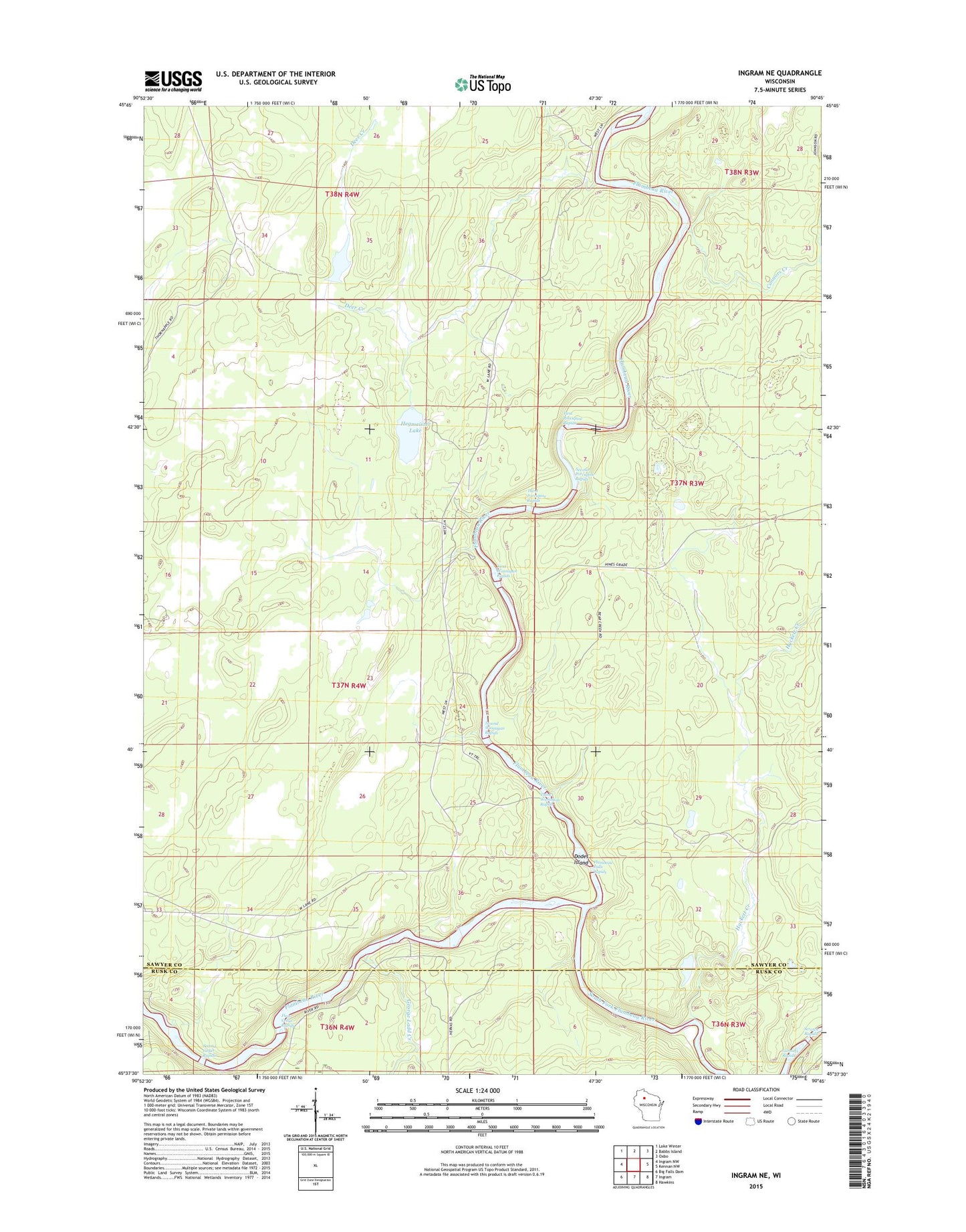
2022 topographic map quadrangle Ingram NE in the state of Wisconsin. Scale: 1:24000. Based on the newly updated USGS 7.5' US Topo map series, this map is in the following counties: Sawyer, Rusk. The map contains contour data, water features, and other items you are used to seeing on USGS maps, but also has updated roads and other features. This is the next generation of topographic maps. Printed on high-quality waterproof paper with UV fade-resistant inks.
Quads adjacent to this one:
West: Ingram NW
Northwest: Lake Winter
North: Babbs Island
Northeast: Oxbo
East: Kennan NW
Southeast: Hawkins
South: Ingram
Southwest: Big Falls Dam
This map covers the same area as the classic USGS quad with code o45090f7.
Contains the following named places: Connors Creek, Deer Creek, Dodes Island, First Cedar Rapids, First Porcupine Rapids, First Wannigan Rapids, Flambeau Falls Rapids, Flambeau River Hardwood Forest State Natural Area, Flambeau River State Forest, George Ladd Creek, Gunners Rapids, Hackett Creek, Hegmeister Lake, Scratch Rapids, Second Cedar Rapids, Second Porcupine Rapids, Second Wannigan Rapids, South Fork Flambeau River, Third Porcupine Rapids, Third Wannigan Rapids