MyTopo
Ixonia Wisconsin US Topo Map
Couldn't load pickup availability
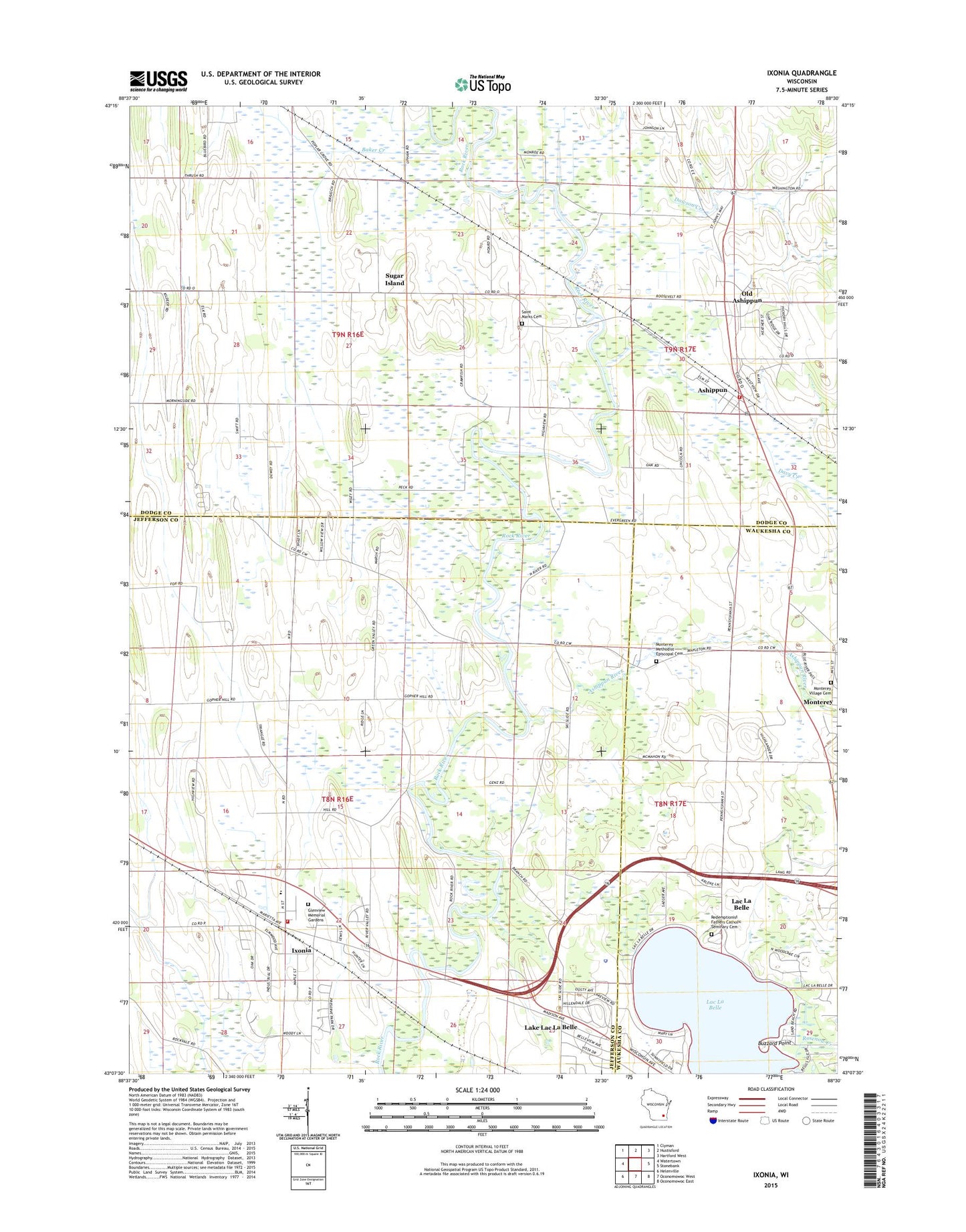
2018 topographic map quadrangle Ixonia in the state of Wisconsin. Scale: 1:24000. Based on the newly updated USGS 7.5' US Topo map series, this map is in the following counties: Jefferson, Dodge, Waukesha. The map contains contour data, water features, and other items you are used to seeing on USGS maps, but also has updated roads and other features. This is the next generation of topographic maps. Printed on high-quality waterproof paper with UV fade-resistant inks.
Quads adjacent to this one:
West: Watertown
Northwest: Clyman
North: Hustisford
Northeast: Hartford West
East: Stonebank
Southeast: Oconomowoc East
South: Oconomowoc West
Southwest: Helenville
Contains the following named places: Ashippun, Ashippun Census Designated Place, Ashippun Elementary School, Ashippun Post Office, Ashippun River, Ashippun Volunteer Fire Department Station 1, Baker Creek, Bara Farms, Beggs Island, Bethel Cemetery, Bethel Church, Buzzard Point, C and L Hereford Farm, Crescentmead Farm, Cross Lutheran Cemetery, Cross Lutheran Church, Cross School, Davy Creek, Dawson Creek, Fireman Park, Glacier Rock Farms, Glenview Memorial Gardens, Ixonia, Ixonia Census Designated Place, Ixonia Elementary School, Ixonia Fire Department, Ixonia Post Office, Lac La Belle, Lac La Belle Police Department, Lake Lac La Belle, Monterey Methodist Cemetery, Monterey Village Cemetery, Old Ashippun, Old Ashippun Census Designated Place, Pennsylvania Street School, Redemptionist Fathers Catholic Seminary Cemetery, Rosenow Creek, Saint John Evangelical Lutheran Church, Saint Johns School, Saint Lukes Church, Saint Marks Cemetery, Saint Marks Church, Sugar Island, Tag Lane Dairy Farm, Town of Ixonia, Town of Lebanon, Village of Lac La Belle, Zion Lutheran Church, ZIP Codes: 53003, 53036