MyTopo
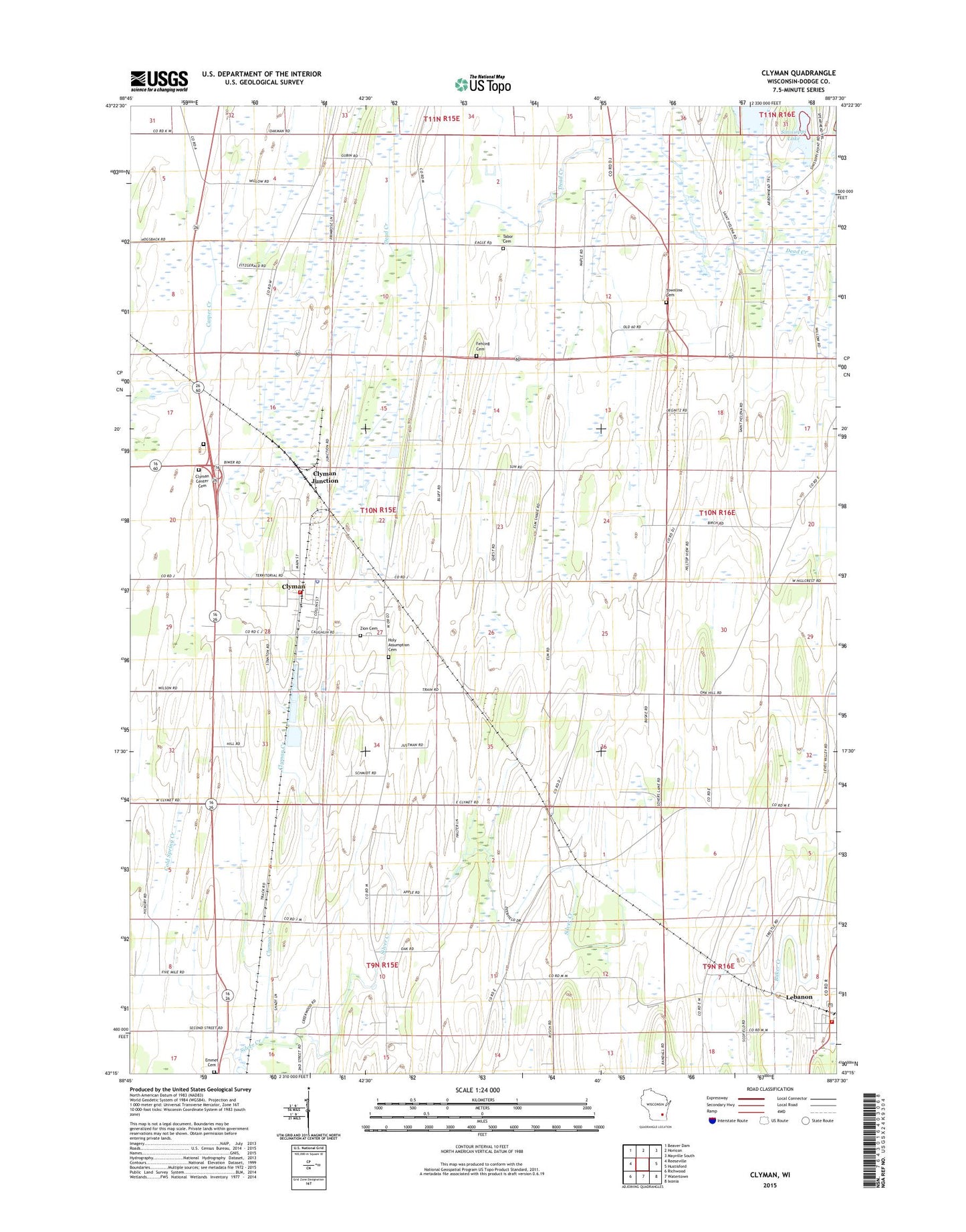
Clyman Wisconsin US Topo Map
Couldn't load pickup availability
2022 topographic map quadrangle Clyman in the state of Wisconsin. Scale: 1:24000. Based on the newly updated USGS 7.5' US Topo map series, this map is in the following counties: Dodge. The map contains contour data, water features, and other items you are used to seeing on USGS maps, but also has updated roads and other features. This is the next generation of topographic maps. Printed on high-quality waterproof paper with UV fade-resistant inks.
Quads adjacent to this one:
West: Reeseville
Northwest: Beaver Dam
North: Horicon
Northeast: Mayville South
East: Hustisford
Southeast: Ixonia
South: Watertown
Southwest: Richwood
This map covers the same area as the classic USGS quad with code o43088c6.
Contains the following named places: American Eagle School, Clyman, Clyman Center Cemetery, Clyman Creek, Clyman Fire Department, Clyman Junction, Clyman Police Department, Clyman Post Office, Dead Creek, Emmet Cemetery, Fairview Farms, Fehling Cemetery, Firemans Park, Holy Assumption Cemetery, Kennedy School, Lebanon, Lebanon Census Designated Place, Lebanon Post Office, Lebanon Volunteer Fire Department, Mengel Cemetery, Peterman Game Farm, Tabor Cemetery, Town of Clyman, Townline Cemetery, Village of Clyman, Wilson School, Zion Lutheran Cemetery, ZIP Codes: 53016, 53039, 53047, 53098