MyTopo
Kellner Wisconsin US Topo Map
Couldn't load pickup availability
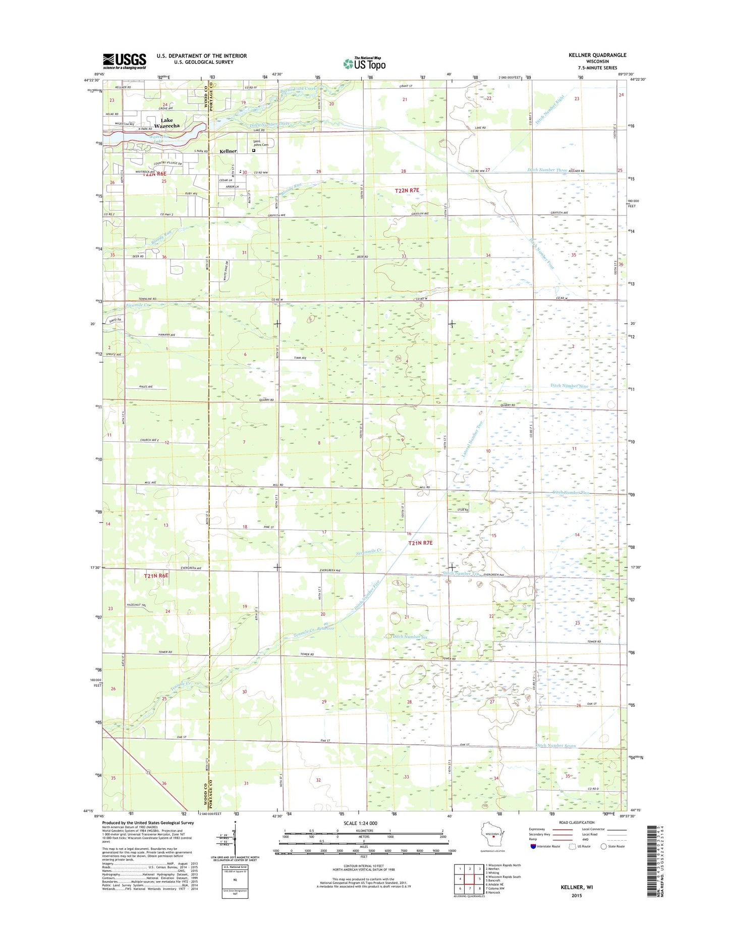
2022 topographic map quadrangle Kellner in the state of Wisconsin. Scale: 1:24000. Based on the newly updated USGS 7.5' US Topo map series, this map is in the following counties: Portage, Wood. The map contains contour data, water features, and other items you are used to seeing on USGS maps, but also has updated roads and other features. This is the next generation of topographic maps. Printed on high-quality waterproof paper with UV fade-resistant inks.
Quads adjacent to this one:
West: Wisconsin Rapids South
Northwest: Wisconsin Rapids North
North: Meehan
Northeast: Whiting
East: Bancroft
Southeast: Hancock
South: Coloma NW
Southwest: Arkdale NE
This map covers the same area as the classic USGS quad with code o44089c6.
Contains the following named places: 46 Reservoir, 54494, Buena Vista Creek, Buena Vista Prairie Chicken Meadow State Natural Area, Buena Vista Quarry Prairie State Natural Area, Church of God, Grant Elementary School, Kellner, Lateral Number Two, Mckinley School, North Branch Tenmile Creek, Portage County Number 35 Dam, Saint Johns Cemetery, South Branch Tenmile Creek, South Wood County Park, Town of Grant, Wazeecha Lake