MyTopo
Coloma NW Wisconsin US Topo Map
Couldn't load pickup availability
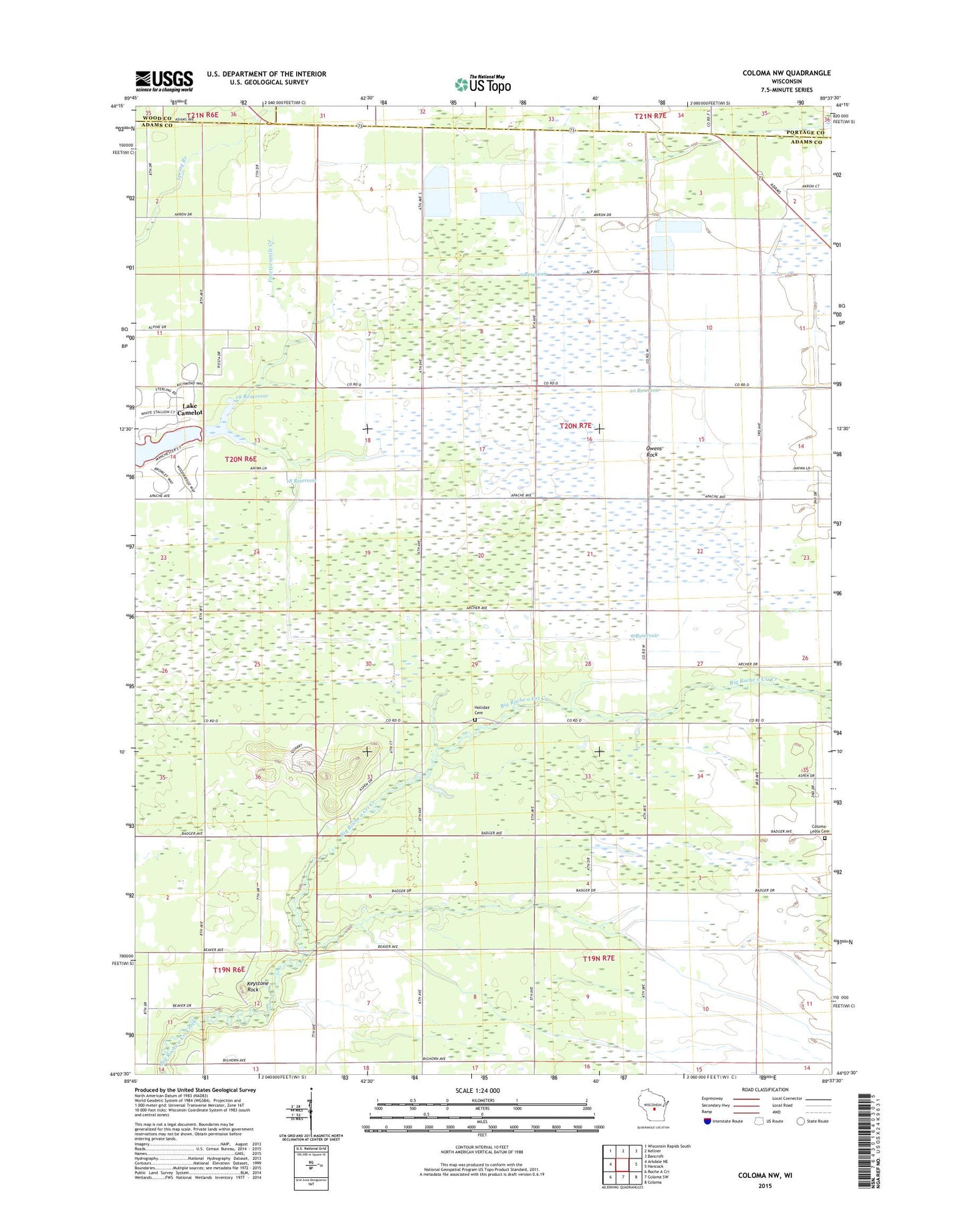
2022 topographic map quadrangle Coloma NW in the state of Wisconsin. Scale: 1:24000. Based on the newly updated USGS 7.5' US Topo map series, this map is in the following counties: Adams, Portage, Wood. The map contains contour data, water features, and other items you are used to seeing on USGS maps, but also has updated roads and other features. This is the next generation of topographic maps. Printed on high-quality waterproof paper with UV fade-resistant inks.
Quads adjacent to this one:
West: Arkdale NE
Northwest: Wisconsin Rapids South
North: Kellner
Northeast: Bancroft
East: Hancock
Southeast: Coloma
South: Coloma SW
Southwest: Roche A Cri
This map covers the same area as the classic USGS quad with code o44089b6.
Contains the following named places: 10 Reservoir, 18 Reservoir, 6 Reservoir, 9 Reservoir, Big Roche A Cri State Fishery Area, Coloma - Leola Cemetery, Holliday Cemetery, Keystone Rock, Leola 15 Dam, Leola 19 Dam, Leola 4 Dam, Leola 8 Dam, Leola Marsh State Wildlife Area, Owens Rock, Town of Leola