MyTopo
Hortonville Wisconsin US Topo Map
Couldn't load pickup availability
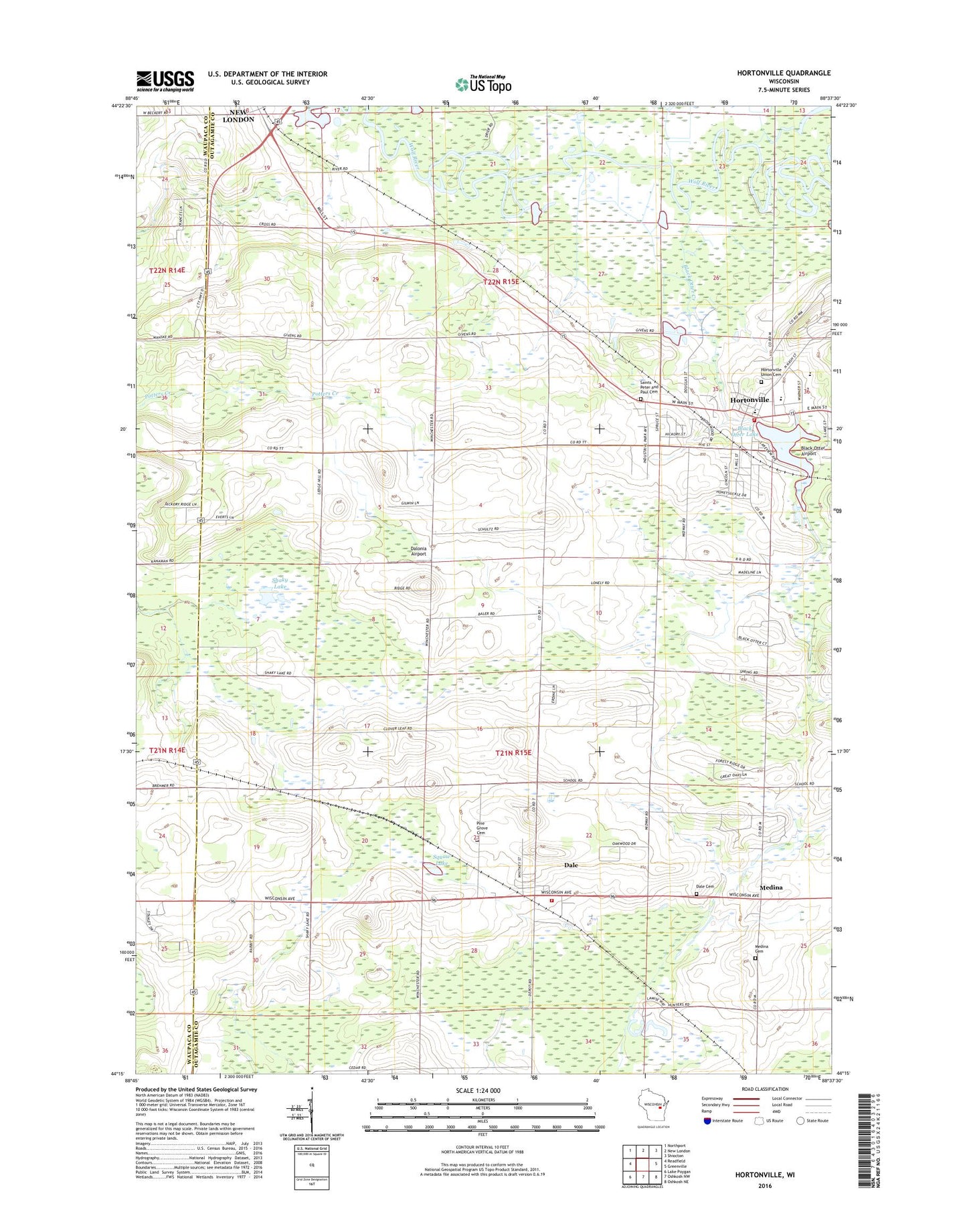
2023 topographic map quadrangle Hortonville in the state of Wisconsin. Scale: 1:24000. Based on the newly updated USGS 7.5' US Topo map series, this map is in the following counties: Outagamie, Waupaca. The map contains contour data, water features, and other items you are used to seeing on USGS maps, but also has updated roads and other features. This is the next generation of topographic maps. Printed on high-quality waterproof paper with UV fade-resistant inks.
Quads adjacent to this one:
West: Readfield
Northwest: Northport
North: New London
Northeast: Shiocton
East: Greenville
Southeast: Oshkosh NE
South: Oshkosh NW
Southwest: Lake Poygan
This map covers the same area as the classic USGS quad with code o44088c6.
Contains the following named places: Bethlehem Evangelical Lutheran School, Black Creek Limestone Quarry, Black Otter Airport, Black Otter Creek, Black Otter Lake, Cloverleaf School, Dale, Dale Census Designated Place, Dale Fire and Rescue, Dale Post Office, Dale Union Cemetery, Dalonia Airport, Daufen Park, Hickory Grove School, Horton Ville Dam, Hortonville, Hortonville Elementary School, Hortonville High School, Hortonville Hortonia Fire Department, Hortonville Middle School, Hortonville Police Department, Hortonville Post Office, Hortonville Union Cemetery, Hortonville Wastewater Treatment Plant, Medina, Medina Cemetery, Pine Grove Cemetery, Saints Peter and Paul Cemetery, Shaky Lake, Shaky Lake State Natural Area, Squaw Lake, Town of Dale, Town of Hortonia, Village of Hortonville, ZIP Codes: 54931, 54944