MyTopo
Loganville Wisconsin US Topo Map
Couldn't load pickup availability
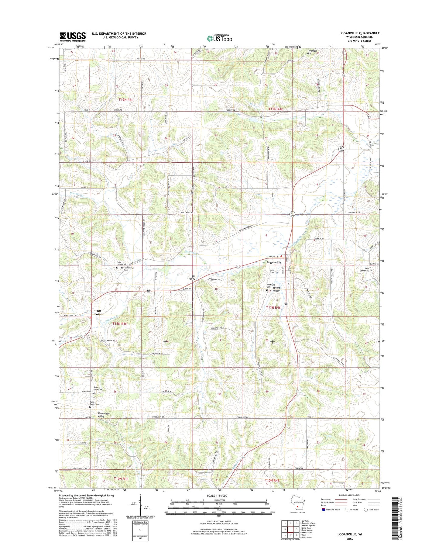
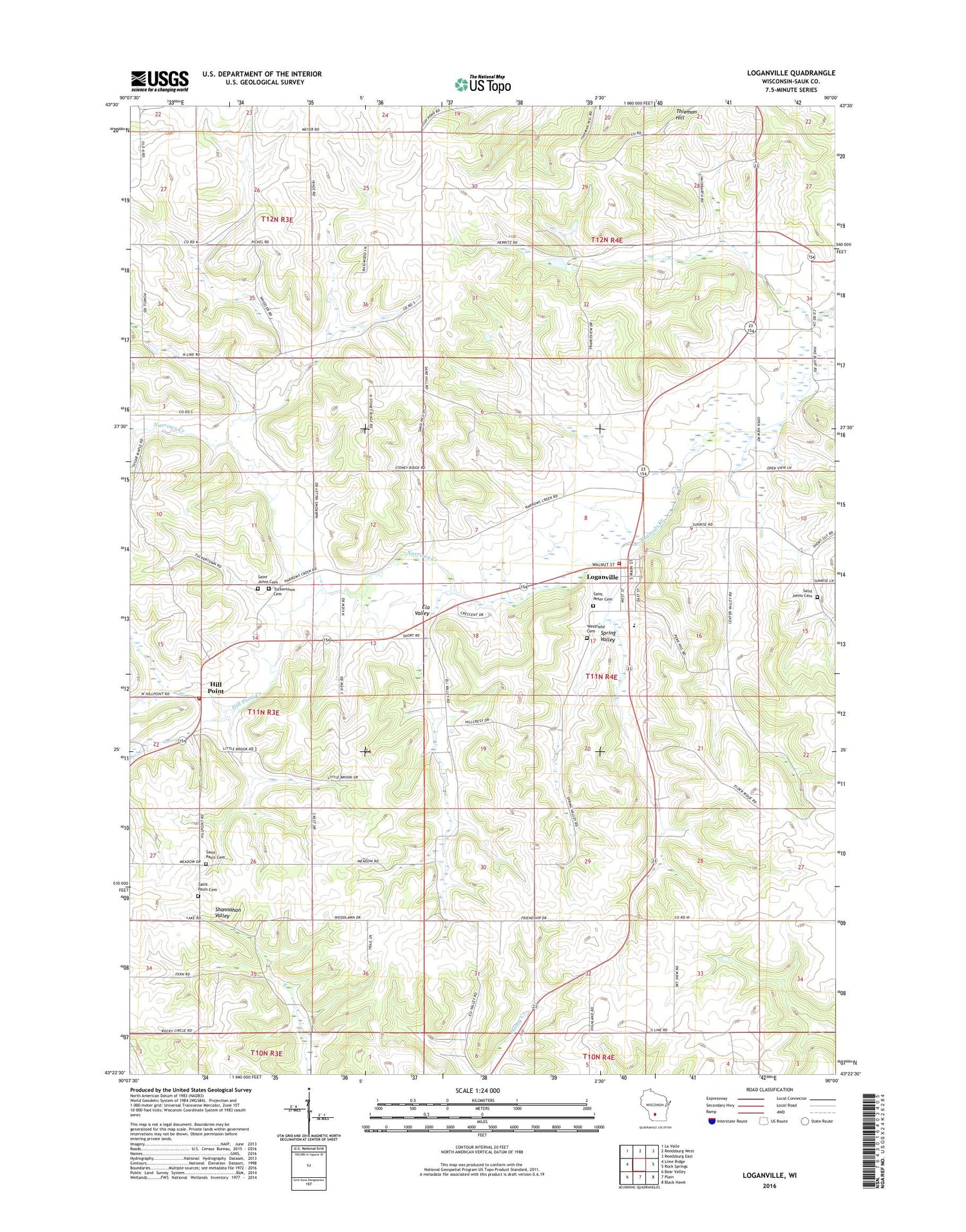
2018 topographic map quadrangle Loganville in the state of Wisconsin. Scale: 1:24000. Based on the newly updated USGS 7.5' US Topo map series, this map is in the following counties: Sauk. The map contains contour data, water features, and other items you are used to seeing on USGS maps, but also has updated roads and other features. This is the next generation of topographic maps. Printed on high-quality waterproof paper with UV fade-resistant inks.
Quads adjacent to this one:
West: Lime Ridge
Northwest: La Valle
North: Reedsburg West
Northeast: Reedsburg East
East: Rock Springs
Southeast: Black Hawk
South: Plain
Southwest: Bear Valley
Contains the following named places: 1 Reservoir, 53943, Allen School, County Farm School, Ela Valley, Friendship School, Hill Point, Hill Point Creek, Hillpoint Post Office, Loganville, Loganville Area Fire Department, Loganville Elementary School, Loganville Post Office, Old Saint Paul Lutheran Cemetery, Open View School, Prairie View School, Saint John Cemetery, Saint John Lutheran Cemetery, Saint Johns Church, Saint Paul Lutheran Cemetery, Saint Pauls Church, Saint Peter Cemetery, Spring Valley, Stolte G-9668 Dam, Town of Westfield, Tri-Center Airport, Tuckertown Cemetery, Tuckertown School, Village of Loganville, Washington Township Volunteer Fire Department, Westfield Cemetery