MyTopo
Black Hawk Wisconsin US Topo Map
Couldn't load pickup availability
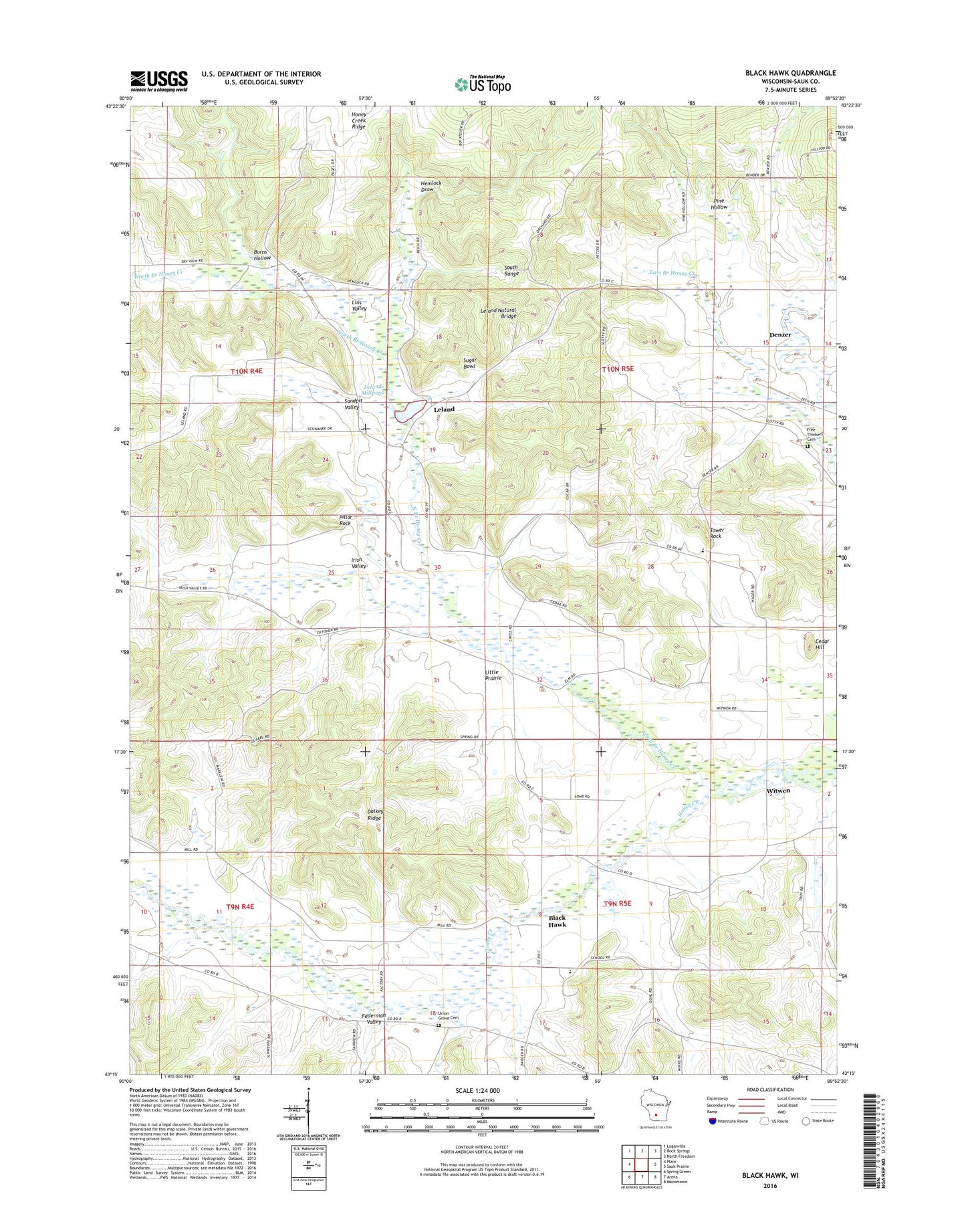
2022 topographic map quadrangle Black Hawk in the state of Wisconsin. Scale: 1:24000. Based on the newly updated USGS 7.5' US Topo map series, this map is in the following counties: Sauk. The map contains contour data, water features, and other items you are used to seeing on USGS maps, but also has updated roads and other features. This is the next generation of topographic maps. Printed on high-quality waterproof paper with UV fade-resistant inks.
Quads adjacent to this one:
West: Plain
Northwest: Loganville
North: Rock Springs
Northeast: North Freedom
East: Sauk Prairie
Southeast: Mazomanie
South: Arena
Southwest: Spring Green
This map covers the same area as the classic USGS quad with code o43089c8.
Contains the following named places: Andrew Roll Free Congregation Cemetery, Bethlehem Church, Black Hawk, Black Hawk Elementary School, Borns Hollow, Cedar Hill, Dalkey Ridge, Denzer, Durst Rockshelter State Natural Area, Federman Valley, Free Thinkers Hall, Hemlock Draw, Honey Creek State Natural Area, Irish Valley, Leland, Leland Dam, Leland Millpond, Leland Millpond 25, Leland Natural Bridge, Lins Valley, Little Prairie, Natural Bridge and Rockshelter State Natural Area, Natural Bridge State Park, North Branch Honey Creek, Our Lady of Loretta Church, Pillar Rock, Pine Hollow, Pine Hollow State Natural Area, Sandpit Valley, Sugar Bowl, Tower Rock, Tower Rock Elementary School, Town of Honey Creek, Union Grove Cemetery, Witwen