MyTopo
Rock Springs Wisconsin US Topo Map
Couldn't load pickup availability
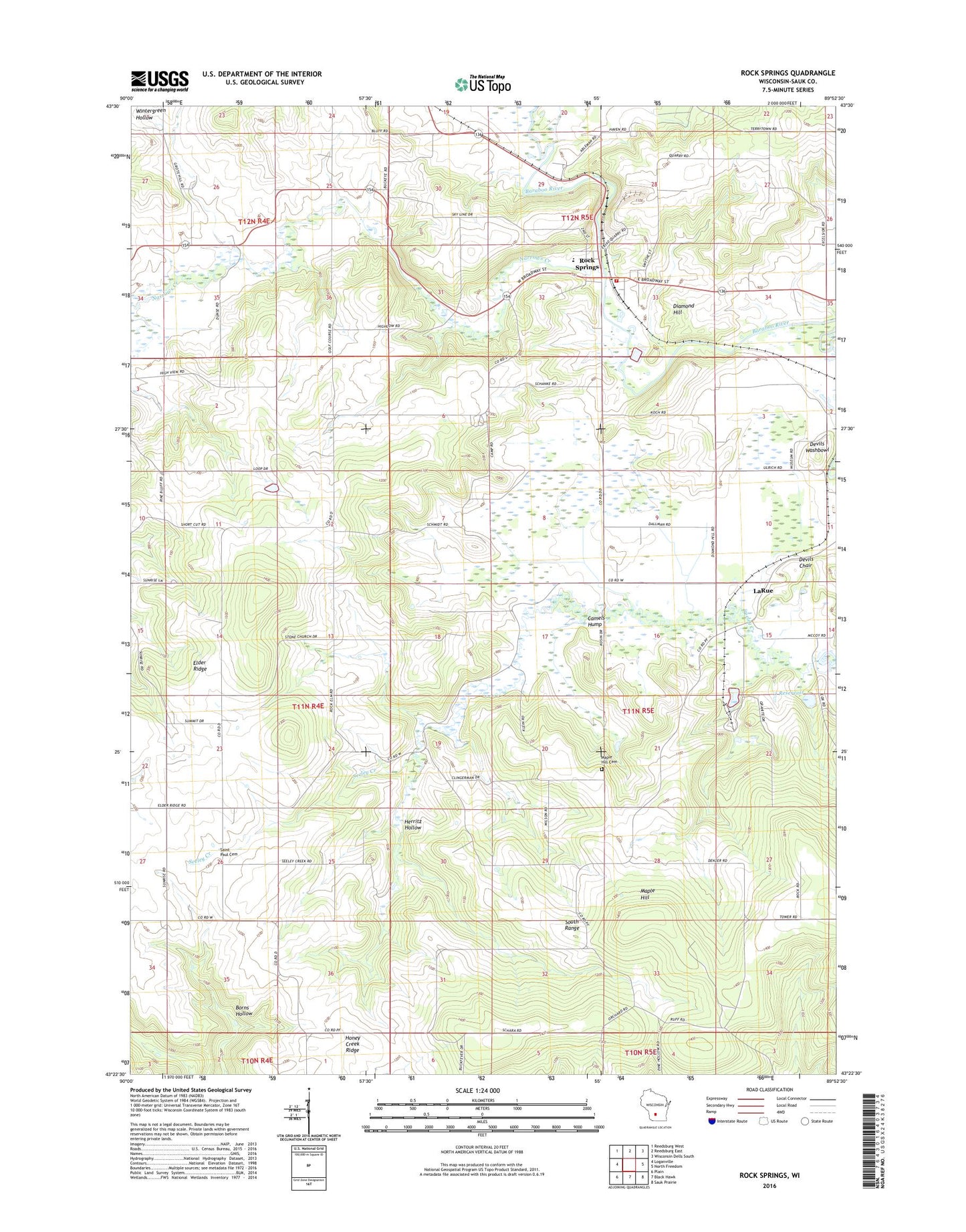
2022 topographic map quadrangle Rock Springs in the state of Wisconsin. Scale: 1:24000. Based on the newly updated USGS 7.5' US Topo map series, this map is in the following counties: Sauk. The map contains contour data, water features, and other items you are used to seeing on USGS maps, but also has updated roads and other features. This is the next generation of topographic maps. Printed on high-quality waterproof paper with UV fade-resistant inks.
Quads adjacent to this one:
West: Loganville
Northwest: Reedsburg West
North: Reedsburg East
Northeast: Wisconsin Dells South
East: North Freedom
Southeast: Sauk Prairie
South: Black Hawk
Southwest: Plain
This map covers the same area as the classic USGS quad with code o43089d8.
Contains the following named places: 1 Reservoir, 53951, 53961, Ableman's Gorge State Natural Area, Camels Hump, Devils Chair, Devils Washbowl, Diamond Hill, Diamond Hill School, East Narrows Prairie Cemetery, Elder Ridge, Elder Ridge School, Flying b Airport, Herritz Hollow, Honey Creek Ridge, Honey Creek Ridge School, LaRue, Maple Hill, Maple Hill Cemetery, Maple Hill School, Narrows Creek, Narrows Prairie School, Pine Hill Cemetery, Rock Elm School, Rock Springs, Rock Springs Elementary School, Rock Springs Fire Department, Rock Springs Post Office, Saint John Evangelical Lutheran Cemetery, Saint Paul Cemetery, Sauk County, Steinhorst and Coughlin G4851 Dam, Town of Freedom, Village of Rock Springs, Westfield Church, Wintergreen Hollow, Zion Church