MyTopo
Long Lake NE Wisconsin US Topo Map
Couldn't load pickup availability
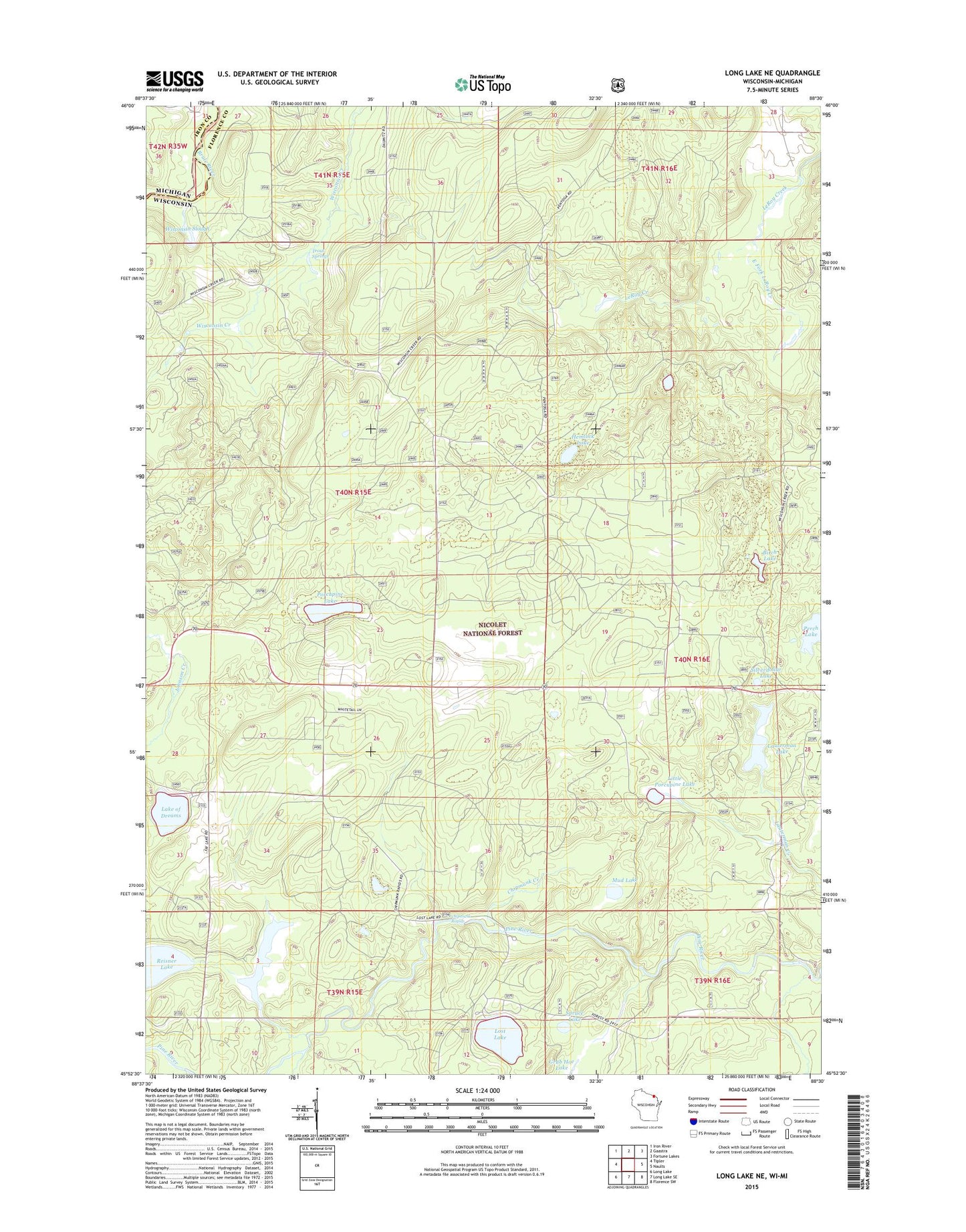
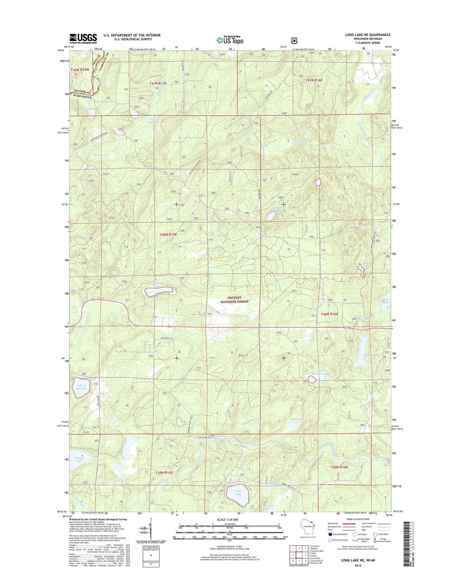
2018 topographic map quadrangle Long Lake NE in the state of Wisconsin. Scale: 1:24000. Based on the newly updated USGS 7.5' US Topo map series, this map is in the following counties: Florence, Iron. The map contains contour data, water features, and other items you are used to seeing on USGS maps, but also has updated roads and other features. This is the next generation of topographic maps. Printed on high-quality waterproof paper with UV fade-resistant inks.
Quads adjacent to this one:
West: Tipler
Northwest: Iron River
North: Gaastra
Northeast: Fortune Lakes
East: Naults
Southeast: Florence SW
South: Long Lake SE
Southwest: Long Lake
Contains the following named places: Birch Lake, Chipmunk Creek, Chipmunk Rapids, Chipmunk Rapids Campground, Dahls Siding, East Fork LeRoy Creek, Florence County Park Campground, French and Losey Siding, Hemlock Lake, Lake of Dreams, Lauterman Lake, Lauterman Lake Walk-In Campground, Lauterman Trail, Little Porcupine Lake, Lost Lake, Lost Lake Campground, Mud Lake, Perch Lake, Porcupine Lake, Purdue University Forestry Camp, Reisner Lake, Silverdollar Lake, Spruce Lake, Town of Tipler, Trout Springs, Wisconsin Slough, Wisconsin Slough State Natural Area