MyTopo
Fortune Lakes Michigan US Topo Map
Couldn't load pickup availability
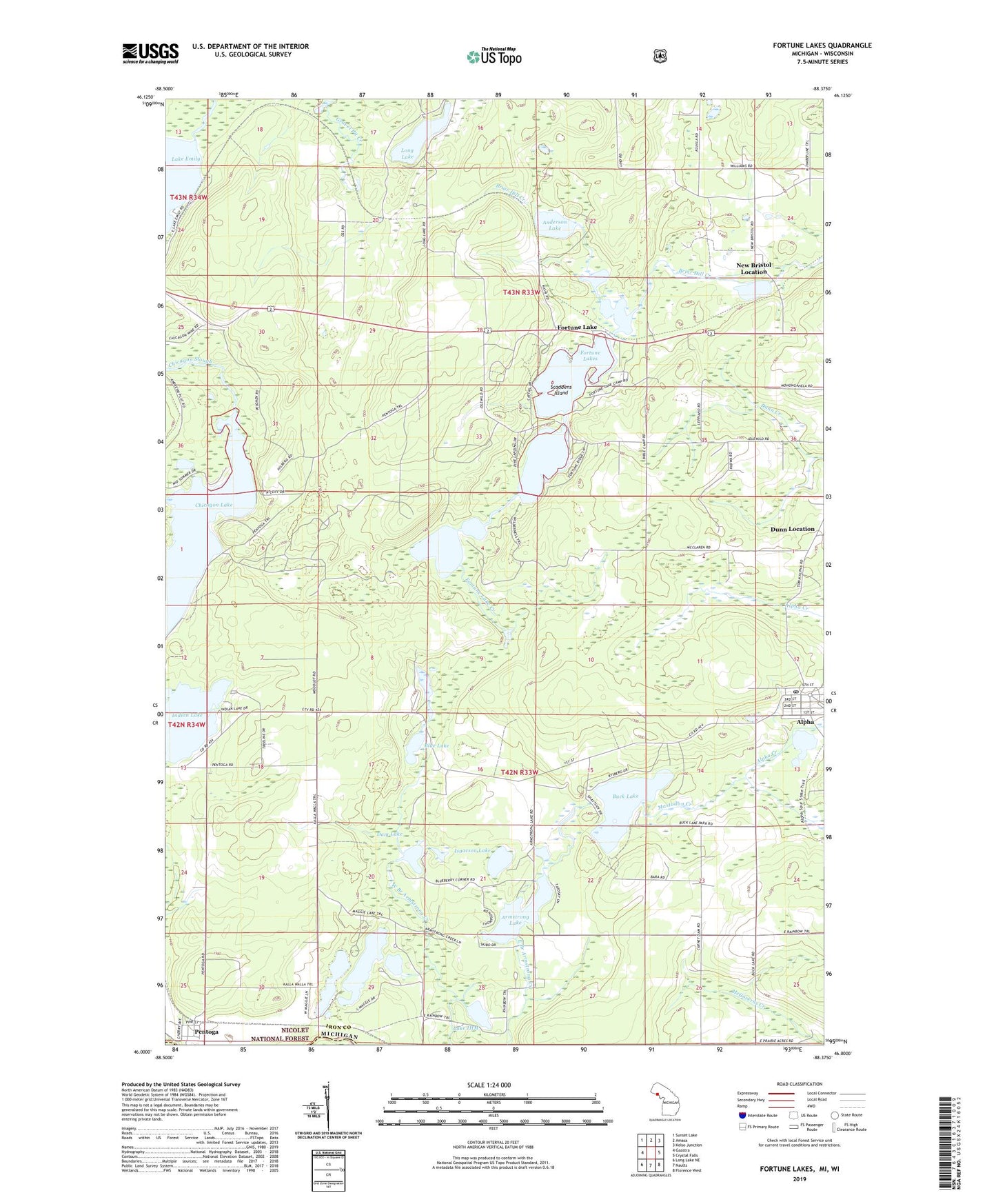
2023 topographic map quadrangle Fortune Lakes in the state of Michigan. Scale: 1:24000. Based on the newly updated USGS 7.5' US Topo map series, this map is in the following counties: Iron, Florence. The map contains contour data, water features, and other items you are used to seeing on USGS maps, but also has updated roads and other features. This is the next generation of topographic maps. Printed on high-quality waterproof paper with UV fade-resistant inks.
Quads adjacent to this one:
West: Gaastra
Northwest: Sunset Lake
North: Amasa
Northeast: Kelso Junction
East: Crystal Falls
Southeast: Florence West
South: Naults
Southwest: Long Lake NE
Contains the following named places: Alpha, Alpha Creek, Alpha Post Office, Alpha Village Hall, Anderson Lake, Armstrong Lake, Bewabic Park, Blue Lake, Buck Lake, Dam Lake, First Lake, Fortune Lake, Fortune Lake Creek, Fortune Lake Lutheran Camp, Fortune Lakes, Gravel Pit Lake, Indian Lake, Iron County Forest Preserve, Isaacson Lake, Lake IHM, Long Lake, Maggie Lakes, Mastodon Creek, Mud Lake, New Bristol Location, Pentoga, Pentoga Post Office, Pentoga Station, Pin Lake, Scaddens Island, Second Lake, Third Lake, Village of Alpha, ZIP Code: 49902