MyTopo
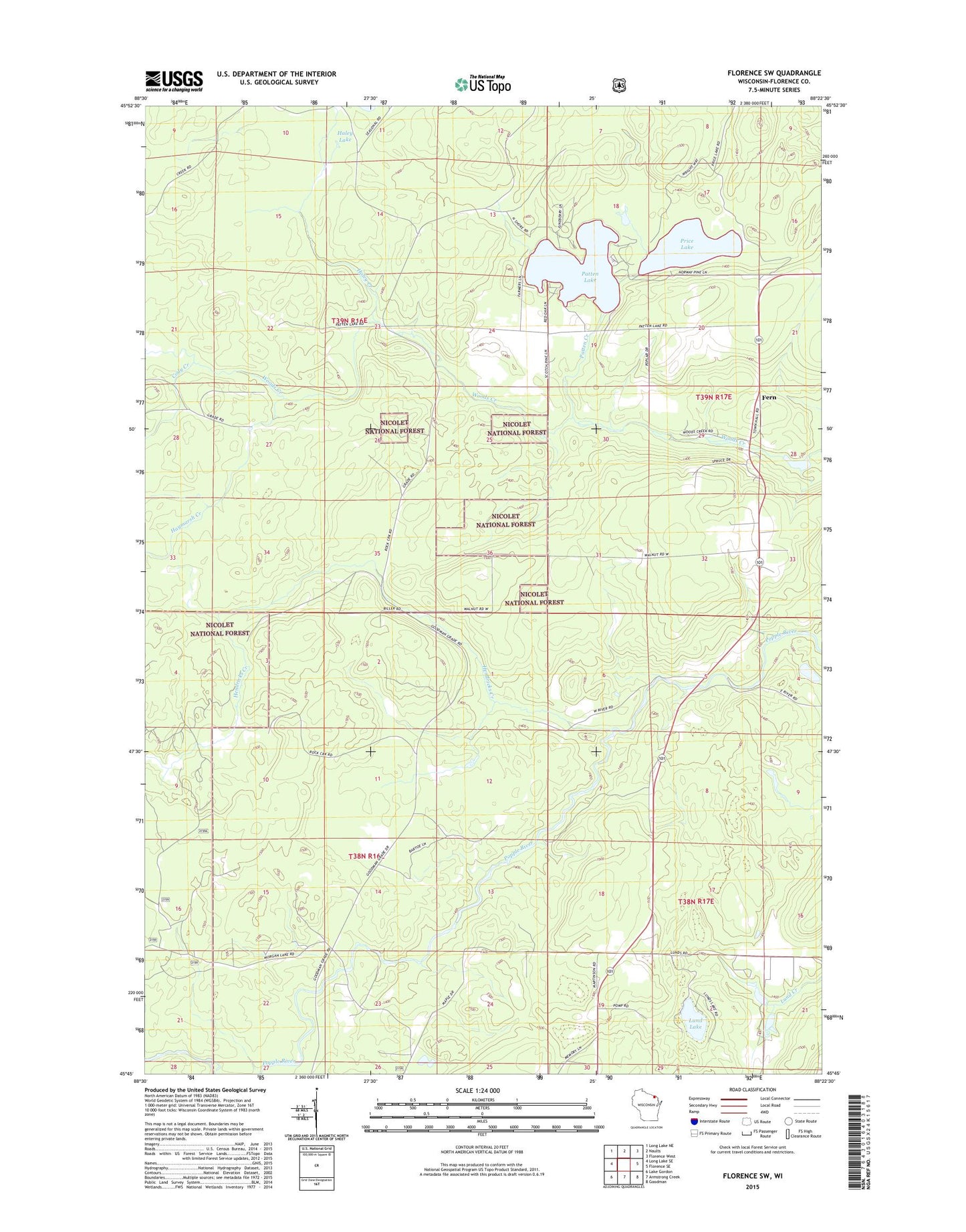
Florence SW Wisconsin US Topo Map
Couldn't load pickup availability
Also explore the Florence SW Forest Service Topo of this same quad for updated USFS data
2022 topographic map quadrangle Florence SW in the state of Wisconsin. Scale: 1:24000. Based on the newly updated USGS 7.5' US Topo map series, this map is in the following counties: Florence. The map contains contour data, water features, and other items you are used to seeing on USGS maps, but also has updated roads and other features. This is the next generation of topographic maps. Printed on high-quality waterproof paper with UV fade-resistant inks.
Quads adjacent to this one:
West: Long Lake SE
Northwest: Long Lake NE
North: Naults
Northeast: Florence West
East: Florence SE
Southeast: Goodman
South: Armstrong Creek
Southwest: Lake Gordon
This map covers the same area as the classic USGS quad with code o45088g4.
Contains the following named places: Bluebird School, Cody Creek, Fern, Fern School, Florence County, Florence County Park Recreation Site, Haley Creek, Haley Lake, Haymarsh Creek, Hegstrom Lake, Hendricks Creek, Lund Lake, Patten Creek, Patten Lake, Price Lake, Spur Three, Woods Creek 2WP656 Dam, Woods Creek Pond 45