MyTopo
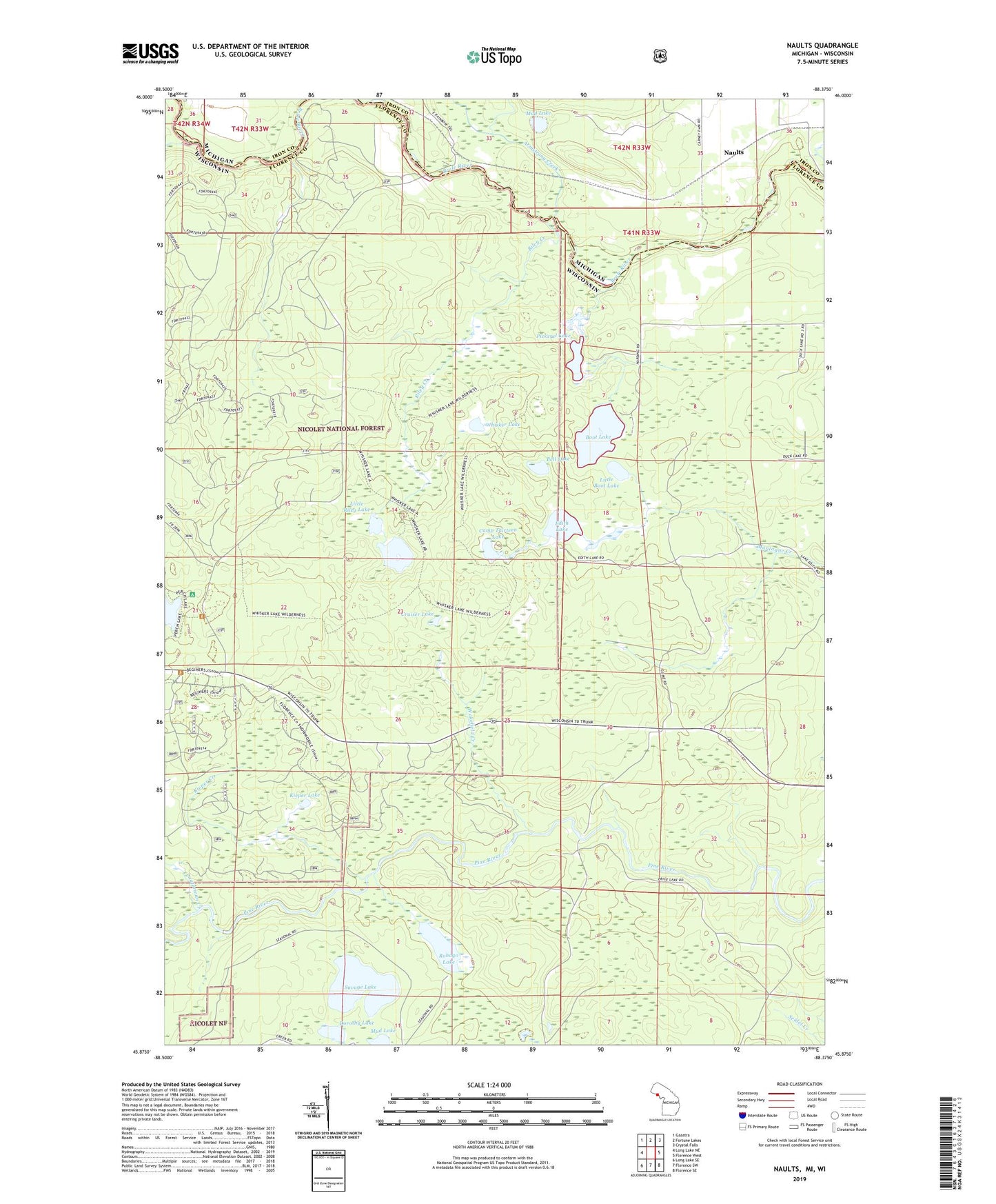
Naults Michigan US Topo Map
Couldn't load pickup availability
Also explore the Naults Forest Service Topo of this same quad for updated USFS data
2023 topographic map quadrangle Naults in the states of Wisconsin, Michigan. Scale: 1:24000. Based on the newly updated USGS 7.5' US Topo map series, this map is in the following counties: Iron, Florence. The map contains contour data, water features, and other items you are used to seeing on USGS maps, but also has updated roads and other features. This is the next generation of topographic maps. Printed on high-quality waterproof paper with UV fade-resistant inks.
Quads adjacent to this one:
West: Long Lake NE
Northwest: Gaastra
North: Fortune Lakes
Northeast: Crystal Falls
East: Florence West
Southeast: Florence SE
South: Florence SW
Southwest: Long Lake SE
Contains the following named places: Armstrong Creek, Bell Lake, Boot Lake, Camp Thirteen Lake, Cruiser Lake, Dorothy Lake, East Branch Armstrong Creek, Edith Lake, Florence Lookout Tower, Fox Maple Woods State Natural Area, Harding School, Kieper Creek, Kieper Lake, Lauterman Creek, LeRoy Creek, Little Boot Lake, Little Riley Lake, Mud Lake, Naults, Perch Lake Campground, Pickerel Lake, Riley Creek, Riley Lake, Robago Lake, Savage Lake, Town of Florence, Wakefield Creek, West Branch Armstrong Creek, Whisker Lake, Whisker Lake Wilderness