MyTopo
Long Lake SE Wisconsin US Topo Map
Couldn't load pickup availability
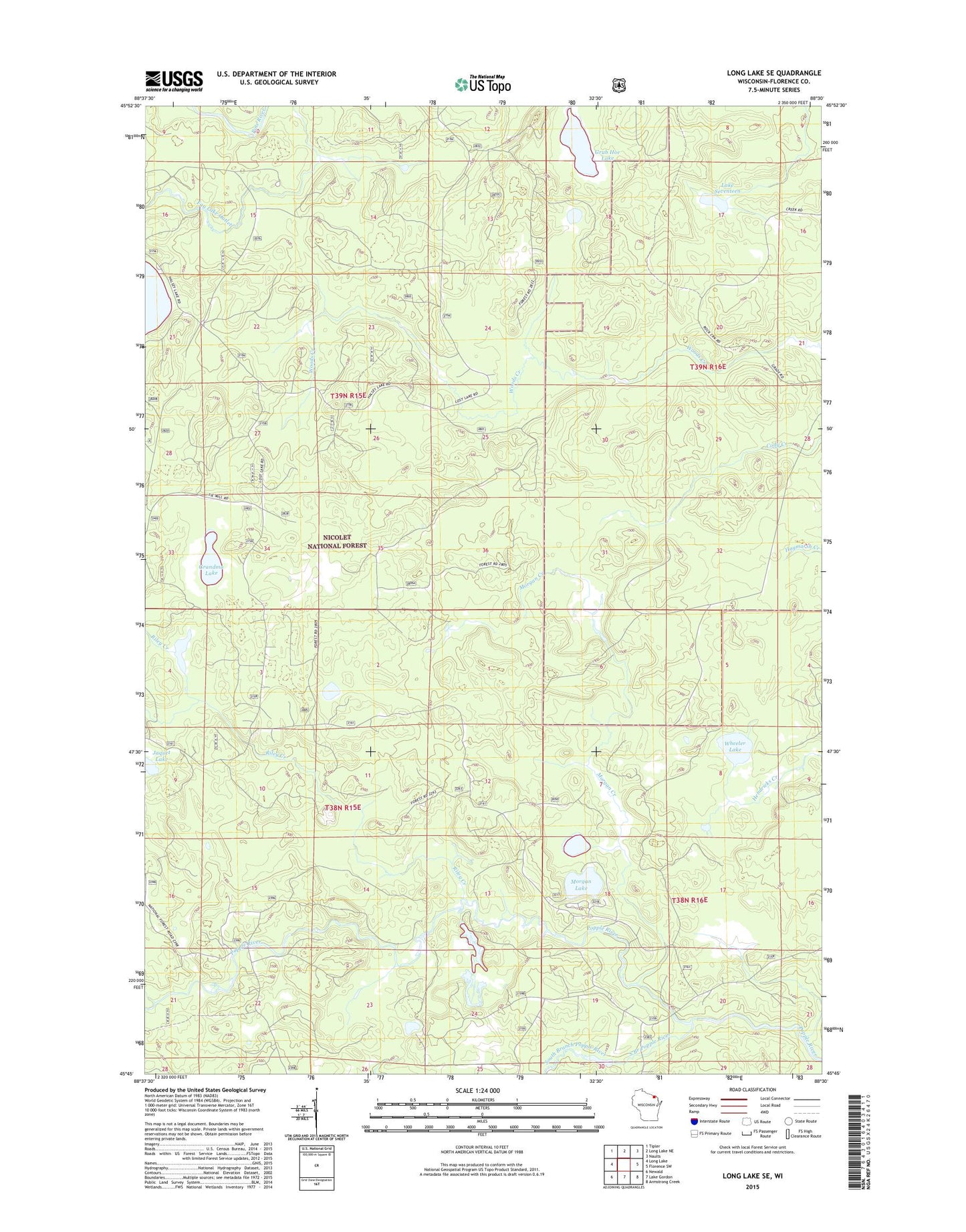
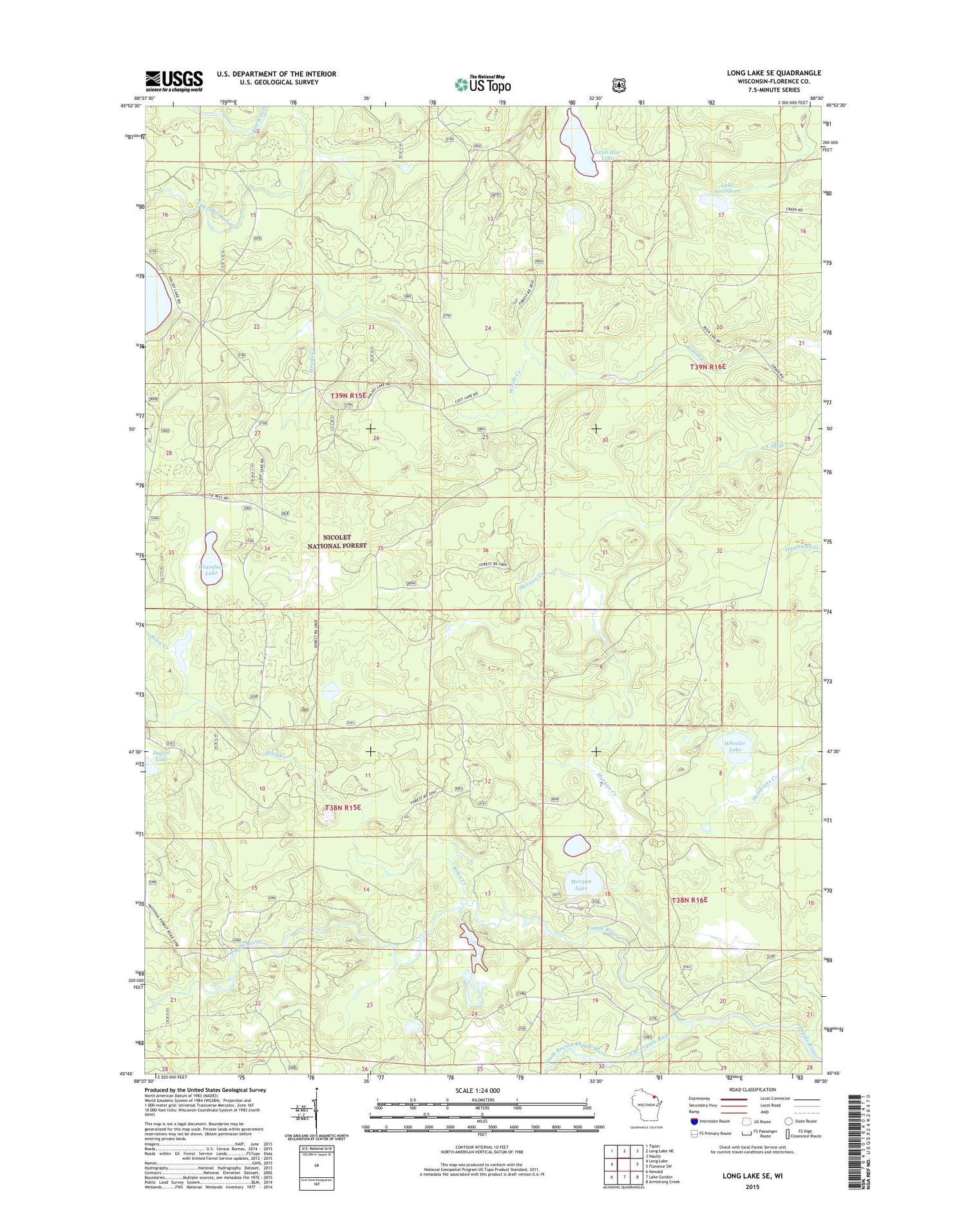
2018 topographic map quadrangle Long Lake SE in the state of Wisconsin. Scale: 1:24000. Based on the newly updated USGS 7.5' US Topo map series, this map is in the following counties: Florence. The map contains contour data, water features, and other items you are used to seeing on USGS maps, but also has updated roads and other features. This is the next generation of topographic maps. Printed on high-quality waterproof paper with UV fade-resistant inks.
Quads adjacent to this one:
West: Long Lake
Northwest: Tipler
North: Long Lake NE
Northeast: Naults
East: Florence SW
Southeast: Armstrong Creek
South: Lake Gordon
Southwest: Newald
Contains the following named places: Chapel of Saint Pius X, Fay Lake Outlet, Grandma Lake, Grandma Lake Wetlands State Natural Area, Grub Hoe Lake, Jaquet Lake, Lake Seventeen, Morgan Creek, Morgan Lake, Morgan Lake Campground, Riley Creek, South Branch Popple River, Town of Fence, Town of Long Lake, Wheeler Lake, ZIP Code: 54120