MyTopo
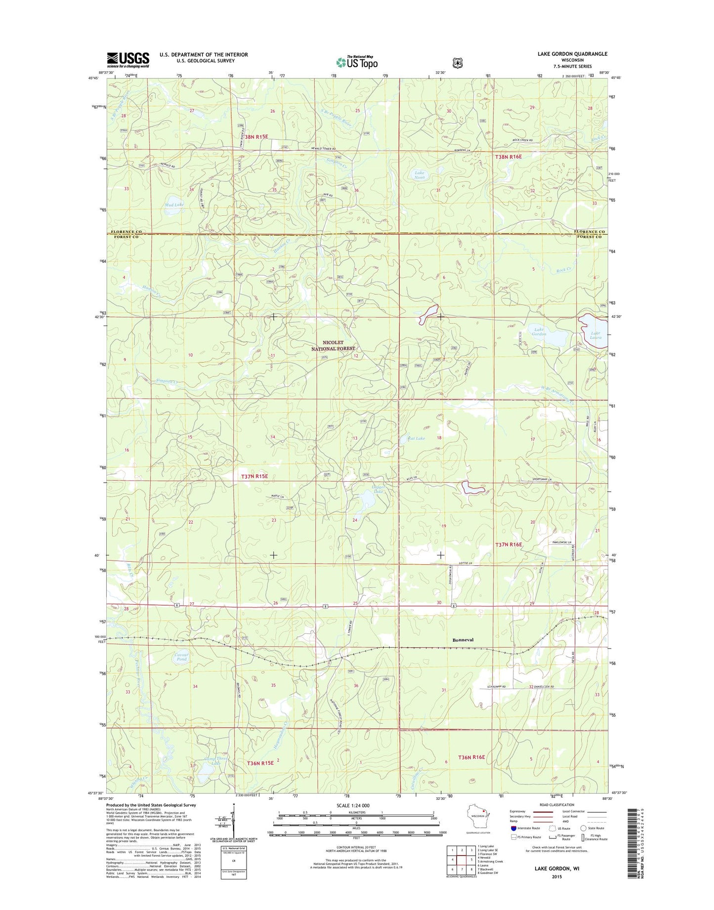
Lake Gordon Wisconsin US Topo Map
Couldn't load pickup availability
Also explore the Lake Gordon Forest Service Topo of this same quad for updated USFS data
2022 topographic map quadrangle Lake Gordon in the state of Wisconsin. Scale: 1:24000. Based on the newly updated USGS 7.5' US Topo map series, this map is in the following counties: Forest, Florence. The map contains contour data, water features, and other items you are used to seeing on USGS maps, but also has updated roads and other features. This is the next generation of topographic maps. Printed on high-quality waterproof paper with UV fade-resistant inks.
Quads adjacent to this one:
West: Newald
Northwest: Long Lake
North: Long Lake SE
Northeast: Florence SW
East: Armstrong Creek
Southeast: Goodman SW
South: Blackwell
Southwest: Laona
This map covers the same area as the classic USGS quad with code o45088f5.
Contains the following named places: Bonneval, Camp Three Lake, Cavour Pond, Hanson Creek, Lake Gordon, Lake Laura, Lake Nona, Laura-Gordon Lakes Campground, Logger Lake, Mud Lake, Nelligan Pond, Newald Lookout Tower, Rat Lake, Simpson Creek, Town of Armstrong Creek, Whiting Creek, ZIP Code: 54103