MyTopo
Lugerville Wisconsin US Topo Map
Couldn't load pickup availability
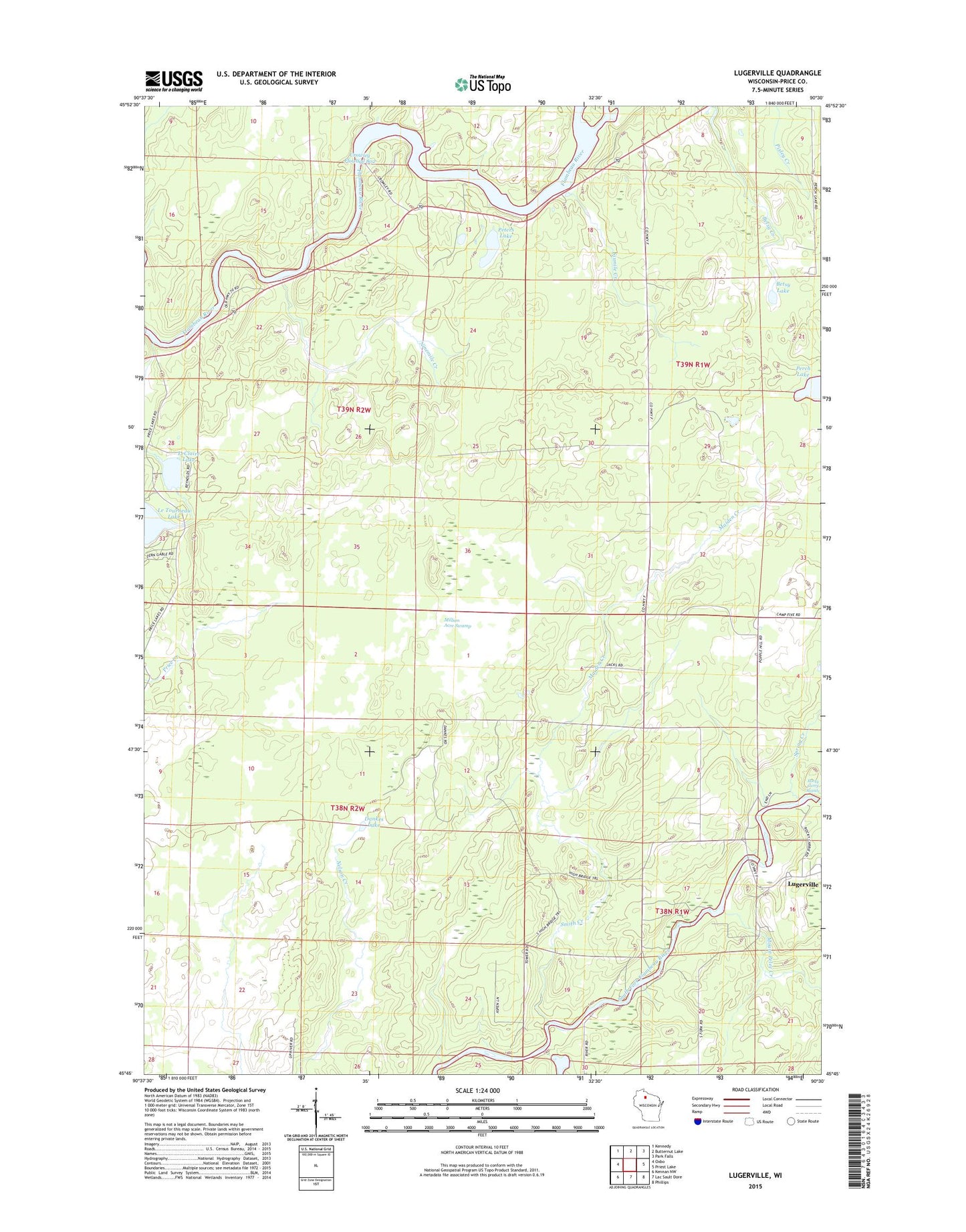
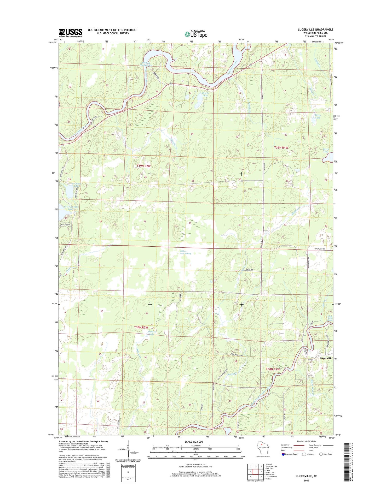
2018 topographic map quadrangle Lugerville in the state of Wisconsin. Scale: 1:24000. Based on the newly updated USGS 7.5' US Topo map series, this map is in the following counties: Price. The map contains contour data, water features, and other items you are used to seeing on USGS maps, but also has updated roads and other features. This is the next generation of topographic maps. Printed on high-quality waterproof paper with UV fade-resistant inks.
Quads adjacent to this one:
West: Oxbo
Northwest: Kennedy
North: Butternut Lake
Northeast: Park Falls
East: Priest Lake
Southeast: Phillips
South: Lac Sault Dore
Southwest: Kennan NW
Contains the following named places: Betsy Lake, Crowley Dam, Crowley Flowage 802, Crowley WP381 Dam, Dankes Lake, Le Tourneau Creek, LeClaire Lake, Lugerville, Lugerville Lookout Tower, Lugerville School, Maiden Creek, Million Acre Swamp, Mount Pelee Creek, Niebauer Springs, Ninemile Creek, Our Saviors Episcopal Church, Perch Lake, Peters Lake, Pixley Dam School, Poplar Hill School, Rocky Carry Park, Rocky Carry Rapids, Sixmile Creek, Smith Creek, Spring Creek, Town of Flambeau